Skip to content

Spatial Operations#

Crop, align, reproject, resample, CRS handling, and coordinate conversion.

ds.same_grid(other) is the predicate behind them: it answers whether two rasters occupy one pixel grid in one CRS, and so can be combined cell by cell without resampling. align is what you call when the answer is no.

Hold "Ctrl" to enable pan & zoom
flowchart LR
    SP(("Spatial<br/>ds.spatial"))
    SP --> C["<b>clip / align</b><br/>crop · align"]
    SP --> P["<b>predicates</b><br/>same_grid"]
    SP --> R["<b>reproject / resample</b><br/>to_crs · warped_view · resample"]
    SP --> M["<b>CRS & longitude</b><br/>set_crs · wrap_longitude"]
    SP --> G["<b>gap fill</b><br/>fill_gaps"]

Crop with a polygon, raster, or bbox tuple#

Dataset.crop(mask) accepts a FeatureCollection / GeoDataFrame polygon mask or another Dataset as a raster mask. For the common "clip to a geographic bounding box" case, pass the keyword-only bbox=(W, S, E, N) (and epsg= if the bbox isn't in the dataset's own CRS) — pyramids builds the one-row FeatureCollection for you and routes through the same polygon path. The same bbox= / epsg= pair is accepted by DatasetCollection.crop (built once and reused across timesteps) and by Dataset.read_array (for a windowed read).

What a crop declares#

The result declares the value its excluded cells hold, which is not always the source's. A band whose own sentinel is storable keeps it. A band whose sentinel cannot be stored — NaN on an integer band — has one derived against its own data: the first value that fits the dtype and occurs nowhere in the band. A floating band always gets NaN.

A band that declares nothing depends on the mask. A raster mask writes the excluded cells itself, so it derives a fill and declares it; a polygon mask lets GDAL fill them, so the source's declaration — none — stands. Int64 and UInt64 are left alone on the polygon route as well, because -dstnodata reaches GDAL as a C double that a value beyond 2**53 does not survive.

Two consequences worth knowing before you index against a result:

  • the output can be smaller than the mask's extent, because rows and columns lying entirely outside it are trimmed once the result declares a sentinel the trim recognises;
  • crop raises NoDataValueError when a band holds every candidate sentinel and no value is free to mark a cell as absent. It does not derive from ValueError.
from pyramids.dataset import Dataset

ds = Dataset.read_file("dem.tif")

# bbox in the dataset's own CRS
ds.crop(bbox=(6.8, 50.3, 7.2, 50.6))

# bbox in WGS84 against a Web-Mercator raster
ds.crop(bbox=(6.8, 50.3, 7.2, 50.6), epsg=4326)

mask= and bbox= are mutually exclusive. If you need the underlying one-row FeatureCollection for other ops, build it with FeatureCollection.from_bbox((W, S, E, N), epsg=…).

Reproject — eager to_crs(...) vs lazy warped_view(...)#

Dataset.to_crs(to_epsg) materialises a reprojected raster: it warps every pixel into the target CRS and returns a new Dataset. Use it when you will consume the whole reprojected result.

Dataset.warped_view(crs) returns a lazy reprojected view — an in-memory warped VRT where nothing is resampled until a window is read, and a windowed read warps only that window. Prefer it for tile serving, partial reads, and chained virtual pipelines. The view pins its source alive.

to_crs warped_view
When pixels warp immediately (whole raster) lazily, per window read
Returns a fully materialised Dataset a VRT-backed view Dataset
Best for consuming the whole result tile serving / partial reads
from pyramids.dataset import Dataset

ds = Dataset.read_file("dem.tif")               # e.g. EPSG:4326
webmerc = ds.to_crs(3857)                       # eager: all pixels warped now
view = ds.warped_view(3857)                     # lazy: warps only what you read
tile = view.read_array(bbox=(...), epsg=3857)   # this window is warped on demand

Both accept a method= resampling name; warped_view also takes cell_size= and bbox= to fix the output grid/extent up front.

pyramids.dataset.engines.Spatial #

Bases: _Engine['Dataset']

Mixin providing CRS, resampling, alignment and cropping operations for Dataset.

Owns set_crs, to_crs, warped_view, wrap_longitude, resample, fill_gaps, same_grid, align and crop. Dataset exposes a same-named facade for each, so ds.crop(...) and ds.spatial.crop(...) are equivalent.

crop is the single owner of the crop fill policy: a rectangular array has no way to hold an absent cell, so the cells a mask excludes need a number, and it is not always the source's declared sentinel. See :meth:_crop_fill_values for how one is derived when the band declares nothing storable, and :meth:_derived_crop_fills for why the cutline route answers that question differently from the raster-mask one.

Source code in src/pyramids/dataset/engines/spatial.py
 554
 555
 556
 557
 558
 559
 560
 561
 562
 563
 564
 565
 566
 567
 568
 569
 570
 571
 572
 573
 574
 575
 576
 577
 578
 579
 580
 581
 582
 583
 584
 585
 586
 587
 588
 589
 590
 591
 592
 593
 594
 595
 596
 597
 598
 599
 600
 601
 602
 603
 604
 605
 606
 607
 608
 609
 610
 611
 612
 613
 614
 615
 616
 617
 618
 619
 620
 621
 622
 623
 624
 625
 626
 627
 628
 629
 630
 631
 632
 633
 634
 635
 636
 637
 638
 639
 640
 641
 642
 643
 644
 645
 646
 647
 648
 649
 650
 651
 652
 653
 654
 655
 656
 657
 658
 659
 660
 661
 662
 663
 664
 665
 666
 667
 668
 669
 670
 671
 672
 673
 674
 675
 676
 677
 678
 679
 680
 681
 682
 683
 684
 685
 686
 687
 688
 689
 690
 691
 692
 693
 694
 695
 696
 697
 698
 699
 700
 701
 702
 703
 704
 705
 706
 707
 708
 709
 710
 711
 712
 713
 714
 715
 716
 717
 718
 719
 720
 721
 722
 723
 724
 725
 726
 727
 728
 729
 730
 731
 732
 733
 734
 735
 736
 737
 738
 739
 740
 741
 742
 743
 744
 745
 746
 747
 748
 749
 750
 751
 752
 753
 754
 755
 756
 757
 758
 759
 760
 761
 762
 763
 764
 765
 766
 767
 768
 769
 770
 771
 772
 773
 774
 775
 776
 777
 778
 779
 780
 781
 782
 783
 784
 785
 786
 787
 788
 789
 790
 791
 792
 793
 794
 795
 796
 797
 798
 799
 800
 801
 802
 803
 804
 805
 806
 807
 808
 809
 810
 811
 812
 813
 814
 815
 816
 817
 818
 819
 820
 821
 822
 823
 824
 825
 826
 827
 828
 829
 830
 831
 832
 833
 834
 835
 836
 837
 838
 839
 840
 841
 842
 843
 844
 845
 846
 847
 848
 849
 850
 851
 852
 853
 854
 855
 856
 857
 858
 859
 860
 861
 862
 863
 864
 865
 866
 867
 868
 869
 870
 871
 872
 873
 874
 875
 876
 877
 878
 879
 880
 881
 882
 883
 884
 885
 886
 887
 888
 889
 890
 891
 892
 893
 894
 895
 896
 897
 898
 899
 900
 901
 902
 903
 904
 905
 906
 907
 908
 909
 910
 911
 912
 913
 914
 915
 916
 917
 918
 919
 920
 921
 922
 923
 924
 925
 926
 927
 928
 929
 930
 931
 932
 933
 934
 935
 936
 937
 938
 939
 940
 941
 942
 943
 944
 945
 946
 947
 948
 949
 950
 951
 952
 953
 954
 955
 956
 957
 958
 959
 960
 961
 962
 963
 964
 965
 966
 967
 968
 969
 970
 971
 972
 973
 974
 975
 976
 977
 978
 979
 980
 981
 982
 983
 984
 985
 986
 987
 988
 989
 990
 991
 992
 993
 994
 995
 996
 997
 998
 999
1000
1001
1002
1003
1004
1005
1006
1007
1008
1009
1010
1011
1012
1013
1014
1015
1016
1017
1018
1019
1020
1021
1022
1023
1024
1025
1026
1027
1028
1029
1030
1031
1032
1033
1034
1035
1036
1037
1038
1039
1040
1041
1042
1043
1044
1045
1046
1047
1048
1049
1050
1051
1052
1053
1054
1055
1056
1057
1058
1059
1060
1061
1062
1063
1064
1065
1066
1067
1068
1069
1070
1071
1072
1073
1074
1075
1076
1077
1078
1079
1080
1081
1082
1083
1084
1085
1086
1087
1088
1089
1090
1091
1092
1093
1094
1095
1096
1097
1098
1099
1100
1101
1102
1103
1104
1105
1106
1107
1108
1109
1110
1111
1112
1113
1114
1115
1116
1117
1118
1119
1120
1121
1122
1123
1124
1125
1126
1127
1128
1129
1130
1131
1132
1133
1134
1135
1136
1137
1138
1139
1140
1141
1142
1143
1144
1145
1146
1147
1148
1149
1150
1151
1152
1153
1154
1155
1156
1157
1158
1159
1160
1161
1162
1163
1164
1165
1166
1167
1168
1169
1170
1171
1172
1173
1174
1175
1176
1177
1178
1179
1180
1181
1182
1183
1184
1185
1186
1187
1188
1189
1190
1191
1192
1193
1194
1195
1196
1197
1198
1199
1200
1201
1202
1203
1204
1205
1206
1207
1208
1209
1210
1211
1212
1213
1214
1215
1216
1217
1218
1219
1220
1221
1222
1223
1224
1225
1226
1227
1228
1229
1230
1231
1232
1233
1234
1235
1236
1237
1238
1239
1240
1241
1242
1243
1244
1245
1246
1247
1248
1249
1250
1251
1252
1253
1254
1255
1256
1257
1258
1259
1260
1261
1262
1263
1264
1265
1266
1267
1268
1269
1270
1271
1272
1273
1274
1275
1276
1277
1278
1279
1280
1281
1282
1283
1284
1285
1286
1287
1288
1289
1290
1291
1292
1293
1294
1295
1296
1297
1298
1299
1300
1301
1302
1303
1304
1305
1306
1307
1308
1309
1310
1311
1312
1313
1314
1315
1316
1317
1318
1319
1320
1321
1322
1323
1324
1325
1326
1327
1328
1329
1330
1331
1332
1333
1334
1335
1336
1337
1338
1339
1340
1341
1342
1343
1344
1345
1346
1347
1348
1349
1350
1351
1352
1353
1354
1355
1356
1357
1358
1359
1360
1361
1362
1363
1364
1365
1366
1367
1368
1369
1370
1371
1372
1373
1374
1375
1376
1377
1378
1379
1380
1381
1382
1383
1384
1385
1386
1387
1388
1389
1390
1391
1392
1393
1394
1395
1396
1397
1398
1399
1400
1401
1402
1403
1404
1405
1406
1407
1408
1409
1410
1411
1412
1413
1414
1415
1416
1417
1418
1419
1420
1421
1422
1423
1424
1425
1426
1427
1428
1429
1430
1431
1432
1433
1434
1435
1436
1437
1438
1439
1440
1441
1442
1443
1444
1445
1446
1447
1448
1449
1450
1451
1452
1453
1454
1455
1456
1457
1458
1459
1460
1461
1462
1463
1464
1465
1466
1467
1468
1469
1470
1471
1472
1473
1474
1475
1476
1477
1478
1479
1480
1481
1482
1483
1484
1485
1486
1487
1488
1489
1490
1491
1492
1493
1494
1495
1496
1497
1498
1499
1500
1501
1502
1503
1504
1505
1506
1507
1508
1509
1510
1511
1512
1513
1514
1515
1516
1517
1518
1519
1520
1521
1522
1523
1524
1525
1526
1527
1528
1529
1530
1531
1532
1533
1534
1535
1536
1537
1538
1539
1540
1541
1542
1543
1544
1545
1546
1547
1548
1549
1550
1551
1552
1553
1554
1555
1556
1557
1558
1559
1560
1561
1562
1563
1564
1565
1566
1567
1568
1569
1570
1571
1572
1573
1574
1575
1576
1577
1578
1579
1580
1581
1582
1583
1584
1585
1586
1587
1588
1589
1590
1591
1592
1593
1594
1595
1596
1597
1598
1599
1600
1601
1602
1603
1604
1605
1606
1607
1608
1609
1610
1611
1612
1613
1614
1615
1616
1617
1618
1619
1620
1621
1622
1623
1624
1625
1626
1627
1628
1629
1630
1631
1632
1633
1634
1635
1636
1637
1638
1639
1640
1641
1642
1643
1644
1645
1646
1647
1648
1649
1650
1651
1652
1653
1654
1655
1656
1657
1658
1659
1660
1661
1662
1663
1664
1665
1666
1667
1668
1669
1670
1671
1672
1673
1674
1675
1676
1677
1678
1679
1680
1681
1682
1683
1684
1685
1686
1687
1688
1689
1690
1691
1692
1693
1694
1695
1696
1697
1698
1699
1700
1701
1702
1703
1704
1705
1706
1707
1708
1709
1710
1711
1712
1713
1714
1715
1716
1717
1718
1719
1720
1721
1722
1723
1724
1725
1726
1727
1728
1729
1730
1731
1732
1733
1734
1735
1736
1737
1738
1739
1740
1741
1742
1743
1744
1745
1746
1747
1748
1749
1750
1751
1752
1753
1754
1755
1756
1757
1758
1759
1760
1761
1762
1763
1764
1765
1766
1767
1768
1769
1770
1771
1772
1773
1774
1775
1776
1777
1778
1779
1780
1781
1782
1783
1784
1785
1786
1787
1788
1789
1790
1791
1792
1793
1794
1795
1796
1797
1798
1799
1800
1801
1802
1803
1804
1805
1806
1807
1808
1809
1810
1811
1812
1813
1814
1815
1816
1817
1818
1819
1820
1821
1822
1823
1824
1825
1826
1827
1828
1829
1830
1831
1832
1833
1834
1835
1836
1837
1838
1839
1840
1841
1842
1843
1844
1845
1846
1847
1848
1849
1850
1851
1852
1853
1854
1855
1856
1857
1858
1859
1860
1861
1862
1863
1864
1865
1866
1867
1868
1869
1870
1871
1872
1873
1874
1875
1876
1877
1878
1879
1880
1881
1882
1883
1884
1885
1886
1887
1888
1889
1890
1891
1892
1893
1894
1895
1896
1897
1898
1899
1900
1901
1902
1903
1904
1905
1906
1907
1908
1909
1910
1911
1912
1913
1914
1915
1916
1917
1918
1919
1920
1921
1922
1923
1924
1925
1926
1927
1928
1929
1930
1931
1932
1933
1934
1935
1936
1937
1938
1939
1940
1941
1942
1943
1944
1945
1946
1947
1948
1949
1950
1951
1952
1953
1954
1955
1956
1957
1958
1959
1960
1961
1962
1963
1964
1965
1966
1967
1968
1969
1970
1971
1972
1973
1974
1975
1976
1977
1978
1979
1980
1981
1982
1983
1984
1985
1986
1987
1988
1989
1990
1991
1992
1993
1994
1995
1996
1997
1998
1999
2000
2001
2002
2003
2004
2005
2006
2007
2008
2009
2010
2011
2012
2013
2014
2015
2016
2017
2018
2019
2020
2021
2022
2023
2024
2025
2026
2027
2028
2029
2030
2031
2032
2033
2034
2035
2036
2037
2038
2039
2040
2041
2042
2043
2044
2045
2046
2047
2048
2049
2050
2051
2052
2053
2054
2055
2056
2057
2058
2059
2060
2061
2062
2063
2064
2065
2066
2067
2068
2069
2070
2071
2072
2073
2074
2075
2076
2077
2078
2079
2080
2081
2082
2083
2084
2085
2086
2087
2088
2089
2090
2091
2092
2093
2094
2095
2096
2097
2098
2099
2100
2101
2102
2103
2104
2105
2106
2107
2108
2109
2110
2111
2112
2113
2114
2115
2116
2117
2118
2119
2120
2121
2122
2123
2124
2125
2126
2127
2128
2129
2130
2131
2132
2133
2134
2135
2136
2137
2138
2139
2140
2141
2142
2143
2144
2145
2146
2147
2148
2149
2150
2151
2152
2153
2154
2155
2156
2157
2158
2159
2160
2161
2162
2163
2164
2165
2166
2167
2168
2169
2170
2171
2172
2173
2174
2175
2176
2177
2178
2179
2180
2181
2182
2183
2184
2185
2186
2187
2188
2189
2190
2191
2192
2193
2194
2195
2196
2197
2198
2199
2200
2201
2202
2203
2204
2205
2206
2207
2208
2209
2210
2211
2212
2213
2214
2215
2216
2217
2218
2219
2220
2221
2222
2223
2224
2225
2226
2227
2228
2229
2230
2231
2232
2233
2234
2235
2236
2237
2238
2239
2240
2241
2242
2243
2244
2245
2246
2247
2248
2249
2250
2251
2252
2253
2254
2255
2256
2257
2258
2259
2260
2261
2262
2263
2264
2265
2266
2267
2268
2269
2270
2271
2272
2273
2274
2275
2276
2277
2278
2279
2280
2281
2282
2283
2284
2285
2286
2287
2288
2289
2290
2291
2292
2293
2294
2295
2296
2297
2298
2299
2300
2301
2302
2303
2304
2305
2306
2307
2308
2309
2310
2311
2312
2313
2314
2315
2316
2317
2318
2319
2320
2321
2322
2323
2324
2325
2326
2327
2328
2329
2330
2331
2332
2333
2334
2335
2336
2337
2338
2339
2340
2341
2342
2343
2344
2345
2346
2347
2348
2349
2350
2351
2352
2353
2354
2355
2356
2357
2358
2359
2360
2361
2362
2363
2364
2365
2366
2367
2368
2369
2370
2371
2372
2373
2374
2375
2376
2377
2378
2379
2380
2381
2382
2383
2384
2385
2386
2387
2388
2389
2390
2391
2392
2393
2394
2395
2396
2397
2398
2399
2400
2401
2402
2403
2404
2405
2406
2407
2408
2409
2410
2411
2412
2413
2414
2415
2416
2417
2418
2419
2420
2421
2422
2423
2424
2425
2426
2427
2428
2429
2430
2431
2432
2433
2434
2435
2436
2437
2438
2439
2440
2441
2442
2443
2444
2445
2446
2447
2448
2449
2450
2451
2452
2453
2454
2455
2456
2457
2458
2459
2460
2461
2462
2463
2464
2465
2466
2467
2468
2469
2470
2471
2472
2473
2474
2475
2476
2477
2478
2479
2480
2481
2482
2483
2484
2485
2486
2487
2488
2489
2490
2491
2492
2493
2494
2495
2496
2497
2498
2499
2500
2501
2502
2503
2504
2505
2506
2507
2508
2509
2510
2511
2512
2513
2514
2515
2516
2517
2518
2519
2520
2521
2522
2523
2524
2525
2526
2527
2528
2529
2530
2531
2532
2533
2534
2535
2536
2537
2538
2539
2540
2541
2542
2543
2544
2545
2546
2547
2548
2549
2550
2551
2552
2553
2554
2555
2556
2557
2558
2559
2560
2561
2562
2563
2564
2565
2566
2567
2568
2569
2570
2571
2572
2573
2574
2575
2576
2577
2578
2579
2580
2581
2582
2583
2584
2585
2586
2587
2588
2589
2590
2591
2592
2593
2594
2595
2596
2597
2598
2599
2600
2601
2602
2603
2604
2605
2606
2607
2608
2609
2610
2611
2612
2613
2614
2615
2616
2617
2618
2619
2620
2621
2622
2623
2624
2625
2626
2627
2628
2629
2630
2631
2632
2633
2634
2635
2636
2637
2638
2639
2640
2641
2642
2643
2644
2645
2646
2647
2648
2649
2650
2651
2652
2653
2654
2655
2656
2657
2658
2659
2660
2661
2662
2663
2664
2665
2666
2667
2668
2669
2670
2671
2672
2673
2674
2675
2676
2677
2678
2679
2680
2681
2682
2683
2684
2685
2686
2687
2688
2689
2690
2691
2692
2693
2694
2695
2696
2697
2698
2699
2700
2701
2702
2703
2704
2705
2706
2707
2708
2709
2710
2711
2712
2713
2714
2715
2716
2717
2718
2719
2720
2721
2722
2723
2724
2725
2726
2727
2728
2729
2730
2731
2732
2733
2734
2735
2736
2737
2738
2739
2740
2741
2742
2743
2744
2745
2746
2747
2748
2749
2750
2751
2752
2753
2754
2755
2756
2757
2758
2759
2760
2761
2762
2763
2764
2765
2766
2767
2768
2769
2770
2771
2772
2773
2774
2775
2776
2777
2778
2779
2780
2781
2782
2783
2784
2785
2786
2787
2788
2789
2790
2791
2792
2793
2794
2795
2796
2797
2798
2799
2800
2801
2802
2803
2804
2805
2806
2807
2808
2809
2810
2811
2812
2813
2814
2815
2816
2817
2818
2819
2820
2821
2822
2823
2824
2825
2826
2827
2828
2829
2830
2831
2832
2833
2834
2835
2836
2837
2838
2839
2840
2841
2842
2843
2844
2845
2846
2847
2848
2849
2850
2851
2852
2853
2854
2855
2856
2857
2858
2859
2860
2861
2862
2863
2864
2865
2866
2867
2868
2869
2870
2871
2872
2873
2874
2875
2876
2877
2878
2879
2880
2881
2882
2883
2884
2885
2886
2887
2888
2889
2890
2891
2892
2893
2894
2895
2896
2897
2898
2899
2900
2901
2902
2903
2904
2905
2906
2907
2908
2909
2910
2911
2912
2913
2914
2915
2916
2917
2918
2919
2920
2921
2922
2923
2924
2925
2926
2927
2928
2929
2930
2931
2932
2933
2934
2935
2936
2937
2938
2939
2940
2941
2942
2943
2944
2945
2946
2947
2948
2949
2950
2951
2952
2953
2954
2955
2956
2957
2958
2959
2960
2961
2962
2963
2964
2965
2966
2967
2968
2969
2970
2971
2972
2973
2974
2975
2976
2977
2978
2979
2980
2981
2982
2983
2984
2985
2986
2987
2988
2989
2990
2991
2992
2993
2994
2995
2996
2997
2998
2999
3000
3001
3002
3003
3004
3005
3006
3007
3008
3009
3010
3011
3012
3013
3014
3015
3016
3017
3018
3019
3020
3021
3022
3023
3024
3025
3026
3027
3028
3029
3030
3031
3032
3033
3034
3035
3036
3037
3038
3039
3040
3041
3042
3043
3044
3045
3046
3047
3048
3049
3050
3051
3052
3053
3054
3055
3056
3057
3058
3059
3060
3061
3062
3063
3064
3065
3066
3067
3068
3069
3070
3071
3072
3073
3074
3075
3076
3077
3078
3079
3080
3081
3082
3083
3084
3085
3086
3087
3088
3089
3090
3091
3092
3093
3094
3095
3096
3097
3098
3099
3100
3101
3102
3103
3104
3105
3106
3107
3108
3109
3110
3111
3112
3113
3114
3115
3116
3117
3118
3119
3120
3121
3122
3123
3124
3125
3126
3127
3128
3129
3130
3131
3132
3133
3134
3135
3136
3137
3138
3139
3140
3141
3142
3143
3144
3145
3146
3147
3148
3149
3150
3151
3152
3153
3154
3155
3156
3157
3158
3159
3160
3161
3162
3163
3164
3165
3166
3167
3168
3169
3170
3171
3172
3173
3174
3175
3176
3177
3178
3179
3180
3181
3182
3183
3184
3185
3186
3187
3188
3189
3190
3191
3192
3193
3194
3195
3196
3197
3198
3199
3200
3201
3202
3203
3204
3205
3206
3207
3208
3209
3210
3211
3212
3213
3214
3215
3216
3217
3218
3219
3220
3221
3222
3223
3224
3225
3226
3227
3228
3229
3230
3231
3232
3233
3234
3235
3236
3237
3238
3239
3240
3241
3242
3243
3244
3245
3246
3247
3248
3249
3250
3251
3252
3253
3254
3255
3256
3257
3258
3259
3260
3261
3262
3263
3264
3265
3266
3267
3268
3269
3270
3271
3272
3273
3274
3275
3276
3277
3278
3279
3280
3281
3282
3283
3284
3285
3286
3287
3288
3289
3290
3291
3292
3293
3294
3295
3296
3297
3298
3299
3300
3301
3302
3303
3304
3305
3306
3307
3308
3309
3310
3311
3312
3313
3314
3315
3316
3317
3318
3319
3320
3321
3322
3323
3324
3325
3326
3327
3328
3329
3330
3331
3332
3333
3334
3335
3336
3337
3338
3339
3340
3341
3342
3343
3344
3345
3346
3347
3348
3349
3350
3351
3352
3353
3354
3355
3356
3357
3358
3359
3360
3361
3362
3363
3364
3365
3366
3367
3368
3369
3370
3371
3372
3373
3374
3375
3376
3377
3378
3379
3380
3381
3382
3383
3384
3385
3386
3387
3388
class Spatial(_Engine["Dataset"]):
    """Mixin providing CRS, resampling, alignment and cropping operations for Dataset.

    Owns `set_crs`, `to_crs`, `warped_view`, `wrap_longitude`, `resample`,
    `fill_gaps`, `same_grid`, `align` and `crop`. `Dataset` exposes a same-named
    facade for each, so `ds.crop(...)` and `ds.spatial.crop(...)` are
    equivalent.

    `crop` is the **single owner of the crop fill policy**: a rectangular array
    has no way to hold an absent cell, so the cells a mask excludes need a
    number, and it is not always the source's declared sentinel. See
    :meth:`_crop_fill_values` for how one is derived when the band declares
    nothing storable, and :meth:`_derived_crop_fills` for why the cutline route
    answers that question differently from the raster-mask one.
    """

    def _get_crs(self) -> str:
        """Get coordinate reference system."""
        return str(self._ds.raster.GetProjection())

    def set_crs(self, crs: str | None = None, epsg: int | None = None) -> None:
        """Set the Coordinate Reference System (CRS).

        Assign the CRS of the raster in place, from either a WKT string (``crs``) or an EPSG
        code (``epsg``). Exactly one of the two must be supplied.

        Args:
            crs (str | None):
                Optional if epsg is specified. WKT string. i.e.
                    ```
                    'GEOGCS["WGS 84",DATUM["WGS_1984",SPHEROID["WGS 84", 6378137,298.257223563,AUTHORITY["EPSG","7030"],
                    AUTHORITY["EPSG","6326"]],PRIMEM["Greenwich",0,AUTHORITY["EPSG","8901"]],UNIT["degree",
                    0.0174532925199433,AUTHORITY["EPSG","9122"]],AXIS["Latitude",NORTH],AXIS["Longitude",EAST],
                    AUTHORITY["EPSG","4326"]]'
                    ```
            epsg (int | None):
                Optional if crs is specified. EPSG code specifying the projection.

        Returns:
            None: The CRS is set on the underlying dataset in place.

        Raises:
            ReadOnlyError: If the dataset is opened read-only.
            TypeError: If the dataset is backed by an ASCII driver, which cannot store a CRS.
            ValueError: If neither ``crs`` nor ``epsg`` is provided.
        """
        # ASCII cannot store a CRS in any mode, so that TypeError takes precedence
        # over the read-only guard below.
        if self._ds.driver_type == "ascii":
            raise TypeError(
                "Setting CRS for ASCII file is not possible, you can save the files to a geotiff and then "
                "reset the crs"
            )
        # Validate the arguments before the read-only guard so an invalid call
        # (neither crs nor epsg) reports the actionable ValueError regardless of
        # access mode, rather than a ReadOnlyError that hides the real mistake.
        if crs is None and epsg is None:
            raise ValueError("Either crs or epsg must be provided.")
        self._ds._require_writable("set the CRS")
        # first change the projection of the gdal dataset object
        # second change the epsg attribute of the Dataset object
        if crs is not None:
            self._ds.raster.SetProjection(crs)
            # An empty crs string means "no CRS", which propagates as None
            # rather than being tagged WGS 84 (ARC-26).
            self._ds._epsg = epsg_of_crs(crs)
        else:
            # crs is None here, so epsg is not None (the neither-None check above
            # rejects both being None); cast narrows it for the type checker without
            # a redundant always-true runtime condition.
            sr = sr_from_epsg(cast(int, epsg))
            self._ds.raster.SetProjection(sr.ExportToWkt())
            self._ds._epsg = epsg
        # A NetCDF container derives its CRS from its variables and memoises the
        # result, so both caches are stale now. Without this, clearing a
        # container's CRS is a no-op: `_get_crs` falls straight back to the
        # cached borrowed value (ARC-26).
        # The inferred-CF cache exists on every Dataset; the container ones only
        # on NetCDF. All three derive from the projection just replaced.
        self._ds.__dict__.pop("_cf_crs_cache", None)
        if hasattr(self._ds, "_container_crs_cache"):
            self._ds._container_crs_cache = None
            self._ds._crs_cache = None  # type: ignore[attr-defined]
            # Leave it False: the property re-resolves on the next read. Setting
            # it True here (as an earlier revision did, two lines below) pinned
            # the pre-set answer and made clearing a CRS a no-op.
            self._ds._epsg_resolved = False  # type: ignore[attr-defined]

    def to_crs(
        self,
        to_epsg: int | str | Any,
        method: str = DEFAULT_RESAMPLING,
        maintain_alignment: bool = False,
        *,
        cell_size: float | tuple[float, float] | None = None,
    ) -> Dataset:
        """Reproject the dataset to any projection.

            (default the WGS84 web mercator projection, without resampling)

        Args:
            to_epsg (int | str | pyproj.CRS):
                The target CRS. Accepts any form :meth:`pyproj.CRS.from_user_input`
                understands: an EPSG reference number (``3857``), an authority string
                (``"EPSG:3857"``, ``"ESRI:54030"`` for Robinson, ``"ESRI:54009"`` for
                Mollweide), a bare numeric string (``"3857"``), a WKT or PROJ4 string
                (``"+proj=ortho +lat_0=39 +lon_0=-9 +datum=WGS84"``), or a
                :class:`pyproj.CRS`. Projections without an EPSG code (orthographic,
                Robinson, Mollweide, polar-stereographic variants) are warped directly
                against the spatial reference; cells outside the projection domain
                are filled with the source's nodata value when one is configured, or
                with GDAL's dtype-default fill value otherwise.
            method (str):
                Resampling method, case-insensitive. Default is "nearest neighbor". Allowed values: "nearest"
                (alias "nearest neighbor"), "bilinear", "cubic", "cubic_spline", "lanczos", "average",
                "mode", "max", "min", "med", "q1", "q3", "sum", and "rms" (the GDAL warp algorithms;
                "sum"/"rms" need GDAL >= 3.1/3.3). See https://gisgeography.com/raster-resampling/.
                Note: the aggregating algorithms ("min", "max", "average", "mode", "med", "q1", "q3", "sum",
                "rms") honour the source no-data value when the raster declares one — no-data cells are excluded
                from the kernel, and a kernel that is entirely no-data yields no-data. A raster with no no-data
                marker has nothing to exclude, so every cell (including a sentinel fill such as 9999) counts as
                valid data.
            maintain_alignment (bool):
                True to maintain the number of rows and columns of the raster the same after reprojection.
                Default is False.
            cell_size (float | tuple, keyword-only):
                Optional output pixel size in target-CRS units. A scalar gives square cells; an
                ``(x_res, y_res)`` pair gives non-square cells. ``None`` (default) lets GDAL pick the
                output resolution. Not supported together with ``maintain_alignment=True``.

        Returns:
            Dataset:
                A new reprojected Dataset.

        Raises:
            CRSError:
                ``to_epsg`` cannot be interpreted as a CRS.
            TypeError:
                ``method`` is not a string.
            ValueError:
                ``method`` is not one of the supported interpolation methods.

        Examples:
            - Reproject a small 4326 raster to Web Mercator (EPSG:3857). The
              source cell size of 0.05° expands to roughly 5566 m near the
              equator and the EPSG of the result confirms the warp:

              ```python
              >>> import numpy as np
              >>> from pyramids.dataset import Dataset, GeoReference
              >>> arr = np.random.rand(4, 5, 5)
              >>> dataset = Dataset.from_array(
              ...     arr,
              ...     geo_ref=GeoReference(top_left_corner=(0.0, 0.0), cell_size=0.05, epsg=4326),
              ... )
              >>> dataset.epsg
              4326
              >>> reprojected = dataset.to_crs(to_epsg=3857)
              >>> reprojected.epsg
              3857
              >>> reprojected.band_count
              4

              ```
            - Reproject to a non-EPSG CRS via an ESRI authority string
              (Robinson, ``ESRI:54030``):

              ```python
              >>> import numpy as np
              >>> from osgeo import osr
              >>> from pyramids.dataset import Dataset
              >>> arr = np.ones((5, 5), dtype=np.float32)
              >>> dataset = Dataset.from_array(
              ...     arr,
              ...     geo_ref=GeoReference(top_left_corner=(0.0, 10.0), cell_size=1.0, epsg=4326),
              ... )
              >>> robinson = dataset.to_crs(to_epsg="ESRI:54030")
              >>> "Robinson" in osr.SpatialReference(wkt=robinson.crs).GetName()
              True

              ```
            - Reproject to a bespoke orthographic projection via a proj4 string
              (no authority code at all):

              ```python
              >>> import numpy as np
              >>> from osgeo import osr
              >>> from pyramids.dataset import Dataset
              >>> arr = np.ones((5, 5), dtype=np.float32)
              >>> dataset = Dataset.from_array(
              ...     arr,
              ...     geo_ref=GeoReference(top_left_corner=(0.0, 10.0), cell_size=1.0, epsg=4326),
              ... )
              >>> proj4 = "+proj=ortho +lat_0=39 +lon_0=-9 +datum=WGS84 +units=m +no_defs"
              >>> ortho = dataset.to_crs(to_epsg=proj4)
              >>> osr.SpatialReference(wkt=ortho.crs).IsProjected()
              1
              >>> ortho.epsg is None  # a bespoke projection has no EPSG code
              True

              ```
            - Contrast ``maintain_alignment=False`` (default) with
              ``maintain_alignment=True``. At 60°N a 4326 → 3857 warp distorts
              cell sizes substantially, so the default `gdal.Warp` heuristic
              picks a different output shape from the source; the alignment-
              preserving path keeps the source row/column count and absorbs the
              distortion into the per-axis cell size instead:

              ```python
              >>> import numpy as np
              >>> from pyramids.dataset import Dataset
              >>> arr = np.ones((10, 10), dtype=np.float32)
              >>> dataset = Dataset.from_array(
              ...     arr,
              ...     geo_ref=GeoReference(top_left_corner=(10.0, 60.5), cell_size=0.1, epsg=4326),
              ... )
              >>> default_warp = dataset.to_crs(to_epsg=3857)
              >>> (default_warp.rows, default_warp.columns)
              (13, 6)
              >>> aligned = dataset.to_crs(to_epsg=3857, maintain_alignment=True)
              >>> (aligned.rows, aligned.columns)
              (10, 10)

              ```

        See Also:
            - :meth:`Spatial.set_crs`: Tag the dataset with a new CRS *without*
              warping the pixels (use when the source CRS metadata is wrong,
              not when you want a reprojection).
            - :meth:`Spatial.resample`: Change the cell size without changing
              the CRS.
            - :func:`pyramids.base.crs.sr_from_user_input`: The helper that
              resolves every accepted CRS form to an
              :class:`osr.SpatialReference`.

        """
        # Reprojection is meaningless without a source CRS: GDAL would warp from
        # an unknown frame and the result would carry `to_epsg` as an unearned
        # claim, with the geotransform untouched. This is the operation
        # `require_crs_spec` exists for, so guard it here rather than only at the
        # callers (ARC-26).
        require_crs_spec(self._ds.epsg, self._ds.crs, "reproject to another CRS")
        dst_sr = sr_from_user_input(to_epsg)
        resampling_method: int = resolve_resampling(method)

        if maintain_alignment:
            # Reject cell_size before validating it, so the more specific "not supported with
            # maintain_alignment" error wins over the generic shape/positivity check.
            if cell_size is not None:
                raise ValueError(
                    "cell_size is not supported with maintain_alignment=True (that path keeps the "
                    "source row/column count). Use maintain_alignment=False to set the output cell size."
                )
            dst_obj = self._reproject_with_ReprojectImage(dst_sr, resampling_method)
        else:
            # cell_size may be a scalar (square) or an (x_res, y_res) pair (non-square output).
            x_res, y_res = _resolve_resolution(cell_size)
            dst_obj = warp_to_dataset(
                self._ds,
                gdal.WarpOptions(
                    dstSRS=_dst_srs_arg(dst_sr),
                    format="VRT",
                    resampleAlg=resampling_method,
                    xRes=x_res,
                    yRes=y_res,
                ),
                error_message="GDAL could not reproject the dataset.",
            )

        return dst_obj

    def warped_view(
        self,
        crs: int | str | Any,
        method: str = DEFAULT_RESAMPLING,
        *,
        cell_size: float | tuple[float, float] | None = None,
        bbox: tuple[float, float, float, float] | None = None,
    ) -> Dataset:
        """Return a lazy, reprojected **view** of the dataset (no pixels warped yet).

        Builds an in-memory warped VRT: nothing is resampled until a window is
        read, and a windowed read warps **only that window**. This is the lazy
        counterpart of :meth:`to_crs` — prefer it for tile serving, partial
        reads of reprojected data, and chained virtual pipelines; prefer
        :meth:`to_crs` when you will consume the whole reprojected raster.

        The returned Dataset keeps a reference to its source, so the source
        handle cannot be garbage-collected underneath the view.

        Note:
            The view captures its source **by handle, not by value**: the VRT
            re-reads the source's geotransform, projection, and pixels lazily on
            each windowed read. Mutating the source in place after the view is
            built (for example :meth:`set_crs` or anything that rewrites the
            geotransform) leaves the view reading from the now-changed source and
            is undefined. Treat the source as read-only for the lifetime of the
            view, or rebuild the view after mutating the source.

        Args:
            crs: Target CRS in any form :meth:`pyproj.CRS.from_user_input`
                accepts (EPSG int, ``"EPSG:3857"``, WKT, PROJ4, pyproj CRS).
            method: Resampling method used when windows are read. Any name
                accepted by :func:`pyramids.base._utils.resolve_resampling`
                (case- and whitespace-insensitive). Default is
                ``"nearest neighbor"``.
            cell_size: Optional output pixel size in target-CRS units. A scalar
                applies to both axes (square cells); an ``(x_res, y_res)`` pair
                gives non-square cells. ``None`` lets GDAL pick the size that
                preserves the source resolution.
            bbox: Optional ``(min_x, min_y, max_x, max_y)`` output extent in
                the **target** CRS; ``None`` covers the warped source extent.

        Returns:
            Dataset: A read-only, VRT-backed reprojected view.

        Raises:
            CRSError: ``crs`` cannot be interpreted as a CRS.
            TypeError: ``method`` is not a string.
            ValueError: ``method`` is not a supported resampling method.
            RuntimeError: GDAL could not build the warped VRT.

        Examples:
            - A view reports the warped CRS without materialising pixels, and
              a windowed read matches the eager reprojection:
                ```python
                >>> import numpy as np
                >>> from pyramids.dataset import Dataset, GeoReference
                >>> src = Dataset.from_array(
                ...     np.random.rand(8, 8).astype("float32"),
                ...     geo_ref=GeoReference(top_left_corner=(0, 8), cell_size=0.01, epsg=4326),
                ... )
                >>> view = src.warped_view(3857)
                >>> view.epsg
                3857
                >>> eager = src.to_crs(3857)
                >>> bool(np.allclose(view.read_array(), eager.read_array()))
                True

                ```
            - The view holds its source alive (safe to drop the original):
                ```python
                >>> import numpy as np
                >>> from pyramids.dataset import Dataset
                >>> src = Dataset.from_array(
                ...     np.ones((4, 4), dtype="float32"),
                ...     geo_ref=GeoReference(top_left_corner=(0, 4), cell_size=0.01, epsg=4326),
                ... )
                >>> view = src.warped_view(3857)
                >>> del src
                >>> view.read_array().shape == (view.rows, view.columns)
                True

                ```

        See Also:
            Spatial.to_crs: The eager reprojection (materialises the result).
        """
        dst_sr = sr_from_user_input(crs)
        resample_alg: int = resolve_resampling(method)
        dst_srs_arg = _dst_srs_arg(dst_sr)
        x_res, y_res = _resolve_resolution(cell_size)
        if bbox is not None:
            if len(bbox) != 4:
                raise ValueError(
                    f"bbox must be (min_x, min_y, max_x, max_y), got {bbox!r}."
                )
            min_x, min_y, max_x, max_y = bbox
            if min_x >= max_x or min_y >= max_y:
                raise ValueError(
                    f"bbox must have min_x < max_x and min_y < max_y, got {bbox!r}."
                )
        options = gdal.WarpOptions(
            format="VRT",
            dstSRS=dst_srs_arg,
            resampleAlg=resample_alg,
            xRes=x_res,
            yRes=y_res,
            outputBounds=bbox,
            multithread=True,
        )
        # The VRT references the source GDAL handle, so the result has to pin
        # it; `warp_to_dataset` is the one place that does.
        return warp_to_dataset(
            self._ds,
            options,
            access="read_only",
            error_message=f"GDAL could not build a warped VRT onto {dst_srs_arg!r}.",
        )

    def _get_epsg(self) -> int | None:
        """Get the EPSG number.

            This function reads the projection of a GEOGCS file or tiff file.

        Returns:
            int: EPSG number.
        """
        prj = self._get_crs()
        # No projection means no EPSG; None propagates instead of a
        # fabricated WGS 84 code (ARC-26).
        epsg = epsg_of_crs(prj)

        return epsg

    def wrap_longitude(self) -> Dataset:
        """Wrap a global raster's longitude from the 0/360 frame to the -180/180 frame.

        The wrap is a pure column roll (no resampling): the columns whose longitude is greater than
        180 (the western hemisphere in the -180/180 frame) move to the front, the remaining columns
        follow, and the geotransform's top-left x is moved to -180. The raster must span the whole
        globe (its last longitude must exceed 180).

        Two execution paths, selected automatically by the source:

        - **File-backed source** (a real on-disk raster): the roll is built as a lazy two-source VRT,
          so no pixel data is read until the result is used (read, plotted, cropped, or written).
        - **In-memory source** (e.g. a NetCDF variable view from ``get_variable``, which has no
          filename for a VRT to reference): an eager fallback copies the dataset once via
          ``MEM.CreateCopy`` (preserving all metadata) and rolls the columns in place, so the source
          is read only once.

        Returns:
            Dataset:
                A new dataset of the same class on the -180/180 grid. Same shape, dtype, band count,
                no-data value, and CRS as the source; only the columns and the top-left x change.
                File-backed inputs yield a VRT-backed (lazy) dataset; in-memory inputs an MEM-backed
                one.

        Raises:
            ValueError: If the grid is not a global 0-360 grid — it must span ~360° of longitude
                (within one cell) and lie in the 0-360 frame (its last longitude exceeds 180).
                Regional windows and grids already in the -180/180 frame are rejected.

        Examples:
            - Shift an in-memory 0-360 global raster and inspect the new extent:
                ```python
                >>> import numpy as np
                >>> from pyramids.dataset import Dataset, GeoReference
                >>> arr = np.arange(360, dtype=np.float32).reshape(1, 360)
                >>> ds = Dataset.from_array(
                ...     arr,
                ...     no_data_value=-9999.0,
                ...     geo_ref=GeoReference(top_left_corner=(0.0, 0.5), cell_size=1.0, epsg=4326),
                ... )
                >>> shifted = ds.wrap_longitude()
                >>> shifted.top_left_corner[0]
                -180.0
                >>> bool(shifted.lon.max() < 180)
                True
                >>> shifted.read_array(band=0).shape
                (1, 360)

                ```
            - A raster that does not span the globe raises ``ValueError``:
                ```python
                >>> import numpy as np
                >>> from pyramids.dataset import Dataset
                >>> ds = Dataset.from_array(
                ...     np.ones((3, 3), dtype=np.float32),
                ...     no_data_value=-9999.0,
                ...     geo_ref=GeoReference(top_left_corner=(0.0, 0.0), cell_size=0.05, epsg=4326),
                ... )
                >>> ds.wrap_longitude()  # doctest: +ELLIPSIS
                Traceback (most recent call last):
                    ...
                ValueError: wrap_longitude requires a global grid ...

                ```

        See Also:
            to_crs: Reproject to a different CRS (a full warp, not a column roll).
        """
        lon = self._ds.lon
        # Require a grid that actually spans the globe in the 0-360 frame: the longitudinal extent
        # (n_columns * cell) must be ~360° (within one cell), and the last longitude must exceed 180.
        # This rejects regional windows (e.g. 200-330) and grids already in the -180/180 frame, which
        # the bare `lon[-1] > 180` check would have silently mis-wrapped.
        cell = abs(float(lon[1] - lon[0])) if len(lon) > 1 else 0.0
        spans_globe = cell > 0 and abs(len(lon) * cell - 360.0) <= cell
        if not (spans_globe and lon[-1] > 180):
            raise ValueError(
                "wrap_longitude requires a global grid spanning ~360° in the 0-360 longitude "
                f"frame; got {len(lon)} columns covering "
                f"{float(lon[0]):g}..{float(lon[-1]):g}°."
            )

        src = self._ds.raster
        n_columns = src.RasterXSize
        first_to_translated = int(np.nonzero(lon > 180)[0][0])
        gt = list(src.GetGeoTransform())
        gt[0] = self._ds.top_left_corner[0] - 180

        # Route to the lazy VRT only when the source is referenceable by a real on-disk path
        # (a plain file). In-memory views — e.g. a NetCDF variable via AsClassicDataset — report the
        # backing file in GetFileList() but expose no usable description for a VRT SourceFilename, so
        # they take the eager path.
        description = src.GetDescription()
        # Path.exists() returns False (it never raises) for a non-path description — an empty
        # in-memory view or a `NETCDF:"file":var` subdataset string — so those take the eager path.
        is_file_backed = bool(description) and Path(description).exists()

        if is_file_backed:
            # A — lazy: file-backed source, roll columns via a two-source VRT (no data read).
            dst = self._wrap_longitude_vrt(src, first_to_translated, gt)
        else:
            # B — eager: in-memory source has no filename for a VRT, so materialise once via
            # CreateCopy (which preserves all metadata) and roll the columns in place, reading the
            # cheap in-memory copy instead of re-reading the source a second time.
            dst = gdal.GetDriverByName("MEM").CreateCopy("", src, 0)
            order = list(range(first_to_translated, n_columns)) + list(
                range(0, first_to_translated)
            )
            for band in range(src.RasterCount):
                gdal_band = dst.GetRasterBand(band + 1)
                gdal_band.WriteArray(gdal_band.ReadAsArray()[:, order])
            dst.SetGeoTransform(gt)
        return self._ds.__class__(dst)

    @staticmethod
    def _wrap_longitude_vrt(src, first_to_translated: int, gt: list) -> gdal.Dataset:
        """Build a lazy two-source VRT that rolls 0-360 columns to -180-180 without reading data.

        Each band gets two ``SimpleSource`` entries that reference the source file by an absolute path:
        the columns ``>= first_to_translated`` (longitudes > 180, i.e. the western hemisphere in the
        -180/180 frame) are mapped to the front, and the remaining columns follow. The source
        projection, dataset metadata, and per-band no-data values are carried across. Reads against the
        returned VRT are deferred to the backing file, so no pixel data is read here.

        Args:
            src (gdal.Dataset):
                The file-backed source dataset (its ``GetDescription()`` must be a resolvable path).
            first_to_translated (int):
                Index of the first column whose longitude exceeds 180; the split point of the roll.
            gt (list):
                The destination geotransform (the source geotransform with its top-left x set to -180).

        Returns:
            gdal.Dataset:
                An in-memory VRT dataset that lazily rolls the columns when read.
        """
        n_columns, n_rows, n_bands = src.RasterXSize, src.RasterYSize, src.RasterCount
        right_width = n_columns - first_to_translated
        # Use an absolute path so the in-memory VRT resolves the source regardless of CWD; leave
        # non-path descriptions (e.g. `NETCDF:"file":var` subdatasets) untouched.
        description = src.GetDescription()
        source_name = (
            str(Path(description).resolve())
            if Path(description).exists()
            else description
        )
        source_name = escape(source_name)

        vrt = gdal.GetDriverByName("VRT").Create("", n_columns, n_rows, 0)
        vrt.SetGeoTransform(gt)
        projection = src.GetProjection()
        if projection:
            vrt.SetProjection(projection)
        vrt.SetMetadata(src.GetMetadata())

        def simple_source(
            band_index: int, src_x_off: int, dst_x_off: int, width: int
        ) -> str:
            dtype = gdal.GetDataTypeName(src.GetRasterBand(band_index).DataType)
            return (
                f"<SimpleSource>"
                f'<SourceFilename relativeToVRT="0">{source_name}</SourceFilename>'
                f"<SourceBand>{band_index}</SourceBand>"
                f'<SourceProperties RasterXSize="{n_columns}" RasterYSize="{n_rows}" '
                f'DataType="{dtype}"/>'
                f'<SrcRect xOff="{src_x_off}" yOff="0" xSize="{width}" ySize="{n_rows}"/>'
                f'<DstRect xOff="{dst_x_off}" yOff="0" xSize="{width}" ySize="{n_rows}"/>'
                f"</SimpleSource>"
            )

        for band_index in range(1, n_bands + 1):
            source_band = src.GetRasterBand(band_index)
            vrt.AddBand(source_band.DataType)
            vrt_band = vrt.GetRasterBand(band_index)
            no_data = source_band.GetNoDataValue()
            if no_data is not None:
                vrt_band.SetNoDataValue(no_data)
            vrt_band.SetMetadataItem(
                "source_0",
                simple_source(band_index, first_to_translated, 0, right_width),
                "new_vrt_sources",
            )
            vrt_band.SetMetadataItem(
                "source_1",
                simple_source(band_index, 0, right_width, first_to_translated),
                "new_vrt_sources",
            )
        return vrt

    def resample(
        self,
        cell_size: int | float | tuple[float, float],
        method: str = DEFAULT_RESAMPLING,
    ) -> Dataset:
        """Resample a raster to a new cell size.

        Resample the raster to `cell_size` using the requested interpolation method, keeping the
        existing CRS and extent. Returns a new in-memory Dataset; the source is left unchanged.

        The warp moves the stored values into bands of the source's own type, so a CF-packed raster
        (`scale_factor` / `add_offset`) keeps its packing on the result and reads back in the same
        physical units.

        Args:
            cell_size (int | float | tuple):
                New cell size to resample the raster to, in the units of the raster CRS. A scalar
                applies to both axes (square cells); an `(x_res, y_res)` pair gives non-square
                cells (e.g. `(2.0, 1.0)` for 2° longitude by 1° latitude).
            method (str):
                Resampling method, case-insensitive. Default is "nearest neighbor". Allowed values: "nearest"
                (alias "nearest neighbor"), "bilinear", "cubic", "cubic_spline", "lanczos", "average",
                "mode", "max", "min", "med", "q1", "q3", "sum", and "rms" (the GDAL warp algorithms;
                "sum"/"rms" need GDAL >= 3.1/3.3). Note: the aggregating algorithms ("average", "mode",
                "med", "q1", "q3", "sum", "rms") are not no-data-aware on this warp path — no-data cells
                inside a resampling kernel are mixed into the result. Prefer "nearest" on rasters that
                carry a no-data marker.

        Returns:
            Dataset:
                A new resampled Dataset.

        Raises:
            TypeError: If `method` is not a string.
            ValueError: If `method` is not one of the supported interpolation methods.

        Examples:
            - Create a 4-band 10×10 dataset at lon/lat (0, 0) with a 0.05° cell size, then resample to a
              coarser 0.1° cell. Halving the resolution halves the row/column count in each dimension
              (10 → 5), and the source CRS and band count carry through unchanged:

              ```python
              >>> import numpy as np
              >>> from pyramids.dataset import Dataset, GeoReference
              >>> arr = np.random.rand(4, 10, 10)
              >>> dataset = Dataset.from_array(
              ...     arr,
              ...     geo_ref=GeoReference(top_left_corner=(0, 0), cell_size=0.05, epsg=4326),
              ... )
              >>> (dataset.rows, dataset.columns, dataset.band_count)
              (10, 10, 4)
              >>> resampled = dataset.resample(cell_size=0.1)
              >>> (resampled.rows, resampled.columns, resampled.band_count, resampled.epsg)
              (5, 5, 4, 4326)
              >>> resampled.geotransform[1]
              0.1

              ```
              ![resample-source](./../../_images/dataset/resample-source.png)
              ![resample-new](./../../_images/dataset/resample-new.png)
        """
        resampling_method: int = resolve_resampling(method)
        # cell_size may be a scalar (square) or an (x_res, y_res) pair (non-square output).
        x_res, y_res = _resolve_resolution(cell_size)

        sr_src = sr_from_wkt(self._ds.crs)
        # NetCDF variable views expose their CRS as an EPSG code (derived from CF coordinates) rather
        # than WKT on the raster, so `crs` can be empty even when `epsg` is known. Fall back to epsg to
        # avoid building a corrupt SpatialReference (which fails on ExportToWkt) (#588).
        if not self._ds.crs and self._ds.epsg:
            sr_src = sr_from_epsg(self._ds.epsg)

        ulx = self._ds.geotransform[0]
        uly = self._ds.geotransform[3]
        # transform the right lower corner point
        lrx = self._ds.geotransform[0] + self._ds.geotransform[1] * self._ds.columns
        lry = self._ds.geotransform[3] + self._ds.geotransform[5] * self._ds.rows

        # new geotransform — separate X/Y cell sizes so non-square output is supported
        new_geo = (
            self._ds.geotransform[0],
            x_res,
            self._ds.geotransform[2],
            self._ds.geotransform[3],
            self._ds.geotransform[4],
            -1 * y_res,
        )
        # create a new raster
        cols = int(np.round(abs(lrx - ulx) / x_res))
        rows = int(np.round(abs(uly - lry) / y_res))
        dtype = self._ds.gdal_dtype[0]
        bands = self._ds.band_count

        dst_obj = self._ds.__class__._build_dataset(
            cols,
            rows,
            bands,
            dtype,
            new_geo,
            sr_src.ExportToWkt(),
            self._ds.no_data_value,
        )
        gdal.ReprojectImage(
            self._ds.raster,
            dst_obj.raster,
            sr_src.ExportToWkt(),
            sr_src.ExportToWkt(),
            resampling_method,
        )
        # `ReprojectImage` moves the stored counts onto the new grid and `_build_dataset`
        # made the destination at the source's own type, so this is a byte-copy and has
        # to hand the recipe on with them. Without it a packed raster comes out of
        # `resample` as bare counts -- the hundredfold error #1124 was filed about.
        carry_packing(self._ds.raster, dst_obj.raster)

        return dst_obj

    def _reproject_with_ReprojectImage(
        self,
        dst_sr: osr.SpatialReference,
        method: int = gdal.GRA_NearestNeighbour,
    ) -> Dataset:
        """Reproject the dataset by deriving an extent from corner reprojection.

        Drives the alignment-preserving branch of :meth:`to_crs` — chosen by
        ``maintain_alignment=True``. Reprojects the source corners through
        :func:`pyramids.base.crs.reproject_coordinates` to compute the output
        extent, measures the X/Y cell-step independently (so a non-square
        output aspect is honoured), allocates the destination raster, and
        finally runs :func:`gdal.ReprojectImage` to fill it.

        Both source and destination spatial references are normalised to
        ``OAMS_TRADITIONAL_GIS_ORDER`` before the identity check -- the
        destination on a clone, so a caller's SRS is not mutated. This lets
        :meth:`osr.SpatialReference.IsSame` report semantic equality even when
        the two SRSes were built from different axis-order strategies (the
        common case: a ``sr_from_wkt(self._ds.crs)`` source + a
        ``sr_from_user_input`` target), which is what enables the same-CRS
        shortcut to actually fire. See issue #418 for the underlying bug.

        For a geographic source whose left edge sits past longitude 180, the
        edge is shifted into the western hemisphere (``- 360``) before
        reprojection so the corner-derived extent does not collapse across
        the dateline.

        Args:
            dst_sr: Target spatial reference. Any axis-mapping strategy is
                accepted: the function normalises both sides, on a clone, so
                the object passed in is never mutated. Built from
                ``Spatial.to_crs(..., maintain_alignment=True)`` via
                :func:`pyramids.base.crs.sr_from_user_input`, but callers may
                pass any pre-built SRS.
            method: GDAL resampling algorithm constant (e.g.
                ``gdal.GRA_NearestNeighbour``, ``gdal.GRA_Bilinear``,
                ``gdal.GRA_Cubic``). Resolve a method *name* through
                :func:`pyramids.base._utils.resolve_resampling` when calling
                from outside :meth:`to_crs`.

        Returns:
            Dataset: A new ``Dataset`` covering the reprojected extent. Cell
            size equals the corner-derived per-axis cell-step on the target
            CRS; row and column counts are derived from the extent / cell-step
            ratio (so the output shape is approximately, not exactly, the
            source shape — corner-sampled spacings are accurate for affine
            reprojections and approximate for footprints spanning large
            latitude ranges, where the gdal.Warp path is preferred).

        Examples:
            - Identity reprojection: passing the source's own CRS hits the
              ``IsSame`` shortcut and preserves the source geotransform
              bit-exactly. Use the public :meth:`to_crs` facade rather than
              calling this private method directly:
                ```python
                >>> import numpy as np
                >>> from pyramids.dataset import Dataset, GeoReference
                >>> arr = np.ones((5, 5), dtype=np.float32)
                >>> ds = Dataset.from_array(
                ...     arr,
                ...     no_data_value=-9999.0,
                ...     geo_ref=GeoReference(top_left_corner=(10.0, 50.0), cell_size=0.5, epsg=4326),
                ... )
                >>> result = ds.to_crs(to_epsg=4326, maintain_alignment=True)
                >>> result.geotransform == ds.geotransform
                True
                >>> (result.rows, result.columns) == (ds.rows, ds.columns)
                True

                ```
            - Cross-CRS alignment-preserving reproject: 4326 → 3857 keeps the
              source row/column count and changes the cell size to metres.
              At 60°N the longitudinal cell size is roughly half the
              latitudinal cell size, so the output is non-square:
                ```python
                >>> import numpy as np
                >>> from pyramids.dataset import Dataset
                >>> arr = np.ones((10, 10), dtype=np.float32)
                >>> ds = Dataset.from_array(
                ...     arr,
                ...     no_data_value=-9999.0,
                ...     geo_ref=GeoReference(top_left_corner=(10.0, 60.5), cell_size=0.1, epsg=4326),
                ... )
                >>> result = ds.to_crs(to_epsg=3857, maintain_alignment=True)
                >>> result.epsg
                3857
                >>> abs(result.geotransform[5]) > abs(result.geotransform[1])
                True

                ```

        See Also:
            - :meth:`Spatial.to_crs`: Public facade that picks this method
              when ``maintain_alignment=True`` and routes through
              :func:`gdal.Warp` otherwise.
            - :func:`pyramids.base.crs.reproject_coordinates`: Reprojects the
              corner / step coordinate pairs used to derive the destination
              extent and cell size.
        """
        src_gt = self._ds.geotransform
        src_x = self._ds.columns
        src_y = self._ds.rows

        src_sr = sr_from_wkt(self._ds.crs)
        # Normalise to traditional GIS axis order (lon/easting first). sr_from_wkt
        # preserves GDAL's default OAMS_AUTHORITY_COMPLIANT order, which is
        # lat-first for geographic CRSes; dst_sr comes from sr_from_user_input,
        # which always uses traditional order. Aligning both sides here lets
        # IsSame() report semantic equality (instead of WKT-byte equality, which
        # fails for two SRSes that differ only in axis-mapping strategy — #418)
        # and removes any axis-order surprise from downstream reprojection math.
        src_sr.SetAxisMappingStrategy(osr.OAMS_TRADITIONAL_GIS_ORDER)
        # The destination too, on a clone so a caller's pre-built SRS is not
        # mutated. `IsSame` *is* axis-mapping sensitive for a geographic CRS
        # (`IGNORE_DATA_AXIS_TO_SRS_AXIS_MAPPING` defaults to `NO`), so
        # normalising only the source left the identity check unable to fire
        # for a `dst_sr` built any way other than `sr_from_user_input` --
        # `sr_from_epsg(4326)` against a WGS 84 source reprojected the raster
        # into its own CRS, which is #418 verbatim. The in-repo caller happens
        # to use `sr_from_user_input`, so this was a promise the docstring made
        # and the code kept only by luck.
        dst_sr = dst_sr.Clone()
        dst_sr.SetAxisMappingStrategy(osr.OAMS_TRADITIONAL_GIS_ORDER)
        src_wkt = src_sr.ExportToWkt()
        dst_wkt = dst_sr.ExportToWkt()
        # Compared as live OSR objects rather than through `crs_equal`. Both
        # operands are already normalised to traditional order above, which is
        # the premise that would make the shared helper equivalent -- but it
        # re-parses each side through pyproj and answers False when pyproj
        # refuses one. A locally-defined PROJCS that GDAL accepts and pyproj
        # does not would then compare unequal to itself, and this method would
        # reproject a raster into its own CRS instead of taking the identity
        # branch. GDAL has already parsed both; asking it again cannot fail.
        same_crs = bool(src_sr.IsSame(dst_sr))

        if not same_crs:
            # In a geographic source whose longitudes wrap past 180, shift the
            # left edge into the western hemisphere before reprojecting so the
            # corner-derived extent does not collapse across the dateline.
            west_edge = (
                src_gt[0] - 360
                if src_sr.IsGeographic() and src_gt[0] > 180
                else src_gt[0]
            )
            xs = [west_edge, west_edge + src_gt[1] * src_x]
            ys = [src_gt[3], src_gt[3] + src_gt[5] * src_y]
            [ulx, lrx], [uly, lry] = reproject_coordinates(
                xs, ys, from_crs=src_wkt, to_crs=dst_wkt
            )
        else:
            ulx = src_gt[0]
            uly = src_gt[3]
            lrx = src_gt[0] + src_gt[1] * src_x
            lry = src_gt[3] + src_gt[5] * src_y

        # measure the X and Y cell-size separately by reprojecting a
        # one-pixel step on each axis. The previous code only stepped
        # X (passing `ys = [src_gt[3], src_gt[3]]`) and reused the X
        # spacing for Y, which forced square output pixels and
        # silently squashed non-square reprojections (e.g. 4326 →
        # 3857 at non-zero latitude). Corner-sampled spacings are
        # exact for affine transforms (UTM ↔ lat-lon, equal-area)
        # and approximate for footprints spanning large latitude
        # ranges where local pixel size varies — for those cases
        # route through the gdal.Warp path in `Spatial.to_crs`.
        x_pair_xs = [src_gt[0], src_gt[0] + src_gt[1]]
        x_pair_ys = [src_gt[3], src_gt[3]]
        y_pair_xs = [src_gt[0], src_gt[0]]
        y_pair_ys = [src_gt[3], src_gt[3] + src_gt[5]]

        if not same_crs:
            # x_pair_xs and x_pair_ys are horizontally spaced by the cell size, after reprojection gives the cell size
            # in x
            new_x_xs, _ = reproject_coordinates(
                x_pair_xs,
                x_pair_ys,
                from_crs=src_wkt,
                to_crs=dst_wkt,
                precision=6,
            )
            # y_pair_xs and y_pair_ys are vertically spaced by the cell size, after reprojection gives the cell size
            # in y
            _, new_y_ys = reproject_coordinates(
                y_pair_xs,
                y_pair_ys,
                from_crs=src_wkt,
                to_crs=dst_wkt,
                precision=6,
            )
        else:
            new_x_xs = x_pair_xs
            new_y_ys = y_pair_ys

        x_spacing = np.abs(new_x_xs[0] - new_x_xs[1])
        y_spacing = np.abs(new_y_ys[0] - new_y_ys[1])

        cols = int(np.round(abs(lrx - ulx) / x_spacing))
        rows = int(np.round(abs(uly - lry) / y_spacing))

        dtype = self._ds.gdal_dtype[0]
        new_geo = (
            ulx,
            x_spacing,
            src_gt[2],
            uly,
            src_gt[4],
            np.sign(src_gt[-1]) * y_spacing,
        )
        dst_obj = self._ds.__class__._build_dataset(
            cols,
            rows,
            self._ds.band_count,
            dtype,
            new_geo,
            dst_sr.ExportToWkt(),
            self._ds.no_data_value,
        )
        gdal.ReprojectImage(
            self._ds.raster,
            dst_obj.raster,
            src_sr.ExportToWkt(),
            dst_sr.ExportToWkt(),
            method,
        )
        # `ReprojectImage` moves the stored counts onto the new grid and `_build_dataset`
        # made the destination at the source's own type, so this is a byte-copy and has
        # to hand the recipe on with them. Without it a packed raster comes out of
        # `to_crs(maintain_alignment=True)` as bare counts -- the hundredfold error #1124 was filed about.
        carry_packing(self._ds.raster, dst_obj.raster)
        return dst_obj

    def fill_gaps(
        self, mask, src_array: np.ndarray, fills: list | None = None
    ) -> np.typing.NDArray:
        """Fill gaps in src_array using nearest neighbors where mask indicates valid cells.

        Args:
            mask (Dataset | np.ndarray):
                Mask dataset or array used to determine valid cells. A mask raster is read in
                stored units (`unpack=False`), since its absent cells are found by its stored
                no-data sentinel.
            src_array (np.ndarray):
                Source array whose gaps will be filled, in stored units -- `crop` reads it with
                `unpack=False` -- because the gaps are matched against a stored sentinel.
            fills (list | None):
                The value each band's absent cells actually hold. `crop`
                resolves this before stamping it into `src_array`, and it is
                not always the source's declaration -- a band that declares
                `NaN` on an integer dtype, or nothing at all, holds a derived
                value instead. Locating the gaps by the declaration would then
                match nothing on an integer array and quietly fill none of
                them. `None` falls back to the declaration, which is right for
                every caller that has not written a fill of its own.

        Returns:
            np.ndarray: The source array with gaps filled where applicable.
        """
        gap_value = self._ds.no_data_value[0] if fills is None else fills[0]
        # align function only equate the no of rows and columns only
        # match no_data_value inserts no_data_value in src raster to all places like mask
        # still places that has no_data_value in the src raster, but it is not no_data_value in the mask
        # and now has to be filled with values
        # compare no of element that is not no_data_value in both rasters to make sure they are matched
        # if both inputs are rasters
        # read_array() is called with no chunks=, so it always returns a plain
        # ndarray here (the dask.Array arm of ArrayLike is unreachable).
        # `unpack=False`: a mask is read to locate its absent cells, and the sentinel
        # they are matched against is a stored value.
        # `squeeze=True` keeps the classic flattened `(bands, rows, cols)` this band-wise
        # count comparison expects, not the dimension-preserving default (#1241).
        mask_array = cast(
            np.typing.NDArray, mask.read_array(unpack=False, squeeze=True)
        )
        mask_noval = mask.no_data_value[0]

        if isinstance(mask, RasterBase) and isinstance(self._ds, RasterBase):
            src_no_data = is_no_data(src_array, gap_value)
            mask_no_data = is_no_data(mask_array, mask_noval)
            elem_src = src_array.size - np.count_nonzero(src_array[src_no_data])
            elem_mask = mask_array.size - np.count_nonzero(mask_array[mask_no_data])

            # Cells that are out-of-domain in src but in-domain in mask
            # need to be interpolated from neighbors.
            if elem_mask > elem_src:
                gap_rows, gap_cols = np.nonzero(src_no_data & ~mask_no_data)
                src_array = Vectorize._nearest_neighbour(
                    src_array,
                    gap_value,
                    gap_rows.tolist(),
                    gap_cols.tolist(),
                )
        return src_array

    def _assert_crop_aligned(
        self, mask: gdal.Dataset | np.ndarray, row: int, col: int
    ) -> None:
        """Raise if source and mask differ in size, grid origin/cell size, or CRS."""
        if row != self._ds.rows or col != self._ds.columns:
            raise ValueError(
                "Two rasters have different number of columns or rows, please resample or match both rasters"
            )
        if isinstance(mask, RasterBase):
            # `cell_size` is a magnitude by definition -- a size cannot be
            # negative -- so on its own it no longer distinguishes a grid from
            # its mirror. Two rasters sharing a top-left corner and a cell
            # magnitude can run in opposite directions and cover disjoint
            # ground, and this is a co-registration check, so the axis
            # directions are compared as well.
            #
            # Only the directions, not the whole transform: the y resolutions
            # of two co-registered rasters legitimately differ here (the
            # Sentinel fixtures this guard has always accepted have the same
            # pixel width and different pixel heights), and tightening that is
            # a separate decision from catching a mirror.
            source_gt = self._ds.geotransform
            mask_gt = mask.geotransform
            flipped = math.copysign(1.0, source_gt[1]) != math.copysign(
                1.0, mask_gt[1]
            ) or math.copysign(1.0, source_gt[5]) != math.copysign(1.0, mask_gt[5])
            if (
                self._ds.top_left_corner != mask.top_left_corner
                or self._ds.cell_size != mask.cell_size
                or flipped
            ):
                raise ValueError(
                    "the location of the upper left corner of both rasters is not the same or cell size is "
                    "different please match both rasters first "
                )
            if mask.epsg != self._ds.epsg:
                raise ValueError(
                    "Dataset A & B are using different coordinate systems please reproject one of them to "
                    "the other raster coordinate system"
                )

    def _crop_fill_values(self) -> list:
        """The value each band writes into the cells a mask excludes.

        Cropping asks a different question from "what sentinel does this band
        declare". The declaration may honestly be *none* -- an integer band
        cannot store `NaN`, and nothing fabricates one on its behalf -- but a
        rectangular array has no way to hold an absent cell, so the excluded
        ones still need a number.

        Where the band declares a storable sentinel, that is the number. Where
        it declares one it cannot store (`NaN` on an integer band) or declares
        none at all, one is derived **against the data**: the first candidate
        that fits the dtype and occurs nowhere in the band, so no real
        observation is reclassified as a gap. The caller then declares it on
        the cropped output, which is what makes the fill honest rather than a
        guess -- the result says which cells are absent instead of leaving a
        bare `0` or a fabricated maximum indistinguishable from data.

        Deriving for a band that declares *nothing* is not inventing a property
        the data lacked: the crop is what makes those cells absent, so
        recording it describes what the operation did. What it replaces was
        collide-or-crash. Only a *multi-band* `uint16` / `uint32` crop
        completed at all, by leaning on the unsigned substitution:
        `_check_no_data_value` turned the band's `None` into 65535, wrote it
        into the excluded cells and declared it, putting every genuinely-65535
        cell of the band out of domain -- the defect this issue is about. Every
        other integer case, single- and multi-band alike, raised `TypeError` on
        the assignment.

        A band whose sentinel is storable costs nothing to resolve -- the
        answer is that sentinel, and the data is never read. Nor is a floating
        band, whose answer is always `NaN`. A band that needs a derived fill is
        asked for its range first, which GDAL streams; only when every
        candidate falls *inside* that range does the band have to be read, and
        then only that band.

        Returns:
            list: One fill value per band, each storable in that band's dtype.

        Raises:
            NoDataValueError: A band holds every candidate sentinel, so nothing
                is free to mark its absent cells with.
        """
        declared = self._ds.no_data_value
        fills = []
        for band in range(self._ds.band_count):
            dtype = np.dtype(self._ds.numpy_dtype[band])
            value = declared[band]
            if fits_dtype(value, dtype):
                fills.append(self._ds.numpy_dtype[band](value))
                continue
            if np.issubdtype(dtype, np.floating):
                # `NaN`, always, and without asking whether the band already
                # holds one. A cell the crop excludes and a cell that was
                # already `NaN` are both "no measurement", so a band carrying
                # its own gaps is not a collision to route around -- treating
                # it as one hands the band `-9999` instead and turns those
                # pre-existing gaps into data. `Analysis._resolve_no_data`
                # settles the floating case the same way, and it is what this
                # path wrote before the fill was derived at all.
                fills.append(self._ds.numpy_dtype[band](np.nan))
                continue
            fill = self._fill_outside_the_band_range(band, dtype)
            if fill is None:
                # Every candidate lies inside the band's range, so which cells
                # actually hold them can only be answered by looking.
                # `unpack=False`: the sentinel has to fit the stored dtype and be
                # free of the stored values, which is what gets written.
                fill = free_no_data(
                    dtype, [], self._ds.read_array(band=band, unpack=False)
                )
            if fill is None:
                raise NoDataValueError(
                    f"band {band + 1} is a {dtype.name} raster holding every "
                    "candidate sentinel, so no value is free to mark a cell as "
                    "absent; declare a no-data value the band does not use "
                    "before cropping, or store it in a wider dtype"
                )
            # As a scalar of the band's own dtype, so a derived fill and a
            # declared one are the same kind of thing to every consumer.
            # `free_no_data` answers in Python scalars whichever branch it
            # takes, so every fill needs this and not just some.
            fills.append(self._ds.numpy_dtype[band](fill))
        return fills

    def _fill_outside_the_band_range(self, band: int, dtype: np.dtype) -> Any:
        """The first candidate sentinel the band's own range cannot contain.

        A value below the band's minimum or above its maximum occurs nowhere in
        it, and GDAL answers that from the band itself -- streaming it block by
        block in C, with no Python array of the whole thing and no widening of
        every cell to 8 bytes. The `uint8` DEM whose values stop at 7 gets its
        `255` here, and never reads.

        That equivalence holds only while GDAL and pyramids are looking at the
        same cells. `ComputeRasterMinMax` skips whatever the band's mask marks
        invalid, and `Dataset.read_array` ignores masks entirely, so on a
        mask-banded or alpha-banded raster GDAL's range omits values the band
        genuinely holds -- and the fill derived from it would be one of them,
        which is the defect this whole path exists to avoid. The shortcut is
        therefore taken only when the mask says every cell counts. A band with
        an unstorable sentinel reports exactly that, since GDAL cannot register
        a `NaN` no-data on an integer band, so the case this was written for
        keeps its fast path.

        That matters most on the path this is called from. `_crop_aligned_tiled`
        exists so neither the full source nor the full destination is held in
        memory, and resolving the fill by materialising the band would have
        undone it for exactly the large rasters it was written to protect.

        Args:
            band: Zero-based index of the band to resolve.
            dtype: That band's numpy dtype.

        Returns:
            Any: The first storable candidate outside the band's range, or
            `None` when the range cannot be trusted (a mask or alpha band) or
            contains every candidate. In both the caller falls back to reading.

        Raises:
            RuntimeError: GDAL could not read the band to compute its range.
        """
        raster_band = self._ds._raster.GetRasterBand(band + 1)
        if raster_band.GetMaskFlags() != gdal.GMF_ALL_VALID:
            # A mask or alpha band hides cells from GDAL that `read_array`
            # returns, so its range is not an answer about this band.
            return None
        # No `try` around this. The one failure worth answering quietly -- a
        # band with no valid cells to sample -- cannot happen past the mask
        # check above, which only lets through bands where every cell is
        # valid. What is left is an I/O failure on a remote source, a corrupt
        # block or a driver refusal, and turning one of those into a silent
        # full materialisation would lose the streaming behaviour for a reason
        # nobody sees.
        minimum, maximum = raster_band.ComputeRasterMinMax(False)
        return next(
            (
                candidate
                for candidate in no_data_candidates(dtype)
                if not minimum <= candidate <= maximum
            ),
            None,
        )

    def _derived_crop_fills(self) -> list | None:
        """The per-band fill, but only when the declared sentinel cannot serve.

        `None` means the warp is left exactly as it was, and it covers two
        cases. A band declaring something storable needs nothing: GDAL's own
        source-to-destination no-data propagation already does the right thing.
        A band declaring *nothing* is left alone too, and that is where this
        path parts company with the raster-mask one.

        The difference is what each path is forced to decide.
        :meth:`_crop_fill_values` writes the excluded cells itself, into a
        numpy array that has no way to hold "absent", so it must put a number
        there -- and having written one it declares it, because the alternative
        is cells that read back as measurements. Here GDAL fills them, so
        nothing forces the question, and the conservative answer is to leave
        the source's own declaration alone.

        What this is *not* is a guard for the netCDF fan-out. The fan-out
        rebuilds a variable from whatever the crop declares
        (`NetCDF._storable_no_data`), and it reads that from both paths alike
        -- so a raster-mask crop of a variable whose file declares no no-data
        already hands it a derived sentinel. Whether the two paths should be
        made to agree, in which direction, is a question about that contract
        rather than about this function; `tests/netcdf` pins what each does
        today.

        A mixed raster -- one band unstorable, another undeclared -- is left
        alone as well, `-dstnodata` taking one value per band with no spelling
        for "none".

        Returns:
            list | None: One fill per band, or `None` when none is needed.
        """
        declared = self._ds.no_data_value
        # Asked of the *declaration*, not of the resolved fills:
        # `_crop_fill_values` derives for an undeclared band too, so a check on
        # what it returns can never see one and a mixed raster would have been
        # stamped after all.
        undeclared = any(declared[band] is None for band in range(self._ds.band_count))
        needed = not undeclared and any(
            not fits_dtype(declared[band], np.dtype(self._ds.numpy_dtype[band]))
            for band in range(self._ds.band_count)
        )
        fills = self._crop_fill_values() if needed else None
        if fills is not None and not all(_survives_a_c_double(f) for f in fills):
            # `-dstnodata` is text GDAL parses into a C double, and a 64-bit
            # integer beyond 2**53 does not survive that: a `uint64` band's
            # maximum arrives rounded to 2**63, which GDAL says out loud and
            # then writes into the pixels. Declaring the value we asked for
            # would describe cells that hold something else, so the warp is
            # left alone instead -- an undeclared border, as before this
            # branch, rather than a declaration that lies.
            fills = None
        return fills

    @staticmethod
    def _declare_fills(dst_obj: Any, fills: list) -> None:
        """Record the fill on each band of a warp result, without writing cells.

        `Bands._set_no_data_value` would also `Fill()` the band, which a warped
        VRT refuses; only the declaration is wanted here, the pixels having
        been written by the warp itself.

        Args:
            dst_obj: The warp result to declare the fills on.
            fills: One fill value per band, in band order.
        """
        for index, fill in enumerate(fills):
            band = dst_obj.raster.GetRasterBand(index + 1)
            # The 64-bit integer types have their own accessors, and the plain
            # one raises for them rather than falling back.
            if band.DataType == gdal.GDT_Int64:
                band.SetNoDataValueAsInt64(int(fill))
            elif band.DataType == gdal.GDT_UInt64:
                band.SetNoDataValueAsUInt64(int(fill))
            else:
                band.SetNoDataValue(float(fill))
            dst_obj._no_data_value[index] = fill

    @staticmethod
    def _warp_nodata(fills: list) -> str:
        """Render per-band fills for `gdal.WarpOptions(dstNodata=...)`.

        The binding stringifies whatever it is given, so a Python list would
        reach GDAL as `"[255, 255]"`. GDAL wants one value per band, separated
        by spaces.

        An integer fill is rendered as an integer rather than through `float`,
        so nothing is lost on this side of the exchange. GDAL parses the text
        back into a C double regardless, which is why a fill that cannot
        survive that is filtered out before it reaches here -- rendering it
        faithfully would not have saved it.

        Args:
            fills: One fill value per band.

        Returns:
            str: The `-dstnodata` argument.
        """
        rendered = []
        for fill in fills:
            if np.issubdtype(np.asarray(fill).dtype, np.integer):
                rendered.append(str(int(fill)))
            else:
                value = float(fill)
                rendered.append("nan" if np.isnan(value) else repr(value))
        return " ".join(rendered)

    def _apply_mask_nodata(
        self,
        src_array: np.ndarray,
        mask_no_data: np.ndarray,
        band_count: int,
        no_data_value: list,
    ) -> None:
        """Write the per-band fill value into the masked cells.

        `no_data_value` is resolved by the caller rather than here, so the
        tiled crop pays for it once instead of on every tile and both arms of
        the aligned crop write the value the output declares. See
        :meth:`_crop_fill_values` for why the fill is not simply the band's
        declared sentinel.

        Args:
            src_array: The source values, modified in place.
            mask_no_data: True where the mask excludes the cell.
            band_count: Number of bands in the source raster.
            no_data_value: One fill value per band.
        """
        if band_count > 1:
            for band in range(self._ds.band_count):
                src_array[band, mask_no_data] = no_data_value[band]
        else:
            src_array[mask_no_data] = no_data_value[0]

    def _write_bands(
        self, dst_obj: Any, src_array: np.ndarray, band_count: int
    ) -> None:
        """Write the (possibly multi-band) array into the destination raster."""
        if band_count > 1:
            for band in range(band_count):
                dst_obj.raster.GetRasterBand(band + 1).WriteArray(src_array[band, :, :])
        else:
            dst_obj.raster.GetRasterBand(1).WriteArray(src_array)

    def _crop_aligned(
        self,
        mask: gdal.Dataset | np.ndarray,
        mask_noval: int | float | None = None,
        fill_gaps: bool = False,
    ) -> Dataset:
        """Clip/crop by matching the nodata layout from mask to the source raster.

        Both rasters must have the same dimensions (rows and columns). Use MatchRasterAlignment prior to this
        method to align both rasters.

        Args:
            mask (Dataset | np.ndarray):
                Mask raster to get the location of the NoDataValue and where it is in the array.
            mask_noval (int | float, optional):
                In case the mask is a numpy array, the mask_noval has to be given.
            fill_gaps (bool):
                Whether to fill gaps after cropping. Default is False.

        Returns:
            Dataset:
                The raster with NoDataValue stored in its cells exactly the same as the source raster.
        """
        if isinstance(mask, RasterBase):
            mask_gt = mask.geotransform
            row = mask.rows
            col = mask.columns
            mask_noval = mask.no_data_value[0]
        elif isinstance(mask, np.ndarray):
            if mask_noval is None:
                raise ValueError(
                    "You have to enter the value of the no_val parameter when the mask is a numpy array"
                )
            row, col = mask.shape
        else:
            raise TypeError(
                "The second parameter 'mask' has to be either gdal.Dataset or numpy array"
                f"given - {type(mask)}"
            )

        band_count = self._ds.band_count
        src_sref = sr_from_wkt(self._ds.crs)

        self._assert_crop_aligned(mask, row, col)

        # No path -> in-memory, which is what driver="MEM" used to say explicitly.
        dst = self._ds.__class__._create_dataset(
            col, row, band_count, self._ds.gdal_dtype[0]
        )
        # if the mask is a numpy array there's no geotransform / CRS
        # to copy from it; fall back to the source raster's because
        # the contract requires both rasters to be already aligned.
        if isinstance(mask, RasterBase):
            dst.SetGeoTransform(mask_gt)
            dst.SetProjection(mask.crs)
        else:
            dst.SetGeoTransform(self._ds.geotransform)
            dst.SetProjection(src_sref.ExportToWkt())

        dst_obj = self._ds.__class__(dst)
        # `dst` was created at the source's own GDAL type and is filled with the
        # source's stored counts (both read paths below ask for them with
        # `unpack=False`), so it has to declare the recipe for reading them back.
        carry_packing(self._ds.raster, dst)
        # The cropped output declares the value its masked cells actually hold,
        # which is not always the source's: a band whose sentinel is unstorable
        # (`NaN` on an integer band) has one derived against its data, and the
        # result has to say so or those cells read back as ordinary numbers.
        fills = self._crop_fill_values()
        dst_obj._set_no_data_value(fills)

        # Apply the mask's no-data layout tile by tile for the raster-mask,
        # no-gap-fill case, so neither the full source (all bands) nor the full
        # mask is ever materialised at once (#969). The mask-apply is purely
        # per-pixel, so the tiled result is byte-identical to the whole-array
        # path. The numpy-array mask (already in memory) and the gap-filling
        # path (which interpolates across the whole array) stay eager below.
        if isinstance(mask, RasterBase) and not fill_gaps:
            self._crop_aligned_tiled(mask, mask_noval, dst_obj, band_count, fills)
            return dst_obj

        # read_array() is called with no chunks=, so it always returns a plain
        # ndarray here (the dask.Array arm of ArrayLike is unreachable).
        # `unpack=False` on both: `dst` holds the source's own GDAL type, so the
        # physical values of a packed band would be truncated on the way in, and the
        # fills stamped over the masked cells are stored sentinels.
        if isinstance(mask, RasterBase):
            mask_array = cast(np.typing.NDArray, mask.read_array(band=0, unpack=False))
        else:
            mask_array = mask.copy()
        # `squeeze=True` keeps the classic flattened `(bands, rows, cols)` this band-wise
        # mask-and-write path expects, not the dimension-preserving default (#1241).
        src_array = cast(
            np.typing.NDArray, self._ds.read_array(unpack=False, squeeze=True)
        )

        mask_no_data = is_no_data(mask_array, mask_noval)
        self._apply_mask_nodata(src_array, mask_no_data, band_count, fills)

        if fill_gaps:
            src_array = self.fill_gaps(mask, src_array, fills)

        self._write_bands(dst_obj, src_array, band_count)
        return dst_obj

    def _crop_aligned_tiled(
        self,
        mask: RasterBase,
        mask_noval: int | float | None,
        dst_obj: Any,
        band_count: int,
        fills: list,
    ) -> None:
        """Stamp the mask's no-data layout onto the source one window at a time.

        Reads the source (all bands) and the mask band a square tile at a time,
        applies the source no-data value where the mask is no-data, and writes
        each masked block straight into `dst_obj`, so the full arrays are never
        held together. The operation is purely per-pixel, hence byte-identical
        to the whole-array path (#969).

        Args:
            mask: The already-aligned raster mask supplying the no-data layout.
            mask_noval: The mask's no-data value used to locate masked cells.
            dst_obj: The destination Dataset the masked blocks are written into.
            band_count: Number of bands in the source raster.
            fills: Per-band value to write into masked cells, resolved once by
                the caller so it is neither re-derived nor re-checked per tile.
        """
        for xoff, yoff, xsize, ysize in self._ds.io._tile_offsets():
            window = [xoff, yoff, xsize, ysize]
            # read_array() is called with no chunks=, so it always returns a
            # plain ndarray here (the dask.Array arm of ArrayLike is unreachable).
            mask_tile = cast(
                np.typing.NDArray, mask.read_array(band=0, window=window, unpack=False)
            )
            src_tile = cast(
                np.typing.NDArray,
                # `squeeze=True` keeps the classic `(bands, rows, cols)` for this band-wise
                # tile write, not the dimension-preserving default (#1241).
                self._ds.read_array(window=window, unpack=False, squeeze=True),
            )
            mask_no_data = is_no_data(mask_tile, mask_noval)
            self._apply_mask_nodata(src_tile, mask_no_data, band_count, fills)
            if band_count > 1:
                for band in range(band_count):
                    dst_obj.raster.GetRasterBand(band + 1).WriteArray(
                        src_tile[band, :, :], xoff, yoff
                    )
            else:
                dst_obj.raster.GetRasterBand(1).WriteArray(src_tile, xoff, yoff)

    def _check_alignment(self, mask) -> bool:
        """Check if raster is aligned with a given mask raster."""
        if not isinstance(mask, RasterBase):
            raise TypeError("The second parameter should be a Dataset")

        return self._ds.rows == mask.rows and self._ds.columns == mask.columns

    def same_grid(self, other: Dataset, *, compare_crs: bool = True) -> bool:
        """Whether ``other`` occupies this dataset's pixel grid, in the same CRS.

        Size alone is not the question: this also requires the same CRS and the
        same geotransform, so two rasters that pass it can be combined cell by
        cell without resampling — which is exactly what
        :meth:`Analysis.combine <pyramids.dataset.engines.Analysis.combine>`
        asks before it does so.

        Geotransform components are compared with a small relative tolerance so
        that byte-for-byte-identical grids (the normal case for per-band files
        of one scene) compare equal even after the round-trip through GDAL's
        floating-point geotransform.

        Args:
            other (Dataset):
                Dataset to compare against this one.
            compare_crs (bool):
                Whether the CRSes must agree too. Default `True`. Pass `False`
                for the one case where a missing CRS is not a mismatch: an input
                that carries no CRS tag at all still sits on this raster's cells
                when its geotransform and size match, and inherits this one's
                georeferencing downstream. `pyramids calc` uses it for exactly
                that.

        Returns:
            bool:
                `True` iff both rasters occupy the same pixel grid — in the same
                CRS unless `compare_crs=False`.

        Raises:
            TypeError:
                `other` is not a Dataset. Reported here rather than as an
                `AttributeError` from the first geo-property read.

        Examples:
            - Two rasters built on one grid can be combined cell by cell:

              ```python
              >>> import numpy as np
              >>> from pyramids.dataset import Dataset, GeoReference
              >>> geo_ref = GeoReference(top_left_corner=(0.0, 5.0), cell_size=0.25, epsg=4326)
              >>> a = Dataset.from_array(np.zeros((20, 20), "float32"), geo_ref=geo_ref)
              >>> b = Dataset.from_array(np.ones((20, 20), "float32"), geo_ref=geo_ref)
              >>> a.same_grid(b)
              True

              ```

            - A different origin is a different grid, even at the same size and
              CRS — `align` brings it onto this one:

              ```python
              >>> import numpy as np
              >>> from pyramids.dataset import Dataset, GeoReference
              >>> here = Dataset.from_array(
              ...     np.zeros((8, 8), "float32"),
              ...     geo_ref=GeoReference(top_left_corner=(0.0, 5.0), cell_size=0.25, epsg=4326),
              ... )
              >>> coarse = Dataset.from_array(
              ...     np.zeros((4, 4), "float32"),
              ...     geo_ref=GeoReference(top_left_corner=(0.0, 5.0), cell_size=0.5, epsg=4326),
              ... )
              >>> here.same_grid(coarse)
              False
              >>> here.same_grid(coarse.align(here))
              True

              ```

            - Identical numbers in a different CRS describe a different grid:

              ```python
              >>> import numpy as np
              >>> from pyramids.dataset import Dataset, GeoReference
              >>> lonlat = Dataset.from_array(
              ...     np.zeros((4, 4), "float32"),
              ...     geo_ref=GeoReference(top_left_corner=(0.0, 5.0), cell_size=0.25, epsg=4326),
              ... )
              >>> projected = Dataset.from_array(
              ...     np.zeros((4, 4), "float32"),
              ...     geo_ref=GeoReference(top_left_corner=(0.0, 5.0), cell_size=0.25, epsg=3857),
              ... )
              >>> lonlat.same_grid(projected)
              False

              ```

        See Also:
            Spatial.align: Resamples a mismatched raster onto this one's grid,
                so that `same_grid` then holds.
            Analysis.combine: Combines two rasters cell by cell, and raises
                unless this predicate holds.
        """
        if not isinstance(other, RasterBase):
            raise TypeError(f"`other` must be a Dataset, got {type(other).__name__}")
        ds = self._ds
        return (
            # `crs_equal(crs_spec(...))`, not `a.epsg == b.epsg`: `epsg` is None
            # for any CRS without an EPSG authority, so two *different* such
            # CRSes both reported None and compared equal. Two geostationary
            # rasters at different sub-satellite longitudes were read as one
            # grid, and the band stack silently dropped every band after the
            # first.
            (
                not compare_crs
                or crs_equal(crs_spec(ds.epsg, ds.crs), crs_spec(other.epsg, other.crs))
            )
            and ds.rows == other.rows
            and ds.columns == other.columns
            and bool(
                np.allclose(
                    np.asarray(ds.geotransform),
                    np.asarray(other.geotransform),
                    rtol=1e-7,
                )
            )
        )

    def align(
        self,
        alignment_src: Dataset,
        *,
        method: str = DEFAULT_RESAMPLING,
    ) -> Dataset:
        """Align the current dataset (rows and columns) to match a given dataset.

        Copies spatial properties from alignment_src to the current raster:
            - The coordinate system
            - The number of rows and columns
            - Cell size
        Then resamples values from the current dataset onto that grid using `method` (nearest neighbor by
        default, so the historical behaviour is unchanged).

        Args:
            alignment_src (Dataset):
                Spatial information source raster to get the spatial information (coordinate system, number of rows and
                columns). The data values of the current dataset are resampled to this alignment.
            method (str, keyword-only):
                Resampling method, case-insensitive. Default is "nearest neighbor". Accepts the same algorithm
                names as :meth:`Spatial.to_crs`: "nearest" (alias "nearest neighbor"), "bilinear", "cubic",
                "cubic_spline", "lanczos", "average", "mode", "max", "min", "med", "q1", "q3", "sum", and "rms"
                (the GDAL warp algorithms; "sum"/"rms" need GDAL >= 3.1/3.3). The aggregating algorithms
                ("min", "max", "average", "mode", "med", "q1", "q3", "sum", "rms") honour the source no-data
                value when the raster declares one: no-data cells are excluded from the kernel and a kernel that
                is entirely no-data yields no-data. A raster that carries no no-data marker has nothing to
                exclude, so every cell — including a sentinel fill such as 9999 — is treated as valid data.

        Returns:
            Dataset: A new aligned Dataset.

        Note:
            - **`method` is keyword-only.** Pass it by name (`align(template, method="bilinear")`), matching
              :meth:`DatasetCollection.align`. This deliberately differs from :meth:`Spatial.to_crs` /
              :meth:`Spatial.resample`, which accept `method` positionally — a bare positional resampling name
              after a `Dataset` template reads poorly and would collide with the collection API's `inplace` slot.
            - **Output dtype follows the template, not the source.** The aligned raster is built with
              `alignment_src`'s data type, so resampling a floating-point source onto an integer-typed template
              with an interpolating `method` ("bilinear"/"cubic"/...) silently drops the fractional part (the
              interpolated values are cast to the template's integer type). Match the template dtype to the
              source, or use "nearest", to avoid it.
            - **CF packing follows the source.** The warp moves the source's stored values, so the source's
              `scale_factor` / `add_offset` are carried onto the result, which reads back in the source's physical
              units; the template's own packing, if any, plays no part.
            - **Cross-CRS aligns resample twice.** When the source and `alignment_src` CRSes differ, the data is
              first reprojected onto an intermediate grid and then resampled onto the template grid, so a
              non-nearest `method` is applied twice. For interpolating kernels ("bilinear"/"cubic") that means the
              result is a little more smoothed than a same-CRS align with the identical `method`; for aggregating
              kernels it changes the statistic itself — "sum" double-aggregates and inflates the total, and
              "average"/"mode"/... become differently weighted, not smoother. The output grid is always exact;
              only pixel values differ. Reproject the source to the template CRS first when an aggregating `method`
              must be exact (a single-pass warp).

        Examples:
            - The source dataset has a `top_left_corner` at (0, 0) with a 5*5 alignment, and a 0.05 degree cell size.

              ```python
              >>> import numpy as np
              >>> from pyramids.dataset import Dataset, GeoReference
              >>> arr = np.random.rand(5, 5)
              >>> dataset = Dataset.from_array(
              ...     arr,
              ...     geo_ref=GeoReference(top_left_corner=(0, 0), cell_size=0.05, epsg=4326),
              ... )
              >>> (dataset.rows, dataset.columns, dataset.epsg, dataset.band_count)
              (5, 5, 4326, 1)

              ```

            - The dataset to be aligned has a top_left_corner at (-0.1, 0.1) (i.e., it has two more rows on top of the
              dataset, and two columns on the left of the dataset).

              ```python
              >>> import numpy as np
              >>> from pyramids.dataset import Dataset
              >>> arr_target = np.random.rand(10, 10)
              >>> dataset_target = Dataset.from_array(
              ...     arr_target,
              ...     geo_ref=GeoReference(top_left_corner=(-0.1, 0.1), cell_size=0.07, epsg=4326),
              ... )
              >>> (dataset_target.rows, dataset_target.columns, dataset_target.geotransform[1])
              (10, 10, 0.07)

              ```

            ![align-source-target](./../../_images/dataset/align-source-target.png)

            - Now call the `align` method and use the source dataset as the alignment template. The aligned
              dataset adopts the source's cell size, dimensions, and CRS:

              ```python
              >>> import numpy as np
              >>> from pyramids.dataset import Dataset
              >>> source = Dataset.from_array(
              ...     np.random.rand(5, 5),
              ...     geo_ref=GeoReference(top_left_corner=(0, 0), cell_size=0.05, epsg=4326),
              ... )
              >>> target = Dataset.from_array(
              ...     np.random.rand(10, 10),
              ...     geo_ref=GeoReference(top_left_corner=(-0.1, 0.1), cell_size=0.07, epsg=4326),
              ... )
              >>> aligned = target.align(source)
              >>> (aligned.rows, aligned.columns, aligned.geotransform[1], aligned.epsg)
              (5, 5, 0.05, 4326)

              ```

            ![align-result](./../../_images/dataset/align-result.png)

            - Choose a different resampling method (e.g. bilinear) while still landing on the template's exact
              grid. The default stays nearest neighbor, so only callers that opt in change behaviour:

              ```python
              >>> import numpy as np
              >>> from pyramids.dataset import Dataset
              >>> source = Dataset.from_array(
              ...     np.arange(25, dtype=np.float32).reshape(5, 5),
              ...     geo_ref=GeoReference(top_left_corner=(0, 0), cell_size=0.05, epsg=4326),
              ... )
              >>> template = Dataset.from_array(
              ...     np.zeros((10, 10), dtype=np.float32),
              ...     geo_ref=GeoReference(top_left_corner=(0, 0), cell_size=0.025, epsg=4326),
              ... )
              >>> aligned = source.align(template, method="bilinear")
              >>> (aligned.rows, aligned.columns, aligned.epsg)
              (10, 10, 4326)

              ```

        Raises:
            TypeError: `alignment_src` is not a `RasterBase`, or `method` is not a string.
            ValueError: `method` is not one of the supported interpolation methods.
            CRSError: Either raster has no CRS. Aligning needs both, and
                pyramids will not assume WGS 84 for an unprojected grid
                (ARC-26).
        """
        if isinstance(alignment_src, RasterBase):
            src = alignment_src
        else:
            raise TypeError(
                "First parameter should be a Dataset read using Dataset.openRaster or a path to the raster, "
                f"given {type(alignment_src)}"
            )

        # Validate/resolve the method up front so a bad name is rejected before any warp runs, even on the
        # same-CRS path (where `to_crs` below is skipped and would otherwise be the only validator).
        resample_alg: int = resolve_resampling(method)

        # reproject the raster to match the projection of alignment_src
        # Both sides are required, and the check must sit OUTSIDE the inequality
        # below: two CRS-less rasters both report `epsg is None`, so they compare
        # equal, skip the branch, and the result is still stamped with the
        # reference's projection further down (ARC-26).
        own_crs = require_crs_spec(
            self._ds.epsg, self._ds.crs, "align a raster onto another grid"
        )
        target_crs = require_crs_spec(
            src.epsg, src.crs, "align onto this reference grid"
        )
        reprojected_raster_b: Dataset = self._ds
        # Compare the resolved CRS, not `epsg` alone: two grids with different
        # real CRSes can both report `epsg is None` (the geostationary shape),
        # compare equal, skip the warp, and be stamped with the reference's
        # projection further down (ARC-26). `crs_equal` rather than `!=`, because
        # `crs_spec` falls back to the raw WKT for a CRS with no EPSG authority
        # -- exactly that case -- so two spellings of one CRS would otherwise
        # warp the data through an identity transform.
        if not crs_equal(own_crs, target_crs):
            reprojected_raster_b = self.to_crs(target_crs, method=method)  # type: ignore[assignment]
        dst_obj = self._ds.__class__._build_dataset(
            src.columns,
            src.rows,
            self._ds.band_count,
            src.gdal_dtype[0],
            src.geotransform,
            src.crs,
            self._ds.no_data_value,
        )
        # resample the reprojected_RasterB onto the freshly built target grid using the requested algorithm
        gdal.ReprojectImage(
            reprojected_raster_b.raster,
            dst_obj.raster,
            src.crs,
            src.crs,
            resample_alg,
        )
        # ReprojectImage moves only pixels onto the freshly built grid, so the
        # output would otherwise lose the class legend, RAT, and band/dataset
        # metadata. Carry them over from the (possibly reprojected) source (#1029).
        carry_raster_metadata(reprojected_raster_b.raster, dst_obj.raster)
        # And the CF packing, which is not part of that metadata: the pixels moved
        # here are stored counts, so `align` has to say what turns them back into
        # measurements or a packed raster comes out a hundredfold off (#1124).
        carry_packing(reprojected_raster_b.raster, dst_obj.raster)

        return dst_obj

    def _crop_with_raster(
        self,
        mask: gdal.Dataset | str,
    ) -> Dataset:
        """Crop this raster using another raster as a mask.

        Args:
            mask (Dataset | str):
                The raster you want to use as a mask to crop this raster; it can be a path or a GDAL Dataset.

        Returns:
            Dataset:
                The cropped raster.
        """
        # get information from the mask raster
        if isinstance(mask, (str, Path)):
            mask = self._ds.__class__.read_file(mask)
        elif not isinstance(mask, RasterBase):
            raise TypeError(
                "The second parameter has to be either path to the mask raster or a gdal.Dataset object"
            )
        if not self._check_alignment(mask):
            # first align the mask with the src raster
            mask = mask.align(self._ds)
        # crop the src raster with the aligned mask
        dst_obj = self._crop_aligned(mask)

        # Hand the trim the *base* Dataset, not the subclass. `_crop_aligned` builds its result as
        # `self._ds.__class__(...)`, so on a NetCDF receiver it is a NetCDF — and
        # Historically (#1073) this died with `TypeError: got an unexpected keyword
        # argument 'geo'`, because the NetCDF override took a different keyword set
        # from the base. #1075 converged the signatures, so that specific divergence
        # is gone -- but a subclass may still override a constructor, so intermediate
        # GDAL results are still built through the base class rather than `type(self)`.
        dst_obj = Spatial._correct_wrap_cutline_error(Spatial._as_base_dataset(dst_obj))
        return dst_obj

    @staticmethod
    def _base_dataset_class(source: type) -> type[Dataset]:
        """The plain `Dataset` class sitting directly above `RasterBase` in `source`'s MRO.

        Intermediate GDAL results must not be built through a subclass: a subclass may override the
        constructors shared raster code calls. `NetCDF.from_array` and the base now agree on a
        keyword-only `geo_ref` core (#1075), so that particular mismatch no longer bites; the
        guard remains because an override may still narrow behaviour — `NetCDF.from_array`
        returns a `Container` and adds `variable_name` / `dims` / `encoding` / `attrs`.

        Args:
            source: The class to walk, normally `type(some_dataset)`.

        Returns:
            type[Dataset]: The base class, or `source` unchanged when the walk finds nothing. That
            leaves such a caller exactly where it was, which is safer than the bare `next()` this
            replaced — whose `StopIteration` would have aborted the crop outright. (`Dataset`
            itself is not usable as the default: this module imports it lazily to break a cycle,
            so the name does not exist at call time.)
        """
        found = next(
            (c for c in source.__mro__ if RasterBase in getattr(c, "__bases__", ())),
            source,
        )
        return cast("type[Dataset]", found)

    @staticmethod
    def _as_base_dataset(src: RasterBase) -> Dataset:
        """Re-wrap `src` as the plain `Dataset` above `RasterBase`, preserving how it was opened.

        See :meth:`_base_dataset_class` for why the subclass must not carry into an intermediate.
        Returns `src` unchanged when it already is the base class, so the common path allocates
        nothing; otherwise the new wrapper is given the same access mode and GDAL environment, or
        it would silently come back read-only and without the source's open options.

        Args:
            src: The dataset to normalise.

        Returns:
            Dataset: `src` itself, or a base-class wrapper over the same GDAL dataset.
        """
        base_cls = Spatial._base_dataset_class(src.__class__)
        if type(src) is base_cls:
            return cast("Dataset", src)
        carried = {
            name: getattr(src, name)
            for name in ("access", "gdal_env", "open_options")
            if getattr(src, name, None) is not None
        }
        return cast("Dataset", base_cls(src.raster, **carried))

    @staticmethod
    def _cutline_window_bounds(
        src: RasterBase, feature: FeatureCollection | GeoDataFrame
    ) -> tuple[float, float, float, float] | None:
        """The source-grid window that contains every cell the cutline can touch.

        Returns `(west, south, east, north)` snapped to source pixel edges and grown by
        one cell on each side so a "touch" crop keeps every cell the polygon merely
        grazes, then clipped to the source extent. `gdal.Warp` bounded to this window
        masks and trims to exactly the same cells the full-source warp would, because the
        cutline masks every cell outside the polygon regardless of the window — only the
        read shrinks.

        The window is only computed when the cutline is **already in the source CRS**. A
        reprojected cutline is not eligible: `geopandas` reprojects a polygon by moving
        its vertices, leaving straight edges, whereas GDAL densifies the cutline when it
        transforms it, so its masked region bulges past the vertex envelope on a curving
        projection — the window would under-cover it and the crop would come back
        truncated. A same-CRS cutline is applied by GDAL with no transform and so no
        densification, so its edges stay straight in source coordinates and the polygon's
        `total_bounds` envelope is exact — for any polygon, not only axis-aligned ones.

        The snapping itself is :class:`~pyramids.dataset.window.Window`'s: covering the
        envelope is `from_bounds`, the touch margin is `buffer(1)`, clipping to the source
        is `crop`, and the map-space window is `to_bounds`. Doing the same arithmetic by
        hand here is how the two drifted apart.

        Returns `None`, falling back to the full-source warp, whenever the optimisation
        cannot be applied safely: a rotated, sheared or non-north-up geotransform; a
        missing or differing CRS; a degenerate (non-finite or zero-width) envelope; or a
        cutline that does not overlap the source (left for the existing "no valid pixels"
        error). A zero-width envelope means a point, line or collapsed-polygon cutline,
        which GDAL rejects ("Cutline not of polygon type") on the full-source path too, so
        declining the optimisation costs nothing.

        Args:
            src: The raster being cropped.
            feature: The cutline.

        Returns:
            tuple[float, float, float, float] | None:
                The clipped window, or None to fall back.
        """
        window: tuple[float, float, float, float] | None = None
        geotransform = src._raster.GetGeoTransform()
        _, dx, row_skew, _, col_skew, dy = geotransform
        source_crs = src.crs
        north_up = not row_skew and not col_skew and dx > 0 and dy < 0
        same_crs = (
            bool(source_crs)
            and feature.crs is not None
            and crs_equal(source_crs, feature.crs.to_wkt())
        )
        if north_up and same_crs:
            envelope = tuple(float(v) for v in feature.total_bounds)
            min_x, min_y, max_x, max_y = envelope
            usable = (
                all(math.isfinite(v) for v in envelope)
                and min_x < max_x
                and min_y < max_y
            )
            if usable:
                clipped = (
                    Window.from_bounds(
                        cast("tuple[float, float, float, float]", envelope),
                        geotransform,
                    )
                    .buffer(1)
                    .crop(rows=src.rows, cols=src.columns)
                )
                if clipped is not None:
                    window = clipped.to_bounds(geotransform)
        return window

    @staticmethod
    def _cutline_segment_length(
        src: RasterBase, feature: FeatureCollection
    ) -> float | None:
        """Densification step for the cutline, about one source pixel wide.

        Dividing the cutline's envelope into a fixed number of parts is scale-free and
        therefore wrong in general: 64 segments across a 64 km window is a 1 km chord,
        fine against 1 km pixels, but 64 segments across a continental lon/lat bbox is
        a ~50 km chord whose sagitta swallows many cells of a 30 m grid. Since the
        reprojected envelope becomes `outputBounds`, that under-coverage truncates the
        crop.

        The step is therefore measured, not assumed: one source pixel is transformed
        into the cutline's own CRS, which converts between their units without either
        being named. The result is floored at 1/4096 of the envelope so a very fine
        raster under a very large window cannot explode the vertex count.

        Args:
            src: The raster being cropped.
            feature: The cutline, in its own CRS.

        Returns:
            float | None: The segment length in the cutline's units, or ``None`` when
            the envelope is degenerate or the scale cannot be measured — in which case
            the caller reprojects the outline undensified, as it did before.
        """
        minx, miny, maxx, maxy = (float(v) for v in feature.total_bounds)
        span = max(maxx - minx, maxy - miny)
        if not (math.isfinite(span) and span > 0):
            return None
        length: float | None = None
        try:
            x0, dx, _, y0, _, dy = src._raster.GetGeoTransform()
            pixel = min(abs(dx), abs(dy))
            to_cutline = Transformer.from_crs(
                crs_from_user_input(src.crs), feature.crs, always_xy=True
            )
            ax, ay = to_cutline.transform(x0, y0)
            bx, by = to_cutline.transform(x0 + pixel, y0)
            step = math.hypot(bx - ax, by - ay)
            if math.isfinite(step) and step > 0:
                length = max(step, span / 4096.0)
        except (RuntimeError, ValueError, TypeError, AttributeError):
            # Narrow rather than bare: these are what a missing geotransform, an
            # unparseable CRS or a transform PROJ refuses actually raise. Catching
            # everything would swallow genuine bugs in the measurement itself and
            # silently degrade the crop instead of failing.
            length = None
        return length

    @staticmethod
    def _cutline_in_source_crs(
        src: RasterBase, feature: FeatureCollection
    ) -> FeatureCollection:
        """Reproject a cutline into the raster's own CRS, densifying it first.

        A cutline in a different CRS used to be handed to GDAL as-is. That silently
        broke `touch=True` crops: :meth:`_cutline_window_bounds` refuses a differing
        CRS, so no `outputBounds` was set and `cropToCutline` is false under `touch`,
        leaving the whole source grid in place. The crop then depended entirely on
        :meth:`_correct_wrap_cutline_error` trimming an all-no-data border — and a
        raster that declares **no no-data value** has no border to detect, so
        `crop(bbox=..., epsg=<other CRS>)` returned the raster *uncropped*, with no
        error. Setting a no-data value on the same raster made the identical call crop
        correctly, which is what made the bug so easy to miss.

        Bringing the cutline into the source CRS here fixes it at the root: the window
        optimisation applies again and GDAL needs no cutline transform, so the crop is
        bounded by the cutline's own window rather than by an incidental no-data
        border. The two cases are not made identical — with a no-data value the
        subsequent trim still tightens the result by the touch margin and the
        reprojection slack, so a band that declares one crops a few cells closer —
        but neither case can any longer return the raster uncropped.

        The edges are densified before reprojecting. A straight edge in one CRS is
        generally a *curve* in another, so reprojecting only the four corners of a bbox
        would cut inside the requested area wherever the true edge bows outward — and
        because the reprojected envelope becomes `outputBounds`, an under-covered edge
        truncates the crop rather than merely blurring it. The segment length comes
        from :meth:`_cutline_segment_length`, which measures one source pixel in the
        cutline's own units, so the density follows the raster's resolution instead of
        a fixed division of the envelope.

        Args:
            src: The raster being cropped.
            feature: The cutline, in any CRS.

        Returns:
            FeatureCollection: The cutline in `src`'s CRS, or `feature` unchanged when
            either side has no CRS or they already agree.
        """
        source_crs = src.crs
        result = feature
        needs_reprojection = (
            bool(source_crs)
            and feature.crs is not None
            and not crs_equal(source_crs, feature.crs.to_wkt())
        )
        if needs_reprojection:
            densified = feature.copy()
            step = Spatial._cutline_segment_length(src, feature)
            if step is not None:
                densified.geometry = densified.geometry.segmentize(step)
            result = densified.to_crs(crs_from_user_input(source_crs))
        return result

    def _crop_bbox_windowed(
        self,
        bbox: tuple[float, float, float, float] | list[float],
        crs: Any,
    ) -> Dataset | None:
        """Crop an axis-aligned bbox by reading only its pixel window.

        The default bbox crop wraps the box in a one-row cutline and runs
        ``gdal.Warp``; over a huge or ``/vsicurl`` source that is far heavier than
        a plain windowed read (#957). When the crop needs neither reprojection nor
        antimeridian handling, this reads just the AOI window straight from the
        source and rebuilds the geotransform, so a small crop out of a very large
        remote raster never triggers a full read.

        Semantics: the crop keeps **every pixel the box overlaps** — the cells from
        ``floor`` of the west/north edges to ``ceil`` of the east/south edges in
        pixel space — the same all-touched convention :meth:`Dataset.read_array`
        uses for its ``bbox=`` argument. The ``bbox=`` crop's warp fallback
        (reprojection / rotated grids) is run with an all-touched cutline so it
        keeps the same cells; only a user-supplied polygon ``mask=`` keeps GDAL's
        centre-containment default. The windowed read is passed through the same
        :meth:`_correct_wrap_cutline_error` trim, so an all-no-data crop raises the
        same "no valid pixels" error and interior all-no-data rows/cols drop the
        same way.

        Eligibility (returns ``None`` to fall back to the warp path otherwise):

        - the source is north-up (no rotation/shear, ``dx > 0``, ``dy < 0``);
        - the bbox CRS equals the source CRS, so no reprojection is needed;
        - the box is a normal ``west < east``, ``south < north`` quadruple that
          overlaps the source (a transposed or non-overlapping box is left to the
          warp path, which reports it with a clear error).

        Args:
            bbox (tuple[float, float, float, float] | list[float]):
                ``(west, south, east, north)`` in the CRS named by ``crs``.
            crs (Any):
                CRS of ``bbox`` — anything :func:`crs_equal` accepts (EPSG code,
                WKT/authority string).

        Returns:
            Dataset | None:
                The windowed crop, or ``None`` when the fast path does not apply.
        """
        result: Dataset | None = None
        x0, dx, row_skew, y0, col_skew, dy = self._ds._raster.GetGeoTransform()
        north_up = not row_skew and not col_skew and dx > 0 and dy < 0
        source_crs = self._ds.crs
        west, south, east, north = (float(v) for v in bbox)
        eligible = (
            north_up
            and bool(source_crs)
            and crs_equal(source_crs, crs)
            and west < east
            and south < north
        )
        if eligible:
            columns, rows = self._ds.columns, self._ds.rows
            # Cells whose extent intersects the box (overlap / all-touched), snapped
            # outward to whole pixels, then clipped to the source grid. A tiny epsilon
            # (in pixel units) absorbs binary-float noise so an edge that is
            # mathematically on a pixel boundary does not flip floor/ceil by one pixel;
            # it is applied in the snap direction (floor edges up, ceil edges down) so
            # it drops nothing but noise-scale (< ~1e-9 px) overlaps, which are
            # sub-nanometre at any realistic cell size.
            eps = 1e-9
            xoff = min(max(math.floor((west - x0) / dx + eps), 0), columns)
            x_far = min(max(math.ceil((east - x0) / dx - eps), 0), columns)
            yoff = min(max(math.floor((y0 - north) / -dy + eps), 0), rows)
            y_far = min(max(math.ceil((y0 - south) / -dy - eps), 0), rows)
            x_size, y_size = x_far - xoff, y_far - yoff
            if x_size > 0 and y_size > 0:
                window = Window(xoff, yoff, x_size, y_size)
                # `unpack=False`: this is a window onto the store, not a computation
                # over it, so it moves counts and carries the recipe with them below.
                # `squeeze=True` keeps the classic `(bands, rows, cols)` the windowed crop
                # rebuild expects, not the dimension-preserving default (#1241).
                array = self._ds.read_array(
                    window=list(window.to_read_args()), unpack=False, squeeze=True
                )
                # `Window.transform` rather than the same arithmetic inline. On
                # the north-up grid this branch is gated to, the two agree
                # exactly; what the shared one adds is carrying the rotation
                # terms through instead of writing zeros, so it stays correct
                # by construction rather than by the gate above.
                new_gt = window.transform(self._ds._raster.GetGeoTransform())
                # Rebuild on the base Dataset class (never a subclass like NetCDF), whose
                # from_array has the plain array->raster behaviour this path needs.
                base_cls = Spatial._base_dataset_class(self._ds.__class__)
                dst = cast(
                    "Dataset",
                    base_cls.from_array(
                        array,
                        no_data_value=self._ds.no_data_value,
                        geo_ref=GeoReference(geo=new_gt),
                    ),
                )
                # Preserve the source CRS from its WKT so _correct_wrap_cutline_error
                # carries it onto the trimmed result (a custom CRS with no EPSG survives).
                dst.crs = source_crs
                carry_packing(self._ds.raster, dst.raster)
                # Same trim the warp path applies with touch=True: drop all-no-data
                # rows/cols and raise "no valid pixels" when the whole window is
                # no-data. The read above covered only the AOI, so this stays off the
                # full source.
                result = Spatial._correct_wrap_cutline_error(dst)
        return result

    def _crop_with_polygon_warp(
        self,
        feature: FeatureCollection | GeoDataFrame,
        touch: bool = True,
        cutline_all_touched: bool = False,
    ) -> Dataset:
        """Crop raster with polygon.

            - Do not convert the polygon into a raster but rather use it directly to crop the raster using the
            gdal.warp function.

        Args:
            feature (FeatureCollection | GeoDataFrame):
                Vector mask.
            touch (bool):
                Include cells that touch the polygon, not only those entirely inside the polygon mask. Defaults to True.
            cutline_all_touched (bool):
                Rasterize the cutline with `CUTLINE_ALL_TOUCHED=TRUE`, keeping every cell the cutline overlaps
                rather than only cells whose centre it contains. Set by the `bbox=` crop so its reprojection /
                rotated-grid fallback matches the windowed fast path's overlap semantics. Defaults to False (the
                GDAL centre-containment default) for a user-supplied polygon mask. Ignored when `touch` is False.

        Returns:
            Dataset:
                Cropped dataset.
        """
        if isinstance(feature, GeoDataFrame):
            feature = FeatureCollection(feature)
        else:
            if not isinstance(feature, FeatureCollection):
                raise TypeError(
                    f"The function takes only a FeatureCollection or GeoDataFrame, given {type(feature)}"
                )

        # gdal.Warp's cutlineDSName needs a *path*; stage the vector in
        # /vsimem/ through the internal OGR bridge. The path is unlinked
        # automatically when the with-block exits.
        # Intermediate GDAL warp results are built on the base Dataset class, never a subclass:
        # `_correct_wrap_cutline_error` calls `from_array`, whose NetCDF override takes a
        # different signature. See `_base_dataset_class`.
        base_cls = Spatial._base_dataset_class(self._ds.__class__)

        # The warp output (VRT) may resolve the cutline lazily, so we must
        # complete every access that could touch the cutline path inside
        # the with-block that keeps that path alive.
        # With touch=True the warp keeps the whole source grid (cropToCutline is
        # False) and _correct_wrap_cutline_error reads it back to trim the no-data
        # border, so peak memory tracked the *source*, not the crop (#854). Bound the
        # warp to the cutline's own window first: the trimmed result is identical
        # because every non-no-data cell lives inside that window, but the read shrinks
        # from the source to the crop. cropToCutline already bounds the touch=False path.
        feature = self._cutline_in_source_crs(self._ds, feature)
        window = self._cutline_window_bounds(self._ds, feature) if touch else None
        # The cells outside the cutline have to hold something, and GDAL's
        # default is `0` -- indistinguishable from a real observation, and
        # declared nowhere. A band whose own sentinel is storable keeps it
        # (`fills` is then `None` and the warp is unchanged); one whose
        # sentinel cannot be stored gets a value derived against its data, the
        # same as the raster-mask crop, so `crop` answers the same way whichever
        # mask it is given.
        fills = self._derived_crop_fills()
        # Pin the resolution to the source's own so the windowed warp is a pixel-exact
        # subset and cannot resample; only needed when a window is set.
        gt = self._ds._raster.GetGeoTransform() if window else None
        with _feature_ogr.as_vsimem_path(feature) as cutline_path:
            warp_options = gdal.WarpOptions(
                format="VRT",
                cropToCutline=not touch,
                cutlineDSName=cutline_path,
                # State the cutline's CRS rather than letting GDAL read it back from
                # the staged file. The cutline is staged as GeoJSON, which can name a
                # CRS only as an OGC URN, so a CRS with no authority code -- an
                # orthographic or Robinson grid, or one rescued from GDAL's PROJ
                # database -- is written with no CRS at all. GDAL then assumes the
                # GeoJSON default of CRS84 and transforms metre coordinates as
                # lon/lat, failing with "Invalid latitude" (issue #964).
                cutlineSRS=(None if feature.crs is None else feature.crs.to_wkt()),
                multithread=True,
                outputBounds=window,
                xRes=abs(gt[1]) if gt else None,
                yRes=abs(gt[5]) if gt else None,
                warpOptions=(
                    ["CUTLINE_ALL_TOUCHED=TRUE"]
                    if touch and cutline_all_touched
                    else None
                ),
                dstNodata=(None if fills is None else self._warp_nodata(fills)),
            )
            # `_base_dataset_class` already returns a `type[Dataset]`; the cast is for the
            # checker's benefit only.
            # Routed through warp_to_dataset for the pin: with `touch` false the
            # result is the raw VRT, which reads through to the source on every
            # access and previously held nothing alive.
            dst_obj = cast(
                "Dataset",
                warp_to_dataset(
                    self._ds,
                    warp_options,
                    dataset_class=cast("type[Dataset]", base_cls),
                    error_message="GDAL could not crop the dataset with the cutline.",
                ),
            )
            if fills is not None:
                # Declared here rather than read back off the warp. GDAL does
                # stamp `-dstnodata` on the output's bands for most widths, but
                # an `Int64` / `UInt64` VRT reports no no-data at all through
                # either accessor even with `<NoDataValue>` in its XML -- so
                # those two came back declaring nothing, and the trim below,
                # which finds the rows and columns lying entirely outside the
                # cutline by reading the sentinel back, left the border in
                # place. Setting it from what we asked for makes every width
                # answer the same way.
                self._declare_fills(dst_obj, fills)
            if touch:
                dst_obj = Spatial._correct_wrap_cutline_error(dst_obj)

        return dst_obj

    @staticmethod
    def _correct_wrap_cutline_error(src: Dataset) -> Dataset:
        """Trim the all-nodata border GDAL leaves after a cutline warp.

        ``gdal.Warp`` with ``cropToCutline=False`` (the ``touch=True``
        crop path) keeps the source grid and fills the cells outside the
        cutline with the no-data value, producing a frame of fully-nodata
        rows and columns around the real data. This rebuilds the dataset
        from the array with those edge rows/columns removed and the
        geotransform shifted to the new top-left corner.

        The output CRS is copied from the source **WKT** (``src.crs``)
        rather than round-tripped through ``src.epsg``: a custom CRS with
        no resolvable EPSG (e.g. a spherical-earth GRIB GEOGCS) would
        otherwise be relabelled — or, before issue #403 was fixed, crash
        on ``sr_from_epsg`` — so the exact source CRS is preserved. When the
        source is unprojected (``src.crs`` is empty) the copy is skipped, so
        the rebuilt dataset keeps the :meth:`Dataset.from_array`
        default CRS instead of having its projection wiped to empty.

        Args:
            src (Dataset): Result of the cutline warp, expected to carry a
                fully-nodata border. Its single no-data value
                (``src.no_data_value[0]``) marks the cells to trim. The
                backing array must be 2D (single band) or 3D
                (band, row, col).

        Returns:
            Dataset: A new in-memory dataset with the all-nodata border
            rows/columns removed, the geotransform shifted to the trimmed
            top-left corner, and the no-data value and band count preserved.
            The CRS is the source CRS, or the ``from_array`` default
            when the source is unprojected.

        Raises:
            ValueError: If the source array is neither 2D nor 3D.

        See Also:
            Spatial.crop: Caller that applies this correction when
                ``touch=True``.

        References:
            https://github.com/serapeum-org/pyramids/issues/74
        """
        # `unpack=False`: the trim deletes whole rows and columns and writes the rest
        # back untouched, so it moves stored counts -- and the sentinel it matches them
        # against is a stored value too, which a physical read would never equal.
        # `carry_packing` hands the recipe to the rebuilt raster below.
        # `squeeze=True` keeps the classic `(bands, rows, cols)` (or 2-D) this trim rebuild
        # expects — it raises on a 4-D+ array — not the dimension-preserving default (#1241).
        big_array = src.read_array(unpack=False, squeeze=True)
        declared = src.no_data_value
        # Not `==`: a NaN sentinel never equals itself, so `==` marks nothing
        # and the all-no-data frame GDAL leaves after a cutline warp survives
        # -- an oversized crop carrying a no-data border.
        #
        # `is_stored_no_data`, not `is_no_data`: this decides which rows and
        # columns get *deleted*, which is exactly the "decides what a reader
        # draws, counts or writes" case that predicate is documented for.
        # `is_no_data`'s operational `rtol` of 0.001 deleted everything within
        # a part per thousand of the sentinel -- and interior rows, not only
        # the border -- so a `float32` band of `-9995` cropped against a
        # `-9999` fill came back as a single cell. The sentinel is proved free
        # of the band's values at storage tolerance, so that is the tolerance
        # the consumer has to ask with, or it deletes data the search
        # deliberately preserved.
        if big_array.ndim == 3:
            # Per band, with each band's own sentinel. Asking band 0's of all
            # of them was harmless while every band declared the same value,
            # and stopped being so once a fill is derived per band: a raster
            # whose second band declares `0` while its first declares `-9999`
            # had its whole border judged against `-9999`, matched nothing in
            # band 2, and was never trimmed at all.
            no_data_mask = np.stack(
                [
                    is_stored_no_data(band_values, declared[index])
                    for index, band_values in enumerate(big_array)
                ]
            )
        else:
            no_data_mask = is_stored_no_data(big_array, declared[0])
        # Find rows and columns to be removed
        if big_array.ndim == 2:
            rows_to_remove = np.all(no_data_mask, axis=1)
            cols_to_remove = np.all(no_data_mask, axis=0)
            # Use boolean indexing to remove rows and columns
            small_array = big_array[~rows_to_remove][:, ~cols_to_remove]
        elif big_array.ndim == 3:
            rows_to_remove = np.all(no_data_mask, axis=(0, 2))
            cols_to_remove = np.all(no_data_mask, axis=(0, 1))
            # Use boolean indexing to remove rows and columns
            # first remove the rows then the columns
            small_array = big_array[:, ~rows_to_remove, :]
            small_array = small_array[:, :, ~cols_to_remove]
            n_rows = np.count_nonzero(~rows_to_remove)
            n_cols = np.count_nonzero(~cols_to_remove)
            small_array = small_array.reshape((src.band_count, n_rows, n_cols))
        else:
            raise ValueError("Array must be 2D or 3D")

        valid_rows = np.nonzero(~rows_to_remove)[0]
        valid_cols = np.nonzero(~cols_to_remove)[0]
        if valid_rows.size == 0 or valid_cols.size == 0:
            raise ValueError(
                "crop produced no valid pixels: the bbox / polygon does not "
                "overlap any valid (non-no-data) data in the dataset."
            )
        x_ind = valid_rows[0]
        y_ind = valid_cols[0]
        # Use the source's separate X/Y pixel sizes (gt[1], gt[5]) rather than a single cell_size, so
        # a non-square grid (e.g. 2° lon, 1° lat) keeps its true latitude spacing. Identical to the
        # old cell_size form on square grids (gt[1] == -gt[5] == cell_size).
        warp_gt = src._raster.GetGeoTransform()
        x_cell, y_cell = warp_gt[1], warp_gt[5]
        new_x = src.x[y_ind] - x_cell / 2
        new_y = src.y[x_ind] - y_cell / 2
        new_gt = (new_x, x_cell, 0, new_y, 0, y_cell)
        new_src = src.from_array(
            small_array,
            no_data_value=src.no_data_value,
            geo_ref=GeoReference(geo=new_gt),
        )
        # Preserve the source CRS from its WKT rather than round-tripping
        # through src.epsg: a custom CRS with no EPSG (e.g. a spherical-earth
        # GRIB GEOGCS) has no resolvable code, so passing epsg=src.epsg would
        # relabel — or, before issue #403 was fixed, crash on — the output.
        # Skip when the source is unprojected: setting an empty WKT would
        # wipe the from_array default, so leave that default in place.
        if src.crs:
            new_src.crs = src.crs
        carry_packing(src._raster, new_src._raster)
        return new_src

    def _crop_antimeridian(
        self,
        bbox: tuple[float, float, float, float],
        crs: Any,
        touch: bool,
    ) -> Dataset:
        """Crop with a geographic bbox whose ``west > east`` crosses the antimeridian.

        Splits the bbox at the grid's longitude seam (``180`` on a ``-180..180``
        grid, ``360`` on a ``0..360`` grid), crops each ``west < east`` half through
        the normal path, and concatenates the halves along longitude into one
        contiguous raster. A half that falls outside the dataset's longitude extent
        is skipped, so a single-sided overlap returns just that half.

        Args:
            bbox: ``(west, south, east, north)`` with ``west > east``.
            crs: The bbox CRS (defaults to the dataset's own upstream).
            touch: Forwarded to the per-half crop.

        Returns:
            Dataset: The cropped strip spanning the seam.

        Raises:
            ValueError: The bbox does not overlap the dataset's longitude extent.
        """
        # _crop_seam_halves is shared with the NetCDF Selection engine and returns
        # Any accordingly; here crop_half/merge_halves are both Dataset-returning,
        # so the result is a Dataset.
        return cast(
            "Dataset",
            _crop_seam_halves(
                self._ds,
                bbox,
                lambda half: self.crop(bbox=half, epsg=crs, touch=touch),
                self._merge_lon_halves,
            ),
        )

    def _merge_lon_halves(self, west_part: Dataset, east_part: Dataset) -> Dataset:
        """Concatenate two longitude-adjacent crops into one contiguous raster.

        `west_part` (the pre-seam half) sits to the left and `east_part` (the
        wrapped half past the seam) to its right; the merged raster keeps
        `west_part`'s north-up geotransform, so the linear longitude mapping simply
        continues past the seam (e.g. 170..180 then 180..190).

        Args:
            west_part: Crop of the pre-seam half.
            east_part: Crop of the post-seam half.

        Returns:
            Dataset: The concatenated raster.
        """
        return _stitch_lon_halves(self._ds, west_part, east_part)

    def _crop_from_bbox(
        self,
        bbox: tuple[float, float, float, float] | list[float],
        mask: GeoDataFrame | FeatureCollection | None,
        epsg: Any,
        touch: bool,
    ) -> Dataset | FeatureCollection:
        """Resolve a `crop(bbox=...)` request to a finished crop or a cutline mask.

        Handles the three bbox outcomes so :meth:`crop` stays flat: an
        antimeridian-crossing geographic box is split and cropped, an eligible
        axis-aligned box is cropped by the windowed fast path, and anything else is
        wrapped in a one-row :class:`FeatureCollection` for the cutline warp.

        Args:
            bbox (tuple[float, float, float, float] | list[float]):
                ``(west, south, east, north)`` in the CRS named by ``epsg``.
            mask (GeoDataFrame | FeatureCollection | None):
                The caller's ``mask`` argument, rejected here if also supplied.
            epsg (Any):
                CRS for ``bbox``; defaults to the dataset's own CRS when ``None``.
            touch (bool):
                Forwarded to the fast path / warp (``True`` enables the fast path).

        Returns:
            Dataset | FeatureCollection:
                A finished :class:`Dataset` crop (antimeridian or fast path), or a
                :class:`FeatureCollection` for the caller to warp.

        Raises:
            ValueError: Both ``mask`` and ``bbox`` were supplied.
        """
        if mask is not None:
            raise ValueError("crop accepts either `mask` or `bbox`, not both")
        # `.epsg` is None for a no-EPSG CRS (e.g. geostationary); fall back to the WKT
        # so a bbox in the grid's own CRS is still honoured (#706).
        crs = (
            epsg
            if epsg is not None
            else require_crs_spec(
                self._ds.epsg, self._ds.crs, "crop by a bbox without an explicit epsg="
            )
        )
        west, _, east, _ = bbox
        crs_geo = bool(crs) and sr_from_user_input(crs).IsGeographic()
        ds_epsg = self._ds.epsg
        ds_geo = ds_epsg is not None and sr_from_user_input(ds_epsg).IsGeographic()
        if west > east and crs_geo and ds_geo:
            # bbox is validated 4-long above; tuple(bbox) loses that fixed arity
            # statically (it may start as a list), so restore it.
            bbox_4 = cast(tuple[float, float, float, float], tuple(bbox))
            _require_antimeridian_seam(self._ds, bbox_4)
            return self._crop_antimeridian(bbox_4, crs, touch)
        # Fast path: an axis-aligned box in the source CRS is just a window, so read
        # only that window instead of warping a cutline over the whole source (#957).
        # Falls through to the warp path when it does not apply (reprojection, a rotated
        # grid, or a degenerate/off-grid box).
        if touch:
            windowed = self._crop_bbox_windowed(bbox, crs)
            if windowed is not None:
                return windowed
        return FeatureCollection.from_bbox(bbox, epsg=crs)

    def crop(
        self,
        mask: GeoDataFrame | FeatureCollection | None = None,
        touch: bool = True,
        *,
        bbox: tuple[float, float, float, float] | list[float] | None = None,
        epsg: Any = None,
    ) -> Dataset:
        """Crop dataset using a polygon mask, a raster mask, or a bbox tuple.

            Crop/Clip the Dataset object using a polygon/raster — or, as a
            convenience, a plain ``(west, south, east, north)`` bbox tuple
            in some EPSG (no need to wrap it in a :class:`FeatureCollection`
            by hand).

        Args:
            mask (GeoDataFrame | Dataset | None):
                GeoDataFrame with a polygon geometry, or a Dataset object.
                Mutually exclusive with ``bbox``; exactly one of the two must
                be supplied.
            touch (bool):
                Include the cells that touch the polygon, not only those that lie entirely inside the polygon mask.
                Default is True.
            bbox (tuple[float, float, float, float] | None, keyword-only):
                ``(west, south, east, north)`` quadruple in the CRS named by
                ``epsg``. Internally wrapped in a one-row
                :class:`FeatureCollection` and routed through the same polygon
                path. Mutually exclusive with ``mask``. A *geographic* bbox with
                ``west > east`` (the STAC convention for an antimeridian-crossing
                area, e.g. ``(170, -10, -170, 10)``) is split at the 180°/360°
                seam, each half cropped, and the halves stitched into one
                contiguous strip whose longitudes continue past the seam
                (``170..190``). Works for ``-180..180`` and ``0..360`` grids.
                Behaviour change: a *geographic* ``west > east`` bbox is read as
                the STAC antimeridian convention (rather than raising
                ``bbox must satisfy west < east``) — but only when the dataset's
                longitude extent actually reaches the 180 seam. On a *regional*
                grid that does not reach the seam (e.g. Europe, lon ``-10..40``) a
                ``west > east`` bbox cannot be a genuine crossing, so it raises a
                clear error instead of silently returning a truncated crop —
                catching a transposed / typo'd bbox. A *projected* ``west > east``
                bbox is still validated and raises, since the antimeridian has no
                meaning off a geographic CRS.
            epsg (Any, keyword-only):
                CRS for ``bbox`` — anything ``geopandas`` accepts for ``crs=``
                (EPSG int, ``"EPSG:4326"``, WKT, ``pyproj.CRS``). Defaults to
                the dataset's own CRS, so a bbox in the dataset's native CRS
                needs no extra argument; pass it explicitly for a bbox in a
                different CRS (the standard reprojection path takes care of it).

        Returns:
            Dataset:
                A new cropped Dataset.

        Hint:
            - If the mask is a dataset with multi-bands, the `crop` method will use the first band as the mask.

        Note:
            A ``bbox`` crop keeps **every pixel the box overlaps** (the all-touched
            convention :meth:`read_array` uses for ``bbox=``), which for a box not
            aligned to pixel edges can be up to one pixel wider per side than a
            polygon ``mask=`` crop (GDAL's centre-containment default). When the box
            is axis-aligned in the dataset's own CRS (no ``epsg`` reprojection, no
            antimeridian split, a north-up grid, ``touch=True``) it is cropped by
            reading only that pixel window straight from the source, so a small crop
            out of a very large or ``/vsicurl`` raster reads only the AOI instead of
            the full source. Ineligible cases (a reprojecting bbox, a rotated grid)
            fall back to the cutline warp, run all-touched so the result matches the
            windowed path; ``touch=False`` keeps the entirely-inside cutline crop.

        Note:
            **The result declares the value its excluded cells hold, which is not
            always the source's.** A band whose own sentinel is storable keeps it and
            nothing changes. A band whose sentinel cannot be stored -- `NaN` on an
            integer band -- has one derived against its own data: the first value that
            fits the dtype and occurs nowhere in the band, written into the excluded
            cells and declared on the output, so they cannot be read back as
            measurements. A floating band always gets `NaN`.

            A band that declares **nothing** depends on which mask is used, because
            the two routes are forced to decide different things:

            - a raster ``mask`` writes the excluded cells itself, into an array with
              no way to hold "absent", so it derives a fill and declares it;
            - a polygon / ``FeatureCollection`` mask lets GDAL fill them, so nothing
              forces the question and the source's own declaration -- none -- stands.

            The ``bbox=`` windowed fast path excludes no cell inside the rectangle it
            reads, so it writes no fill and declares nothing new. The same box falling
            back to the cutline warp *does* exclude cells; two routes to one region can
            therefore report a different ``no_data_value``, for a band whose sentinel
            was unstorable to begin with.

            `Int64` and `UInt64` are a further exception on the cutline route.
            ``-dstnodata`` reaches GDAL as a C double, which a value beyond 2**53 does
            not survive, so no fill is offered for one and the border is left
            undeclared.

        Raises:
            NoDataValueError: A band holds every candidate sentinel, so no value is
                free to mark the cells the mask excludes. Note this does **not**
                derive from ``ValueError``.
            AlignmentError: A raster ``mask`` does not share the dataset's grid.
            TypeError: ``mask`` is not a ``Dataset``, ``FeatureCollection`` or
                ``GeoDataFrame``.

        Examples:
            - Crop the raster using a polygon mask.

              - The polygon covers 4 cells in the 3rd and 4th rows and 3rd and 4th column `arr[2:4, 2:4]`, so the result
                dataset will have the same number of bands `4`, 2 rows and 2 columns.
              - First, create the dataset to have 4 bands, 10 rows and 10 columns; the dataset has a cell size of 0.05
                degree, the top left corner of the dataset is (0, 0).

              ```python
              >>> import numpy as np
              >>> import geopandas as gpd
              >>> from shapely.geometry import Polygon
              >>> from pyramids.dataset import Dataset, GeoReference
              >>> arr = np.random.rand(4, 10, 10)
              >>> cell_size = 0.05
              >>> top_left_corner = (0, 0)
              >>> dataset = Dataset.from_array(
              ...     arr,
              ...     geo_ref=GeoReference(top_left_corner=top_left_corner, cell_size=cell_size, epsg=4326),
              ... )

              ```
            - Second, create the polygon using shapely polygon, and use the xmin, ymin, xmax, ymax = [0.1, -0.2, 0.2 -0.1]
                to cover the 4 cells.

                ```python
                >>> mask = gpd.GeoDataFrame(geometry=[Polygon([(0.1, -0.1), (0.1, -0.2), (0.2, -0.2), (0.2, -0.1)])], crs=4326)

                ```
            - Pass the `geodataframe` to the crop method using the `mask` parameter.

              ```python
              >>> cropped_dataset = dataset.crop(mask=mask)

              ```
            - Check the cropped dataset:

              ```python
              >>> print(cropped_dataset.shape)
              (4, 2, 2)
              >>> print(cropped_dataset.geotransform)
              (0.1, 0.05, 0.0, -0.1, 0.0, -0.05)
              >>> print(cropped_dataset.read_array(band=0))# doctest: +SKIP
              [[0.00921161 0.90841171]
               [0.355636   0.18650262]]
              >>> print(arr[0, 2:4, 2:4])# doctest: +SKIP
              [[0.00921161 0.90841171]
               [0.355636   0.18650262]]

              ```
            - Crop a raster using another raster mask:

              - Create a mask dataset with the same extent of the polygon we used in the previous example.

              ```python
              >>> geotransform = (0.1, 0.05, 0.0, -0.1, 0.0, -0.05)
              >>> mask_dataset = Dataset.from_array(
              ...     np.random.rand(2, 2),
              ...     geo_ref=GeoReference(geo=geotransform, epsg=4326),
              ... )

              ```
            - Then use the mask dataset to crop the dataset.

              ```python
              >>> cropped_dataset_2 = dataset.crop(mask=mask_dataset)
              >>> print(cropped_dataset_2.shape)
              (4, 2, 2)

              ```
            - Check the cropped dataset:

              ```python
              >>> print(cropped_dataset_2.geotransform)
              (0.1, 0.05, 0.0, -0.1, 0.0, -0.05)
              >>> print(cropped_dataset_2.read_array(band=0))# doctest: +SKIP
              [[0.00921161 0.90841171]
               [0.355636   0.18650262]]
              >>> print(arr[0, 2:4, 2:4])# doctest: +SKIP
               [[0.00921161 0.90841171]
               [0.355636   0.18650262]]

              ```

            - Crop using a ``(west, south, east, north)`` bbox tuple instead of
              a hand-built ``FeatureCollection`` (the bbox CRS defaults to the
              dataset's own):

              ```python
              >>> import numpy as np
              >>> from pyramids.dataset import Dataset
              >>> arr_int = np.arange(100, dtype="int16").reshape(10, 10)
              >>> dataset_bbox = Dataset.from_array(
              ...     arr_int,
              ...     geo_ref=GeoReference(top_left_corner=(0, 0), cell_size=0.05, epsg=4326),
              ... )
              >>> cropped_bbox = dataset_bbox.crop(bbox=(0.1, -0.2, 0.2, -0.1))
              >>> cropped_bbox.shape
              (1, 2, 2)
              >>> cropped_bbox.epsg
              4326

              ```

            - Crop across the antimeridian with a ``west > east`` geographic bbox
              (STAC convention); the two sides are stitched into one contiguous
              strip whose longitudes continue past the 180° seam:

              ```python
              >>> import numpy as np
              >>> from pyramids.dataset import Dataset
              >>> grid = Dataset.from_array(
              ...     np.arange(180 * 360, dtype="float32").reshape(180, 360),
              ...     geo_ref=GeoReference(top_left_corner=(-180.0, 90.0), cell_size=1.0, epsg=4326),
              ... )
              >>> strip = grid.crop(bbox=(170.0, -10.0, -170.0, 10.0))
              >>> strip.shape
              (1, 20, 20)
              >>> strip.bbox
              [170.0, -10.0, 190.0, 10.0]

              ```

            - Supplying both ``mask`` and ``bbox`` is rejected:

              ```python
              >>> import numpy as np
              >>> from pyramids.dataset import Dataset
              >>> from pyramids.feature import FeatureCollection
              >>> dataset_excl = Dataset.from_array(
              ...     np.zeros((4, 5), dtype="int16"),
              ...     geo_ref=GeoReference(top_left_corner=(0, 0), cell_size=0.05, epsg=4326),
              ... )
              >>> fc = FeatureCollection.from_bbox((0.0, -0.1, 0.1, 0.0), epsg=4326)
              >>> try:
              ...     dataset_excl.crop(mask=fc, bbox=(0.0, -0.1, 0.1, 0.0))
              ... except ValueError as exc:
              ...     print("not both" in str(exc))
              True

              ```

        """
        bbox_mask = False
        if bbox is not None:
            # Resolve the bbox: a completed crop (antimeridian split or windowed fast
            # path) is returned as-is; otherwise it yields a FeatureCollection to warp.
            resolved = self._crop_from_bbox(bbox, mask, epsg, touch)
            if isinstance(resolved, RasterBase):
                return cast("Dataset", resolved)
            mask = resolved
            bbox_mask = True
        if mask is None:
            raise TypeError(
                "crop requires a `mask` (GeoDataFrame / FeatureCollection / "
                "Dataset) or a `bbox` (west, south, east, north) tuple"
            )
        if isinstance(mask, GeoDataFrame):
            # A bbox that fell through the fast path (reprojection / rotated grid) still
            # crops by overlap, so its warp uses the all-touched cutline to match the fast
            # path; a user-supplied polygon mask keeps GDAL's centre-containment default.
            dst = self._crop_with_polygon_warp(
                mask, touch=touch, cutline_all_touched=bbox_mask
            )
        elif isinstance(mask, RasterBase):
            dst = self._crop_with_raster(mask)
        else:
            raise TypeError(
                "The second parameter: mask could be either GeoDataFrame or Dataset object"
            )

        return dst

set_crs(crs=None, epsg=None) #

Set the Coordinate Reference System (CRS).

Assign the CRS of the raster in place, from either a WKT string (crs) or an EPSG code (epsg). Exactly one of the two must be supplied.

Parameters:

Name Type Description Default
crs str | None

Optional if epsg is specified. WKT string. i.e.

'GEOGCS["WGS 84",DATUM["WGS_1984",SPHEROID["WGS 84", 6378137,298.257223563,AUTHORITY["EPSG","7030"],
AUTHORITY["EPSG","6326"]],PRIMEM["Greenwich",0,AUTHORITY["EPSG","8901"]],UNIT["degree",
0.0174532925199433,AUTHORITY["EPSG","9122"]],AXIS["Latitude",NORTH],AXIS["Longitude",EAST],
AUTHORITY["EPSG","4326"]]'

None
epsg int | None

Optional if crs is specified. EPSG code specifying the projection.

None

Returns:

Name Type Description
None None

The CRS is set on the underlying dataset in place.

Raises:

Type Description
ReadOnlyError

If the dataset is opened read-only.

TypeError

If the dataset is backed by an ASCII driver, which cannot store a CRS.

ValueError

If neither crs nor epsg is provided.

Source code in src/pyramids/dataset/engines/spatial.py
def set_crs(self, crs: str | None = None, epsg: int | None = None) -> None:
    """Set the Coordinate Reference System (CRS).

    Assign the CRS of the raster in place, from either a WKT string (``crs``) or an EPSG
    code (``epsg``). Exactly one of the two must be supplied.

    Args:
        crs (str | None):
            Optional if epsg is specified. WKT string. i.e.
                ```
                'GEOGCS["WGS 84",DATUM["WGS_1984",SPHEROID["WGS 84", 6378137,298.257223563,AUTHORITY["EPSG","7030"],
                AUTHORITY["EPSG","6326"]],PRIMEM["Greenwich",0,AUTHORITY["EPSG","8901"]],UNIT["degree",
                0.0174532925199433,AUTHORITY["EPSG","9122"]],AXIS["Latitude",NORTH],AXIS["Longitude",EAST],
                AUTHORITY["EPSG","4326"]]'
                ```
        epsg (int | None):
            Optional if crs is specified. EPSG code specifying the projection.

    Returns:
        None: The CRS is set on the underlying dataset in place.

    Raises:
        ReadOnlyError: If the dataset is opened read-only.
        TypeError: If the dataset is backed by an ASCII driver, which cannot store a CRS.
        ValueError: If neither ``crs`` nor ``epsg`` is provided.
    """
    # ASCII cannot store a CRS in any mode, so that TypeError takes precedence
    # over the read-only guard below.
    if self._ds.driver_type == "ascii":
        raise TypeError(
            "Setting CRS for ASCII file is not possible, you can save the files to a geotiff and then "
            "reset the crs"
        )
    # Validate the arguments before the read-only guard so an invalid call
    # (neither crs nor epsg) reports the actionable ValueError regardless of
    # access mode, rather than a ReadOnlyError that hides the real mistake.
    if crs is None and epsg is None:
        raise ValueError("Either crs or epsg must be provided.")
    self._ds._require_writable("set the CRS")
    # first change the projection of the gdal dataset object
    # second change the epsg attribute of the Dataset object
    if crs is not None:
        self._ds.raster.SetProjection(crs)
        # An empty crs string means "no CRS", which propagates as None
        # rather than being tagged WGS 84 (ARC-26).
        self._ds._epsg = epsg_of_crs(crs)
    else:
        # crs is None here, so epsg is not None (the neither-None check above
        # rejects both being None); cast narrows it for the type checker without
        # a redundant always-true runtime condition.
        sr = sr_from_epsg(cast(int, epsg))
        self._ds.raster.SetProjection(sr.ExportToWkt())
        self._ds._epsg = epsg
    # A NetCDF container derives its CRS from its variables and memoises the
    # result, so both caches are stale now. Without this, clearing a
    # container's CRS is a no-op: `_get_crs` falls straight back to the
    # cached borrowed value (ARC-26).
    # The inferred-CF cache exists on every Dataset; the container ones only
    # on NetCDF. All three derive from the projection just replaced.
    self._ds.__dict__.pop("_cf_crs_cache", None)
    if hasattr(self._ds, "_container_crs_cache"):
        self._ds._container_crs_cache = None
        self._ds._crs_cache = None  # type: ignore[attr-defined]
        # Leave it False: the property re-resolves on the next read. Setting
        # it True here (as an earlier revision did, two lines below) pinned
        # the pre-set answer and made clearing a CRS a no-op.
        self._ds._epsg_resolved = False  # type: ignore[attr-defined]

to_crs(to_epsg, method=DEFAULT_RESAMPLING, maintain_alignment=False, *, cell_size=None) #

Reproject the dataset to any projection.

(default the WGS84 web mercator projection, without resampling)

Parameters:

Name Type Description Default
to_epsg int | str | CRS

The target CRS. Accepts any form :meth:pyproj.CRS.from_user_input understands: an EPSG reference number (3857), an authority string ("EPSG:3857", "ESRI:54030" for Robinson, "ESRI:54009" for Mollweide), a bare numeric string ("3857"), a WKT or PROJ4 string ("+proj=ortho +lat_0=39 +lon_0=-9 +datum=WGS84"), or a :class:pyproj.CRS. Projections without an EPSG code (orthographic, Robinson, Mollweide, polar-stereographic variants) are warped directly against the spatial reference; cells outside the projection domain are filled with the source's nodata value when one is configured, or with GDAL's dtype-default fill value otherwise.

required
method str

Resampling method, case-insensitive. Default is "nearest neighbor". Allowed values: "nearest" (alias "nearest neighbor"), "bilinear", "cubic", "cubic_spline", "lanczos", "average", "mode", "max", "min", "med", "q1", "q3", "sum", and "rms" (the GDAL warp algorithms; "sum"/"rms" need GDAL >= 3.1/3.3). See https://gisgeography.com/raster-resampling/. Note: the aggregating algorithms ("min", "max", "average", "mode", "med", "q1", "q3", "sum", "rms") honour the source no-data value when the raster declares one — no-data cells are excluded from the kernel, and a kernel that is entirely no-data yields no-data. A raster with no no-data marker has nothing to exclude, so every cell (including a sentinel fill such as 9999) counts as valid data.

DEFAULT_RESAMPLING
maintain_alignment bool

True to maintain the number of rows and columns of the raster the same after reprojection. Default is False.

False
cell_size (float | tuple, keyword - only)

Optional output pixel size in target-CRS units. A scalar gives square cells; an (x_res, y_res) pair gives non-square cells. None (default) lets GDAL pick the output resolution. Not supported together with maintain_alignment=True.

None

Returns:

Name Type Description
Dataset Dataset

A new reprojected Dataset.

Raises:

Type Description
CRSError

to_epsg cannot be interpreted as a CRS.

TypeError

method is not a string.

ValueError

method is not one of the supported interpolation methods.

Examples:

  • Reproject a small 4326 raster to Web Mercator (EPSG:3857). The source cell size of 0.05° expands to roughly 5566 m near the equator and the EPSG of the result confirms the warp:

>>> import numpy as np
>>> from pyramids.dataset import Dataset, GeoReference
>>> arr = np.random.rand(4, 5, 5)
>>> dataset = Dataset.from_array(
...     arr,
...     geo_ref=GeoReference(top_left_corner=(0.0, 0.0), cell_size=0.05, epsg=4326),
... )
>>> dataset.epsg
4326
>>> reprojected = dataset.to_crs(to_epsg=3857)
>>> reprojected.epsg
3857
>>> reprojected.band_count
4
- Reproject to a non-EPSG CRS via an ESRI authority string (Robinson, ESRI:54030):

>>> import numpy as np
>>> from osgeo import osr
>>> from pyramids.dataset import Dataset
>>> arr = np.ones((5, 5), dtype=np.float32)
>>> dataset = Dataset.from_array(
...     arr,
...     geo_ref=GeoReference(top_left_corner=(0.0, 10.0), cell_size=1.0, epsg=4326),
... )
>>> robinson = dataset.to_crs(to_epsg="ESRI:54030")
>>> "Robinson" in osr.SpatialReference(wkt=robinson.crs).GetName()
True
- Reproject to a bespoke orthographic projection via a proj4 string (no authority code at all):

>>> import numpy as np
>>> from osgeo import osr
>>> from pyramids.dataset import Dataset
>>> arr = np.ones((5, 5), dtype=np.float32)
>>> dataset = Dataset.from_array(
...     arr,
...     geo_ref=GeoReference(top_left_corner=(0.0, 10.0), cell_size=1.0, epsg=4326),
... )
>>> proj4 = "+proj=ortho +lat_0=39 +lon_0=-9 +datum=WGS84 +units=m +no_defs"
>>> ortho = dataset.to_crs(to_epsg=proj4)
>>> osr.SpatialReference(wkt=ortho.crs).IsProjected()
1
>>> ortho.epsg is None  # a bespoke projection has no EPSG code
True
- Contrast maintain_alignment=False (default) with maintain_alignment=True. At 60°N a 4326 → 3857 warp distorts cell sizes substantially, so the default gdal.Warp heuristic picks a different output shape from the source; the alignment- preserving path keeps the source row/column count and absorbs the distortion into the per-axis cell size instead:

>>> import numpy as np
>>> from pyramids.dataset import Dataset
>>> arr = np.ones((10, 10), dtype=np.float32)
>>> dataset = Dataset.from_array(
...     arr,
...     geo_ref=GeoReference(top_left_corner=(10.0, 60.5), cell_size=0.1, epsg=4326),
... )
>>> default_warp = dataset.to_crs(to_epsg=3857)
>>> (default_warp.rows, default_warp.columns)
(13, 6)
>>> aligned = dataset.to_crs(to_epsg=3857, maintain_alignment=True)
>>> (aligned.rows, aligned.columns)
(10, 10)
See Also
  • :meth:Spatial.set_crs: Tag the dataset with a new CRS without warping the pixels (use when the source CRS metadata is wrong, not when you want a reprojection).
  • :meth:Spatial.resample: Change the cell size without changing the CRS.
  • :func:pyramids.base.crs.sr_from_user_input: The helper that resolves every accepted CRS form to an :class:osr.SpatialReference.
Source code in src/pyramids/dataset/engines/spatial.py
def to_crs(
    self,
    to_epsg: int | str | Any,
    method: str = DEFAULT_RESAMPLING,
    maintain_alignment: bool = False,
    *,
    cell_size: float | tuple[float, float] | None = None,
) -> Dataset:
    """Reproject the dataset to any projection.

        (default the WGS84 web mercator projection, without resampling)

    Args:
        to_epsg (int | str | pyproj.CRS):
            The target CRS. Accepts any form :meth:`pyproj.CRS.from_user_input`
            understands: an EPSG reference number (``3857``), an authority string
            (``"EPSG:3857"``, ``"ESRI:54030"`` for Robinson, ``"ESRI:54009"`` for
            Mollweide), a bare numeric string (``"3857"``), a WKT or PROJ4 string
            (``"+proj=ortho +lat_0=39 +lon_0=-9 +datum=WGS84"``), or a
            :class:`pyproj.CRS`. Projections without an EPSG code (orthographic,
            Robinson, Mollweide, polar-stereographic variants) are warped directly
            against the spatial reference; cells outside the projection domain
            are filled with the source's nodata value when one is configured, or
            with GDAL's dtype-default fill value otherwise.
        method (str):
            Resampling method, case-insensitive. Default is "nearest neighbor". Allowed values: "nearest"
            (alias "nearest neighbor"), "bilinear", "cubic", "cubic_spline", "lanczos", "average",
            "mode", "max", "min", "med", "q1", "q3", "sum", and "rms" (the GDAL warp algorithms;
            "sum"/"rms" need GDAL >= 3.1/3.3). See https://gisgeography.com/raster-resampling/.
            Note: the aggregating algorithms ("min", "max", "average", "mode", "med", "q1", "q3", "sum",
            "rms") honour the source no-data value when the raster declares one — no-data cells are excluded
            from the kernel, and a kernel that is entirely no-data yields no-data. A raster with no no-data
            marker has nothing to exclude, so every cell (including a sentinel fill such as 9999) counts as
            valid data.
        maintain_alignment (bool):
            True to maintain the number of rows and columns of the raster the same after reprojection.
            Default is False.
        cell_size (float | tuple, keyword-only):
            Optional output pixel size in target-CRS units. A scalar gives square cells; an
            ``(x_res, y_res)`` pair gives non-square cells. ``None`` (default) lets GDAL pick the
            output resolution. Not supported together with ``maintain_alignment=True``.

    Returns:
        Dataset:
            A new reprojected Dataset.

    Raises:
        CRSError:
            ``to_epsg`` cannot be interpreted as a CRS.
        TypeError:
            ``method`` is not a string.
        ValueError:
            ``method`` is not one of the supported interpolation methods.

    Examples:
        - Reproject a small 4326 raster to Web Mercator (EPSG:3857). The
          source cell size of 0.05° expands to roughly 5566 m near the
          equator and the EPSG of the result confirms the warp:

          ```python
          >>> import numpy as np
          >>> from pyramids.dataset import Dataset, GeoReference
          >>> arr = np.random.rand(4, 5, 5)
          >>> dataset = Dataset.from_array(
          ...     arr,
          ...     geo_ref=GeoReference(top_left_corner=(0.0, 0.0), cell_size=0.05, epsg=4326),
          ... )
          >>> dataset.epsg
          4326
          >>> reprojected = dataset.to_crs(to_epsg=3857)
          >>> reprojected.epsg
          3857
          >>> reprojected.band_count
          4

          ```
        - Reproject to a non-EPSG CRS via an ESRI authority string
          (Robinson, ``ESRI:54030``):

          ```python
          >>> import numpy as np
          >>> from osgeo import osr
          >>> from pyramids.dataset import Dataset
          >>> arr = np.ones((5, 5), dtype=np.float32)
          >>> dataset = Dataset.from_array(
          ...     arr,
          ...     geo_ref=GeoReference(top_left_corner=(0.0, 10.0), cell_size=1.0, epsg=4326),
          ... )
          >>> robinson = dataset.to_crs(to_epsg="ESRI:54030")
          >>> "Robinson" in osr.SpatialReference(wkt=robinson.crs).GetName()
          True

          ```
        - Reproject to a bespoke orthographic projection via a proj4 string
          (no authority code at all):

          ```python
          >>> import numpy as np
          >>> from osgeo import osr
          >>> from pyramids.dataset import Dataset
          >>> arr = np.ones((5, 5), dtype=np.float32)
          >>> dataset = Dataset.from_array(
          ...     arr,
          ...     geo_ref=GeoReference(top_left_corner=(0.0, 10.0), cell_size=1.0, epsg=4326),
          ... )
          >>> proj4 = "+proj=ortho +lat_0=39 +lon_0=-9 +datum=WGS84 +units=m +no_defs"
          >>> ortho = dataset.to_crs(to_epsg=proj4)
          >>> osr.SpatialReference(wkt=ortho.crs).IsProjected()
          1
          >>> ortho.epsg is None  # a bespoke projection has no EPSG code
          True

          ```
        - Contrast ``maintain_alignment=False`` (default) with
          ``maintain_alignment=True``. At 60°N a 4326 → 3857 warp distorts
          cell sizes substantially, so the default `gdal.Warp` heuristic
          picks a different output shape from the source; the alignment-
          preserving path keeps the source row/column count and absorbs the
          distortion into the per-axis cell size instead:

          ```python
          >>> import numpy as np
          >>> from pyramids.dataset import Dataset
          >>> arr = np.ones((10, 10), dtype=np.float32)
          >>> dataset = Dataset.from_array(
          ...     arr,
          ...     geo_ref=GeoReference(top_left_corner=(10.0, 60.5), cell_size=0.1, epsg=4326),
          ... )
          >>> default_warp = dataset.to_crs(to_epsg=3857)
          >>> (default_warp.rows, default_warp.columns)
          (13, 6)
          >>> aligned = dataset.to_crs(to_epsg=3857, maintain_alignment=True)
          >>> (aligned.rows, aligned.columns)
          (10, 10)

          ```

    See Also:
        - :meth:`Spatial.set_crs`: Tag the dataset with a new CRS *without*
          warping the pixels (use when the source CRS metadata is wrong,
          not when you want a reprojection).
        - :meth:`Spatial.resample`: Change the cell size without changing
          the CRS.
        - :func:`pyramids.base.crs.sr_from_user_input`: The helper that
          resolves every accepted CRS form to an
          :class:`osr.SpatialReference`.

    """
    # Reprojection is meaningless without a source CRS: GDAL would warp from
    # an unknown frame and the result would carry `to_epsg` as an unearned
    # claim, with the geotransform untouched. This is the operation
    # `require_crs_spec` exists for, so guard it here rather than only at the
    # callers (ARC-26).
    require_crs_spec(self._ds.epsg, self._ds.crs, "reproject to another CRS")
    dst_sr = sr_from_user_input(to_epsg)
    resampling_method: int = resolve_resampling(method)

    if maintain_alignment:
        # Reject cell_size before validating it, so the more specific "not supported with
        # maintain_alignment" error wins over the generic shape/positivity check.
        if cell_size is not None:
            raise ValueError(
                "cell_size is not supported with maintain_alignment=True (that path keeps the "
                "source row/column count). Use maintain_alignment=False to set the output cell size."
            )
        dst_obj = self._reproject_with_ReprojectImage(dst_sr, resampling_method)
    else:
        # cell_size may be a scalar (square) or an (x_res, y_res) pair (non-square output).
        x_res, y_res = _resolve_resolution(cell_size)
        dst_obj = warp_to_dataset(
            self._ds,
            gdal.WarpOptions(
                dstSRS=_dst_srs_arg(dst_sr),
                format="VRT",
                resampleAlg=resampling_method,
                xRes=x_res,
                yRes=y_res,
            ),
            error_message="GDAL could not reproject the dataset.",
        )

    return dst_obj

warped_view(crs, method=DEFAULT_RESAMPLING, *, cell_size=None, bbox=None) #

Return a lazy, reprojected view of the dataset (no pixels warped yet).

Builds an in-memory warped VRT: nothing is resampled until a window is read, and a windowed read warps only that window. This is the lazy counterpart of :meth:to_crs — prefer it for tile serving, partial reads of reprojected data, and chained virtual pipelines; prefer :meth:to_crs when you will consume the whole reprojected raster.

The returned Dataset keeps a reference to its source, so the source handle cannot be garbage-collected underneath the view.

Note

The view captures its source by handle, not by value: the VRT re-reads the source's geotransform, projection, and pixels lazily on each windowed read. Mutating the source in place after the view is built (for example :meth:set_crs or anything that rewrites the geotransform) leaves the view reading from the now-changed source and is undefined. Treat the source as read-only for the lifetime of the view, or rebuild the view after mutating the source.

Parameters:

Name Type Description Default
crs int | str | Any

Target CRS in any form :meth:pyproj.CRS.from_user_input accepts (EPSG int, "EPSG:3857", WKT, PROJ4, pyproj CRS).

required
method str

Resampling method used when windows are read. Any name accepted by :func:pyramids.base._utils.resolve_resampling (case- and whitespace-insensitive). Default is "nearest neighbor".

DEFAULT_RESAMPLING
cell_size float | tuple[float, float] | None

Optional output pixel size in target-CRS units. A scalar applies to both axes (square cells); an (x_res, y_res) pair gives non-square cells. None lets GDAL pick the size that preserves the source resolution.

None
bbox tuple[float, float, float, float] | None

Optional (min_x, min_y, max_x, max_y) output extent in the target CRS; None covers the warped source extent.

None

Returns:

Name Type Description
Dataset Dataset

A read-only, VRT-backed reprojected view.

Raises:

Type Description
CRSError

crs cannot be interpreted as a CRS.

TypeError

method is not a string.

ValueError

method is not a supported resampling method.

RuntimeError

GDAL could not build the warped VRT.

Examples:

  • A view reports the warped CRS without materialising pixels, and a windowed read matches the eager reprojection:
    >>> import numpy as np
    >>> from pyramids.dataset import Dataset, GeoReference
    >>> src = Dataset.from_array(
    ...     np.random.rand(8, 8).astype("float32"),
    ...     geo_ref=GeoReference(top_left_corner=(0, 8), cell_size=0.01, epsg=4326),
    ... )
    >>> view = src.warped_view(3857)
    >>> view.epsg
    3857
    >>> eager = src.to_crs(3857)
    >>> bool(np.allclose(view.read_array(), eager.read_array()))
    True
    
  • The view holds its source alive (safe to drop the original):
    >>> import numpy as np
    >>> from pyramids.dataset import Dataset
    >>> src = Dataset.from_array(
    ...     np.ones((4, 4), dtype="float32"),
    ...     geo_ref=GeoReference(top_left_corner=(0, 4), cell_size=0.01, epsg=4326),
    ... )
    >>> view = src.warped_view(3857)
    >>> del src
    >>> view.read_array().shape == (view.rows, view.columns)
    True
    
See Also

Spatial.to_crs: The eager reprojection (materialises the result).

Source code in src/pyramids/dataset/engines/spatial.py
def warped_view(
    self,
    crs: int | str | Any,
    method: str = DEFAULT_RESAMPLING,
    *,
    cell_size: float | tuple[float, float] | None = None,
    bbox: tuple[float, float, float, float] | None = None,
) -> Dataset:
    """Return a lazy, reprojected **view** of the dataset (no pixels warped yet).

    Builds an in-memory warped VRT: nothing is resampled until a window is
    read, and a windowed read warps **only that window**. This is the lazy
    counterpart of :meth:`to_crs` — prefer it for tile serving, partial
    reads of reprojected data, and chained virtual pipelines; prefer
    :meth:`to_crs` when you will consume the whole reprojected raster.

    The returned Dataset keeps a reference to its source, so the source
    handle cannot be garbage-collected underneath the view.

    Note:
        The view captures its source **by handle, not by value**: the VRT
        re-reads the source's geotransform, projection, and pixels lazily on
        each windowed read. Mutating the source in place after the view is
        built (for example :meth:`set_crs` or anything that rewrites the
        geotransform) leaves the view reading from the now-changed source and
        is undefined. Treat the source as read-only for the lifetime of the
        view, or rebuild the view after mutating the source.

    Args:
        crs: Target CRS in any form :meth:`pyproj.CRS.from_user_input`
            accepts (EPSG int, ``"EPSG:3857"``, WKT, PROJ4, pyproj CRS).
        method: Resampling method used when windows are read. Any name
            accepted by :func:`pyramids.base._utils.resolve_resampling`
            (case- and whitespace-insensitive). Default is
            ``"nearest neighbor"``.
        cell_size: Optional output pixel size in target-CRS units. A scalar
            applies to both axes (square cells); an ``(x_res, y_res)`` pair
            gives non-square cells. ``None`` lets GDAL pick the size that
            preserves the source resolution.
        bbox: Optional ``(min_x, min_y, max_x, max_y)`` output extent in
            the **target** CRS; ``None`` covers the warped source extent.

    Returns:
        Dataset: A read-only, VRT-backed reprojected view.

    Raises:
        CRSError: ``crs`` cannot be interpreted as a CRS.
        TypeError: ``method`` is not a string.
        ValueError: ``method`` is not a supported resampling method.
        RuntimeError: GDAL could not build the warped VRT.

    Examples:
        - A view reports the warped CRS without materialising pixels, and
          a windowed read matches the eager reprojection:
            ```python
            >>> import numpy as np
            >>> from pyramids.dataset import Dataset, GeoReference
            >>> src = Dataset.from_array(
            ...     np.random.rand(8, 8).astype("float32"),
            ...     geo_ref=GeoReference(top_left_corner=(0, 8), cell_size=0.01, epsg=4326),
            ... )
            >>> view = src.warped_view(3857)
            >>> view.epsg
            3857
            >>> eager = src.to_crs(3857)
            >>> bool(np.allclose(view.read_array(), eager.read_array()))
            True

            ```
        - The view holds its source alive (safe to drop the original):
            ```python
            >>> import numpy as np
            >>> from pyramids.dataset import Dataset
            >>> src = Dataset.from_array(
            ...     np.ones((4, 4), dtype="float32"),
            ...     geo_ref=GeoReference(top_left_corner=(0, 4), cell_size=0.01, epsg=4326),
            ... )
            >>> view = src.warped_view(3857)
            >>> del src
            >>> view.read_array().shape == (view.rows, view.columns)
            True

            ```

    See Also:
        Spatial.to_crs: The eager reprojection (materialises the result).
    """
    dst_sr = sr_from_user_input(crs)
    resample_alg: int = resolve_resampling(method)
    dst_srs_arg = _dst_srs_arg(dst_sr)
    x_res, y_res = _resolve_resolution(cell_size)
    if bbox is not None:
        if len(bbox) != 4:
            raise ValueError(
                f"bbox must be (min_x, min_y, max_x, max_y), got {bbox!r}."
            )
        min_x, min_y, max_x, max_y = bbox
        if min_x >= max_x or min_y >= max_y:
            raise ValueError(
                f"bbox must have min_x < max_x and min_y < max_y, got {bbox!r}."
            )
    options = gdal.WarpOptions(
        format="VRT",
        dstSRS=dst_srs_arg,
        resampleAlg=resample_alg,
        xRes=x_res,
        yRes=y_res,
        outputBounds=bbox,
        multithread=True,
    )
    # The VRT references the source GDAL handle, so the result has to pin
    # it; `warp_to_dataset` is the one place that does.
    return warp_to_dataset(
        self._ds,
        options,
        access="read_only",
        error_message=f"GDAL could not build a warped VRT onto {dst_srs_arg!r}.",
    )

wrap_longitude() #

Wrap a global raster's longitude from the 0/360 frame to the -180/180 frame.

The wrap is a pure column roll (no resampling): the columns whose longitude is greater than 180 (the western hemisphere in the -180/180 frame) move to the front, the remaining columns follow, and the geotransform's top-left x is moved to -180. The raster must span the whole globe (its last longitude must exceed 180).

Two execution paths, selected automatically by the source:

  • File-backed source (a real on-disk raster): the roll is built as a lazy two-source VRT, so no pixel data is read until the result is used (read, plotted, cropped, or written).
  • In-memory source (e.g. a NetCDF variable view from get_variable, which has no filename for a VRT to reference): an eager fallback copies the dataset once via MEM.CreateCopy (preserving all metadata) and rolls the columns in place, so the source is read only once.

Returns:

Name Type Description
Dataset Dataset

A new dataset of the same class on the -180/180 grid. Same shape, dtype, band count, no-data value, and CRS as the source; only the columns and the top-left x change. File-backed inputs yield a VRT-backed (lazy) dataset; in-memory inputs an MEM-backed one.

Raises:

Type Description
ValueError

If the grid is not a global 0-360 grid — it must span ~360° of longitude (within one cell) and lie in the 0-360 frame (its last longitude exceeds 180). Regional windows and grids already in the -180/180 frame are rejected.

Examples:

  • Shift an in-memory 0-360 global raster and inspect the new extent:
    >>> import numpy as np
    >>> from pyramids.dataset import Dataset, GeoReference
    >>> arr = np.arange(360, dtype=np.float32).reshape(1, 360)
    >>> ds = Dataset.from_array(
    ...     arr,
    ...     no_data_value=-9999.0,
    ...     geo_ref=GeoReference(top_left_corner=(0.0, 0.5), cell_size=1.0, epsg=4326),
    ... )
    >>> shifted = ds.wrap_longitude()
    >>> shifted.top_left_corner[0]
    -180.0
    >>> bool(shifted.lon.max() < 180)
    True
    >>> shifted.read_array(band=0).shape
    (1, 360)
    
  • A raster that does not span the globe raises ValueError:
    >>> import numpy as np
    >>> from pyramids.dataset import Dataset
    >>> ds = Dataset.from_array(
    ...     np.ones((3, 3), dtype=np.float32),
    ...     no_data_value=-9999.0,
    ...     geo_ref=GeoReference(top_left_corner=(0.0, 0.0), cell_size=0.05, epsg=4326),
    ... )
    >>> ds.wrap_longitude()  # doctest: +ELLIPSIS
    Traceback (most recent call last):
        ...
    ValueError: wrap_longitude requires a global grid ...
    
See Also

to_crs: Reproject to a different CRS (a full warp, not a column roll).

Source code in src/pyramids/dataset/engines/spatial.py
def wrap_longitude(self) -> Dataset:
    """Wrap a global raster's longitude from the 0/360 frame to the -180/180 frame.

    The wrap is a pure column roll (no resampling): the columns whose longitude is greater than
    180 (the western hemisphere in the -180/180 frame) move to the front, the remaining columns
    follow, and the geotransform's top-left x is moved to -180. The raster must span the whole
    globe (its last longitude must exceed 180).

    Two execution paths, selected automatically by the source:

    - **File-backed source** (a real on-disk raster): the roll is built as a lazy two-source VRT,
      so no pixel data is read until the result is used (read, plotted, cropped, or written).
    - **In-memory source** (e.g. a NetCDF variable view from ``get_variable``, which has no
      filename for a VRT to reference): an eager fallback copies the dataset once via
      ``MEM.CreateCopy`` (preserving all metadata) and rolls the columns in place, so the source
      is read only once.

    Returns:
        Dataset:
            A new dataset of the same class on the -180/180 grid. Same shape, dtype, band count,
            no-data value, and CRS as the source; only the columns and the top-left x change.
            File-backed inputs yield a VRT-backed (lazy) dataset; in-memory inputs an MEM-backed
            one.

    Raises:
        ValueError: If the grid is not a global 0-360 grid — it must span ~360° of longitude
            (within one cell) and lie in the 0-360 frame (its last longitude exceeds 180).
            Regional windows and grids already in the -180/180 frame are rejected.

    Examples:
        - Shift an in-memory 0-360 global raster and inspect the new extent:
            ```python
            >>> import numpy as np
            >>> from pyramids.dataset import Dataset, GeoReference
            >>> arr = np.arange(360, dtype=np.float32).reshape(1, 360)
            >>> ds = Dataset.from_array(
            ...     arr,
            ...     no_data_value=-9999.0,
            ...     geo_ref=GeoReference(top_left_corner=(0.0, 0.5), cell_size=1.0, epsg=4326),
            ... )
            >>> shifted = ds.wrap_longitude()
            >>> shifted.top_left_corner[0]
            -180.0
            >>> bool(shifted.lon.max() < 180)
            True
            >>> shifted.read_array(band=0).shape
            (1, 360)

            ```
        - A raster that does not span the globe raises ``ValueError``:
            ```python
            >>> import numpy as np
            >>> from pyramids.dataset import Dataset
            >>> ds = Dataset.from_array(
            ...     np.ones((3, 3), dtype=np.float32),
            ...     no_data_value=-9999.0,
            ...     geo_ref=GeoReference(top_left_corner=(0.0, 0.0), cell_size=0.05, epsg=4326),
            ... )
            >>> ds.wrap_longitude()  # doctest: +ELLIPSIS
            Traceback (most recent call last):
                ...
            ValueError: wrap_longitude requires a global grid ...

            ```

    See Also:
        to_crs: Reproject to a different CRS (a full warp, not a column roll).
    """
    lon = self._ds.lon
    # Require a grid that actually spans the globe in the 0-360 frame: the longitudinal extent
    # (n_columns * cell) must be ~360° (within one cell), and the last longitude must exceed 180.
    # This rejects regional windows (e.g. 200-330) and grids already in the -180/180 frame, which
    # the bare `lon[-1] > 180` check would have silently mis-wrapped.
    cell = abs(float(lon[1] - lon[0])) if len(lon) > 1 else 0.0
    spans_globe = cell > 0 and abs(len(lon) * cell - 360.0) <= cell
    if not (spans_globe and lon[-1] > 180):
        raise ValueError(
            "wrap_longitude requires a global grid spanning ~360° in the 0-360 longitude "
            f"frame; got {len(lon)} columns covering "
            f"{float(lon[0]):g}..{float(lon[-1]):g}°."
        )

    src = self._ds.raster
    n_columns = src.RasterXSize
    first_to_translated = int(np.nonzero(lon > 180)[0][0])
    gt = list(src.GetGeoTransform())
    gt[0] = self._ds.top_left_corner[0] - 180

    # Route to the lazy VRT only when the source is referenceable by a real on-disk path
    # (a plain file). In-memory views — e.g. a NetCDF variable via AsClassicDataset — report the
    # backing file in GetFileList() but expose no usable description for a VRT SourceFilename, so
    # they take the eager path.
    description = src.GetDescription()
    # Path.exists() returns False (it never raises) for a non-path description — an empty
    # in-memory view or a `NETCDF:"file":var` subdataset string — so those take the eager path.
    is_file_backed = bool(description) and Path(description).exists()

    if is_file_backed:
        # A — lazy: file-backed source, roll columns via a two-source VRT (no data read).
        dst = self._wrap_longitude_vrt(src, first_to_translated, gt)
    else:
        # B — eager: in-memory source has no filename for a VRT, so materialise once via
        # CreateCopy (which preserves all metadata) and roll the columns in place, reading the
        # cheap in-memory copy instead of re-reading the source a second time.
        dst = gdal.GetDriverByName("MEM").CreateCopy("", src, 0)
        order = list(range(first_to_translated, n_columns)) + list(
            range(0, first_to_translated)
        )
        for band in range(src.RasterCount):
            gdal_band = dst.GetRasterBand(band + 1)
            gdal_band.WriteArray(gdal_band.ReadAsArray()[:, order])
        dst.SetGeoTransform(gt)
    return self._ds.__class__(dst)

resample(cell_size, method=DEFAULT_RESAMPLING) #

Resample a raster to a new cell size.

Resample the raster to cell_size using the requested interpolation method, keeping the existing CRS and extent. Returns a new in-memory Dataset; the source is left unchanged.

The warp moves the stored values into bands of the source's own type, so a CF-packed raster (scale_factor / add_offset) keeps its packing on the result and reads back in the same physical units.

Parameters:

Name Type Description Default
cell_size int | float | tuple

New cell size to resample the raster to, in the units of the raster CRS. A scalar applies to both axes (square cells); an (x_res, y_res) pair gives non-square cells (e.g. (2.0, 1.0) for 2° longitude by 1° latitude).

required
method str

Resampling method, case-insensitive. Default is "nearest neighbor". Allowed values: "nearest" (alias "nearest neighbor"), "bilinear", "cubic", "cubic_spline", "lanczos", "average", "mode", "max", "min", "med", "q1", "q3", "sum", and "rms" (the GDAL warp algorithms; "sum"/"rms" need GDAL >= 3.1/3.3). Note: the aggregating algorithms ("average", "mode", "med", "q1", "q3", "sum", "rms") are not no-data-aware on this warp path — no-data cells inside a resampling kernel are mixed into the result. Prefer "nearest" on rasters that carry a no-data marker.

DEFAULT_RESAMPLING

Returns:

Name Type Description
Dataset Dataset

A new resampled Dataset.

Raises:

Type Description
TypeError

If method is not a string.

ValueError

If method is not one of the supported interpolation methods.

Examples:

  • Create a 4-band 10×10 dataset at lon/lat (0, 0) with a 0.05° cell size, then resample to a coarser 0.1° cell. Halving the resolution halves the row/column count in each dimension (10 → 5), and the source CRS and band count carry through unchanged:

>>> import numpy as np
>>> from pyramids.dataset import Dataset, GeoReference
>>> arr = np.random.rand(4, 10, 10)
>>> dataset = Dataset.from_array(
...     arr,
...     geo_ref=GeoReference(top_left_corner=(0, 0), cell_size=0.05, epsg=4326),
... )
>>> (dataset.rows, dataset.columns, dataset.band_count)
(10, 10, 4)
>>> resampled = dataset.resample(cell_size=0.1)
>>> (resampled.rows, resampled.columns, resampled.band_count, resampled.epsg)
(5, 5, 4, 4326)
>>> resampled.geotransform[1]
0.1
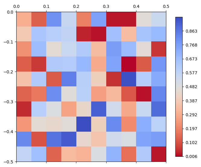
resample-source resample-new

Source code in src/pyramids/dataset/engines/spatial.py
def resample(
    self,
    cell_size: int | float | tuple[float, float],
    method: str = DEFAULT_RESAMPLING,
) -> Dataset:
    """Resample a raster to a new cell size.

    Resample the raster to `cell_size` using the requested interpolation method, keeping the
    existing CRS and extent. Returns a new in-memory Dataset; the source is left unchanged.

    The warp moves the stored values into bands of the source's own type, so a CF-packed raster
    (`scale_factor` / `add_offset`) keeps its packing on the result and reads back in the same
    physical units.

    Args:
        cell_size (int | float | tuple):
            New cell size to resample the raster to, in the units of the raster CRS. A scalar
            applies to both axes (square cells); an `(x_res, y_res)` pair gives non-square
            cells (e.g. `(2.0, 1.0)` for 2° longitude by 1° latitude).
        method (str):
            Resampling method, case-insensitive. Default is "nearest neighbor". Allowed values: "nearest"
            (alias "nearest neighbor"), "bilinear", "cubic", "cubic_spline", "lanczos", "average",
            "mode", "max", "min", "med", "q1", "q3", "sum", and "rms" (the GDAL warp algorithms;
            "sum"/"rms" need GDAL >= 3.1/3.3). Note: the aggregating algorithms ("average", "mode",
            "med", "q1", "q3", "sum", "rms") are not no-data-aware on this warp path — no-data cells
            inside a resampling kernel are mixed into the result. Prefer "nearest" on rasters that
            carry a no-data marker.

    Returns:
        Dataset:
            A new resampled Dataset.

    Raises:
        TypeError: If `method` is not a string.
        ValueError: If `method` is not one of the supported interpolation methods.

    Examples:
        - Create a 4-band 10×10 dataset at lon/lat (0, 0) with a 0.05° cell size, then resample to a
          coarser 0.1° cell. Halving the resolution halves the row/column count in each dimension
          (10 → 5), and the source CRS and band count carry through unchanged:

          ```python
          >>> import numpy as np
          >>> from pyramids.dataset import Dataset, GeoReference
          >>> arr = np.random.rand(4, 10, 10)
          >>> dataset = Dataset.from_array(
          ...     arr,
          ...     geo_ref=GeoReference(top_left_corner=(0, 0), cell_size=0.05, epsg=4326),
          ... )
          >>> (dataset.rows, dataset.columns, dataset.band_count)
          (10, 10, 4)
          >>> resampled = dataset.resample(cell_size=0.1)
          >>> (resampled.rows, resampled.columns, resampled.band_count, resampled.epsg)
          (5, 5, 4, 4326)
          >>> resampled.geotransform[1]
          0.1
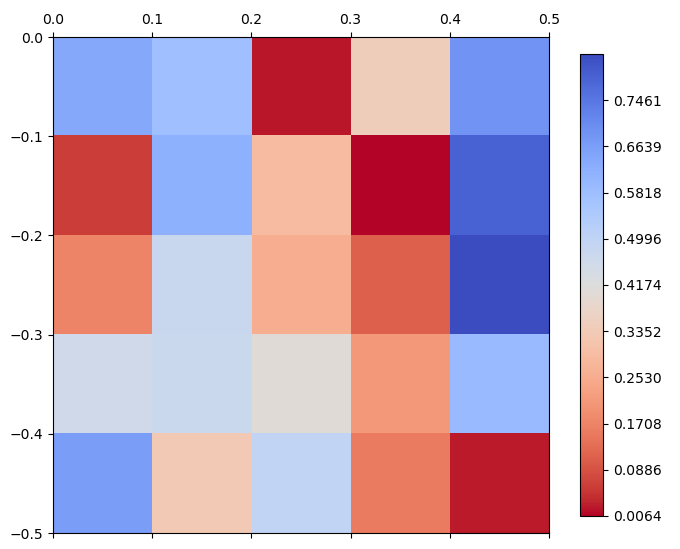
          ```
          ![resample-source](./../../_images/dataset/resample-source.png)
          ![resample-new](./../../_images/dataset/resample-new.png)
    """
    resampling_method: int = resolve_resampling(method)
    # cell_size may be a scalar (square) or an (x_res, y_res) pair (non-square output).
    x_res, y_res = _resolve_resolution(cell_size)

    sr_src = sr_from_wkt(self._ds.crs)
    # NetCDF variable views expose their CRS as an EPSG code (derived from CF coordinates) rather
    # than WKT on the raster, so `crs` can be empty even when `epsg` is known. Fall back to epsg to
    # avoid building a corrupt SpatialReference (which fails on ExportToWkt) (#588).
    if not self._ds.crs and self._ds.epsg:
        sr_src = sr_from_epsg(self._ds.epsg)

    ulx = self._ds.geotransform[0]
    uly = self._ds.geotransform[3]
    # transform the right lower corner point
    lrx = self._ds.geotransform[0] + self._ds.geotransform[1] * self._ds.columns
    lry = self._ds.geotransform[3] + self._ds.geotransform[5] * self._ds.rows

    # new geotransform — separate X/Y cell sizes so non-square output is supported
    new_geo = (
        self._ds.geotransform[0],
        x_res,
        self._ds.geotransform[2],
        self._ds.geotransform[3],
        self._ds.geotransform[4],
        -1 * y_res,
    )
    # create a new raster
    cols = int(np.round(abs(lrx - ulx) / x_res))
    rows = int(np.round(abs(uly - lry) / y_res))
    dtype = self._ds.gdal_dtype[0]
    bands = self._ds.band_count

    dst_obj = self._ds.__class__._build_dataset(
        cols,
        rows,
        bands,
        dtype,
        new_geo,
        sr_src.ExportToWkt(),
        self._ds.no_data_value,
    )
    gdal.ReprojectImage(
        self._ds.raster,
        dst_obj.raster,
        sr_src.ExportToWkt(),
        sr_src.ExportToWkt(),
        resampling_method,
    )
    # `ReprojectImage` moves the stored counts onto the new grid and `_build_dataset`
    # made the destination at the source's own type, so this is a byte-copy and has
    # to hand the recipe on with them. Without it a packed raster comes out of
    # `resample` as bare counts -- the hundredfold error #1124 was filed about.
    carry_packing(self._ds.raster, dst_obj.raster)

    return dst_obj

fill_gaps(mask, src_array, fills=None) #

Fill gaps in src_array using nearest neighbors where mask indicates valid cells.

Parameters:

Name Type Description Default
mask Dataset | ndarray

Mask dataset or array used to determine valid cells. A mask raster is read in stored units (unpack=False), since its absent cells are found by its stored no-data sentinel.

required
src_array ndarray

Source array whose gaps will be filled, in stored units -- crop reads it with unpack=False -- because the gaps are matched against a stored sentinel.

required
fills list | None

The value each band's absent cells actually hold. crop resolves this before stamping it into src_array, and it is not always the source's declaration -- a band that declares NaN on an integer dtype, or nothing at all, holds a derived value instead. Locating the gaps by the declaration would then match nothing on an integer array and quietly fill none of them. None falls back to the declaration, which is right for every caller that has not written a fill of its own.

None

Returns:

Type Description
NDArray

np.ndarray: The source array with gaps filled where applicable.

Source code in src/pyramids/dataset/engines/spatial.py
def fill_gaps(
    self, mask, src_array: np.ndarray, fills: list | None = None
) -> np.typing.NDArray:
    """Fill gaps in src_array using nearest neighbors where mask indicates valid cells.

    Args:
        mask (Dataset | np.ndarray):
            Mask dataset or array used to determine valid cells. A mask raster is read in
            stored units (`unpack=False`), since its absent cells are found by its stored
            no-data sentinel.
        src_array (np.ndarray):
            Source array whose gaps will be filled, in stored units -- `crop` reads it with
            `unpack=False` -- because the gaps are matched against a stored sentinel.
        fills (list | None):
            The value each band's absent cells actually hold. `crop`
            resolves this before stamping it into `src_array`, and it is
            not always the source's declaration -- a band that declares
            `NaN` on an integer dtype, or nothing at all, holds a derived
            value instead. Locating the gaps by the declaration would then
            match nothing on an integer array and quietly fill none of
            them. `None` falls back to the declaration, which is right for
            every caller that has not written a fill of its own.

    Returns:
        np.ndarray: The source array with gaps filled where applicable.
    """
    gap_value = self._ds.no_data_value[0] if fills is None else fills[0]
    # align function only equate the no of rows and columns only
    # match no_data_value inserts no_data_value in src raster to all places like mask
    # still places that has no_data_value in the src raster, but it is not no_data_value in the mask
    # and now has to be filled with values
    # compare no of element that is not no_data_value in both rasters to make sure they are matched
    # if both inputs are rasters
    # read_array() is called with no chunks=, so it always returns a plain
    # ndarray here (the dask.Array arm of ArrayLike is unreachable).
    # `unpack=False`: a mask is read to locate its absent cells, and the sentinel
    # they are matched against is a stored value.
    # `squeeze=True` keeps the classic flattened `(bands, rows, cols)` this band-wise
    # count comparison expects, not the dimension-preserving default (#1241).
    mask_array = cast(
        np.typing.NDArray, mask.read_array(unpack=False, squeeze=True)
    )
    mask_noval = mask.no_data_value[0]

    if isinstance(mask, RasterBase) and isinstance(self._ds, RasterBase):
        src_no_data = is_no_data(src_array, gap_value)
        mask_no_data = is_no_data(mask_array, mask_noval)
        elem_src = src_array.size - np.count_nonzero(src_array[src_no_data])
        elem_mask = mask_array.size - np.count_nonzero(mask_array[mask_no_data])

        # Cells that are out-of-domain in src but in-domain in mask
        # need to be interpolated from neighbors.
        if elem_mask > elem_src:
            gap_rows, gap_cols = np.nonzero(src_no_data & ~mask_no_data)
            src_array = Vectorize._nearest_neighbour(
                src_array,
                gap_value,
                gap_rows.tolist(),
                gap_cols.tolist(),
            )
    return src_array

same_grid(other, *, compare_crs=True) #

Whether other occupies this dataset's pixel grid, in the same CRS.

Size alone is not the question: this also requires the same CRS and the same geotransform, so two rasters that pass it can be combined cell by cell without resampling — which is exactly what :meth:Analysis.combine <pyramids.dataset.engines.Analysis.combine> asks before it does so.

Geotransform components are compared with a small relative tolerance so that byte-for-byte-identical grids (the normal case for per-band files of one scene) compare equal even after the round-trip through GDAL's floating-point geotransform.

Parameters:

Name Type Description Default
other Dataset

Dataset to compare against this one.

required
compare_crs bool

Whether the CRSes must agree too. Default True. Pass False for the one case where a missing CRS is not a mismatch: an input that carries no CRS tag at all still sits on this raster's cells when its geotransform and size match, and inherits this one's georeferencing downstream. pyramids calc uses it for exactly that.

True

Returns:

Name Type Description
bool bool

True iff both rasters occupy the same pixel grid — in the same CRS unless compare_crs=False.

Raises:

Type Description
TypeError

other is not a Dataset. Reported here rather than as an AttributeError from the first geo-property read.

Examples:

  • Two rasters built on one grid can be combined cell by cell:
>>> import numpy as np
>>> from pyramids.dataset import Dataset, GeoReference
>>> geo_ref = GeoReference(top_left_corner=(0.0, 5.0), cell_size=0.25, epsg=4326)
>>> a = Dataset.from_array(np.zeros((20, 20), "float32"), geo_ref=geo_ref)
>>> b = Dataset.from_array(np.ones((20, 20), "float32"), geo_ref=geo_ref)
>>> a.same_grid(b)
True
  • A different origin is a different grid, even at the same size and CRS — align brings it onto this one:
>>> import numpy as np
>>> from pyramids.dataset import Dataset, GeoReference
>>> here = Dataset.from_array(
...     np.zeros((8, 8), "float32"),
...     geo_ref=GeoReference(top_left_corner=(0.0, 5.0), cell_size=0.25, epsg=4326),
... )
>>> coarse = Dataset.from_array(
...     np.zeros((4, 4), "float32"),
...     geo_ref=GeoReference(top_left_corner=(0.0, 5.0), cell_size=0.5, epsg=4326),
... )
>>> here.same_grid(coarse)
False
>>> here.same_grid(coarse.align(here))
True
  • Identical numbers in a different CRS describe a different grid:
>>> import numpy as np
>>> from pyramids.dataset import Dataset, GeoReference
>>> lonlat = Dataset.from_array(
...     np.zeros((4, 4), "float32"),
...     geo_ref=GeoReference(top_left_corner=(0.0, 5.0), cell_size=0.25, epsg=4326),
... )
>>> projected = Dataset.from_array(
...     np.zeros((4, 4), "float32"),
...     geo_ref=GeoReference(top_left_corner=(0.0, 5.0), cell_size=0.25, epsg=3857),
... )
>>> lonlat.same_grid(projected)
False
See Also

Spatial.align: Resamples a mismatched raster onto this one's grid, so that same_grid then holds. Analysis.combine: Combines two rasters cell by cell, and raises unless this predicate holds.

Source code in src/pyramids/dataset/engines/spatial.py
def same_grid(self, other: Dataset, *, compare_crs: bool = True) -> bool:
    """Whether ``other`` occupies this dataset's pixel grid, in the same CRS.

    Size alone is not the question: this also requires the same CRS and the
    same geotransform, so two rasters that pass it can be combined cell by
    cell without resampling — which is exactly what
    :meth:`Analysis.combine <pyramids.dataset.engines.Analysis.combine>`
    asks before it does so.

    Geotransform components are compared with a small relative tolerance so
    that byte-for-byte-identical grids (the normal case for per-band files
    of one scene) compare equal even after the round-trip through GDAL's
    floating-point geotransform.

    Args:
        other (Dataset):
            Dataset to compare against this one.
        compare_crs (bool):
            Whether the CRSes must agree too. Default `True`. Pass `False`
            for the one case where a missing CRS is not a mismatch: an input
            that carries no CRS tag at all still sits on this raster's cells
            when its geotransform and size match, and inherits this one's
            georeferencing downstream. `pyramids calc` uses it for exactly
            that.

    Returns:
        bool:
            `True` iff both rasters occupy the same pixel grid — in the same
            CRS unless `compare_crs=False`.

    Raises:
        TypeError:
            `other` is not a Dataset. Reported here rather than as an
            `AttributeError` from the first geo-property read.

    Examples:
        - Two rasters built on one grid can be combined cell by cell:

          ```python
          >>> import numpy as np
          >>> from pyramids.dataset import Dataset, GeoReference
          >>> geo_ref = GeoReference(top_left_corner=(0.0, 5.0), cell_size=0.25, epsg=4326)
          >>> a = Dataset.from_array(np.zeros((20, 20), "float32"), geo_ref=geo_ref)
          >>> b = Dataset.from_array(np.ones((20, 20), "float32"), geo_ref=geo_ref)
          >>> a.same_grid(b)
          True

          ```

        - A different origin is a different grid, even at the same size and
          CRS — `align` brings it onto this one:

          ```python
          >>> import numpy as np
          >>> from pyramids.dataset import Dataset, GeoReference
          >>> here = Dataset.from_array(
          ...     np.zeros((8, 8), "float32"),
          ...     geo_ref=GeoReference(top_left_corner=(0.0, 5.0), cell_size=0.25, epsg=4326),
          ... )
          >>> coarse = Dataset.from_array(
          ...     np.zeros((4, 4), "float32"),
          ...     geo_ref=GeoReference(top_left_corner=(0.0, 5.0), cell_size=0.5, epsg=4326),
          ... )
          >>> here.same_grid(coarse)
          False
          >>> here.same_grid(coarse.align(here))
          True

          ```

        - Identical numbers in a different CRS describe a different grid:

          ```python
          >>> import numpy as np
          >>> from pyramids.dataset import Dataset, GeoReference
          >>> lonlat = Dataset.from_array(
          ...     np.zeros((4, 4), "float32"),
          ...     geo_ref=GeoReference(top_left_corner=(0.0, 5.0), cell_size=0.25, epsg=4326),
          ... )
          >>> projected = Dataset.from_array(
          ...     np.zeros((4, 4), "float32"),
          ...     geo_ref=GeoReference(top_left_corner=(0.0, 5.0), cell_size=0.25, epsg=3857),
          ... )
          >>> lonlat.same_grid(projected)
          False

          ```

    See Also:
        Spatial.align: Resamples a mismatched raster onto this one's grid,
            so that `same_grid` then holds.
        Analysis.combine: Combines two rasters cell by cell, and raises
            unless this predicate holds.
    """
    if not isinstance(other, RasterBase):
        raise TypeError(f"`other` must be a Dataset, got {type(other).__name__}")
    ds = self._ds
    return (
        # `crs_equal(crs_spec(...))`, not `a.epsg == b.epsg`: `epsg` is None
        # for any CRS without an EPSG authority, so two *different* such
        # CRSes both reported None and compared equal. Two geostationary
        # rasters at different sub-satellite longitudes were read as one
        # grid, and the band stack silently dropped every band after the
        # first.
        (
            not compare_crs
            or crs_equal(crs_spec(ds.epsg, ds.crs), crs_spec(other.epsg, other.crs))
        )
        and ds.rows == other.rows
        and ds.columns == other.columns
        and bool(
            np.allclose(
                np.asarray(ds.geotransform),
                np.asarray(other.geotransform),
                rtol=1e-7,
            )
        )
    )

align(alignment_src, *, method=DEFAULT_RESAMPLING) #

Align the current dataset (rows and columns) to match a given dataset.

Copies spatial properties from alignment_src to the current raster
  • The coordinate system
  • The number of rows and columns
  • Cell size

Then resamples values from the current dataset onto that grid using method (nearest neighbor by default, so the historical behaviour is unchanged).

Parameters:

Name Type Description Default
alignment_src Dataset

Spatial information source raster to get the spatial information (coordinate system, number of rows and columns). The data values of the current dataset are resampled to this alignment.

required
method (str, keyword - only)

Resampling method, case-insensitive. Default is "nearest neighbor". Accepts the same algorithm names as :meth:Spatial.to_crs: "nearest" (alias "nearest neighbor"), "bilinear", "cubic", "cubic_spline", "lanczos", "average", "mode", "max", "min", "med", "q1", "q3", "sum", and "rms" (the GDAL warp algorithms; "sum"/"rms" need GDAL >= 3.1/3.3). The aggregating algorithms ("min", "max", "average", "mode", "med", "q1", "q3", "sum", "rms") honour the source no-data value when the raster declares one: no-data cells are excluded from the kernel and a kernel that is entirely no-data yields no-data. A raster that carries no no-data marker has nothing to exclude, so every cell — including a sentinel fill such as 9999 — is treated as valid data.

DEFAULT_RESAMPLING

Returns:

Name Type Description
Dataset Dataset

A new aligned Dataset.

Note
  • method is keyword-only. Pass it by name (align(template, method="bilinear")), matching :meth:DatasetCollection.align. This deliberately differs from :meth:Spatial.to_crs / :meth:Spatial.resample, which accept method positionally — a bare positional resampling name after a Dataset template reads poorly and would collide with the collection API's inplace slot.
  • Output dtype follows the template, not the source. The aligned raster is built with alignment_src's data type, so resampling a floating-point source onto an integer-typed template with an interpolating method ("bilinear"/"cubic"/...) silently drops the fractional part (the interpolated values are cast to the template's integer type). Match the template dtype to the source, or use "nearest", to avoid it.
  • CF packing follows the source. The warp moves the source's stored values, so the source's scale_factor / add_offset are carried onto the result, which reads back in the source's physical units; the template's own packing, if any, plays no part.
  • Cross-CRS aligns resample twice. When the source and alignment_src CRSes differ, the data is first reprojected onto an intermediate grid and then resampled onto the template grid, so a non-nearest method is applied twice. For interpolating kernels ("bilinear"/"cubic") that means the result is a little more smoothed than a same-CRS align with the identical method; for aggregating kernels it changes the statistic itself — "sum" double-aggregates and inflates the total, and "average"/"mode"/... become differently weighted, not smoother. The output grid is always exact; only pixel values differ. Reproject the source to the template CRS first when an aggregating method must be exact (a single-pass warp).

Examples:

  • The source dataset has a top_left_corner at (0, 0) with a 5*5 alignment, and a 0.05 degree cell size.
>>> import numpy as np
>>> from pyramids.dataset import Dataset, GeoReference
>>> arr = np.random.rand(5, 5)
>>> dataset = Dataset.from_array(
...     arr,
...     geo_ref=GeoReference(top_left_corner=(0, 0), cell_size=0.05, epsg=4326),
... )
>>> (dataset.rows, dataset.columns, dataset.epsg, dataset.band_count)
(5, 5, 4326, 1)
  • The dataset to be aligned has a top_left_corner at (-0.1, 0.1) (i.e., it has two more rows on top of the dataset, and two columns on the left of the dataset).
>>> import numpy as np
>>> from pyramids.dataset import Dataset
>>> arr_target = np.random.rand(10, 10)
>>> dataset_target = Dataset.from_array(
...     arr_target,
...     geo_ref=GeoReference(top_left_corner=(-0.1, 0.1), cell_size=0.07, epsg=4326),
... )
>>> (dataset_target.rows, dataset_target.columns, dataset_target.geotransform[1])
(10, 10, 0.07)
align-source-target

  • Now call the align method and use the source dataset as the alignment template. The aligned dataset adopts the source's cell size, dimensions, and CRS:
>>> import numpy as np
>>> from pyramids.dataset import Dataset
>>> source = Dataset.from_array(
...     np.random.rand(5, 5),
...     geo_ref=GeoReference(top_left_corner=(0, 0), cell_size=0.05, epsg=4326),
... )
>>> target = Dataset.from_array(
...     np.random.rand(10, 10),
...     geo_ref=GeoReference(top_left_corner=(-0.1, 0.1), cell_size=0.07, epsg=4326),
... )
>>> aligned = target.align(source)
>>> (aligned.rows, aligned.columns, aligned.geotransform[1], aligned.epsg)
(5, 5, 0.05, 4326)
align-result

  • Choose a different resampling method (e.g. bilinear) while still landing on the template's exact grid. The default stays nearest neighbor, so only callers that opt in change behaviour:
>>> import numpy as np
>>> from pyramids.dataset import Dataset
>>> source = Dataset.from_array(
...     np.arange(25, dtype=np.float32).reshape(5, 5),
...     geo_ref=GeoReference(top_left_corner=(0, 0), cell_size=0.05, epsg=4326),
... )
>>> template = Dataset.from_array(
...     np.zeros((10, 10), dtype=np.float32),
...     geo_ref=GeoReference(top_left_corner=(0, 0), cell_size=0.025, epsg=4326),
... )
>>> aligned = source.align(template, method="bilinear")
>>> (aligned.rows, aligned.columns, aligned.epsg)
(10, 10, 4326)

Raises:

Type Description
TypeError

alignment_src is not a RasterBase, or method is not a string.

ValueError

method is not one of the supported interpolation methods.

CRSError

Either raster has no CRS. Aligning needs both, and pyramids will not assume WGS 84 for an unprojected grid (ARC-26).

Source code in src/pyramids/dataset/engines/spatial.py
def align(
    self,
    alignment_src: Dataset,
    *,
    method: str = DEFAULT_RESAMPLING,
) -> Dataset:
    """Align the current dataset (rows and columns) to match a given dataset.

    Copies spatial properties from alignment_src to the current raster:
        - The coordinate system
        - The number of rows and columns
        - Cell size
    Then resamples values from the current dataset onto that grid using `method` (nearest neighbor by
    default, so the historical behaviour is unchanged).

    Args:
        alignment_src (Dataset):
            Spatial information source raster to get the spatial information (coordinate system, number of rows and
            columns). The data values of the current dataset are resampled to this alignment.
        method (str, keyword-only):
            Resampling method, case-insensitive. Default is "nearest neighbor". Accepts the same algorithm
            names as :meth:`Spatial.to_crs`: "nearest" (alias "nearest neighbor"), "bilinear", "cubic",
            "cubic_spline", "lanczos", "average", "mode", "max", "min", "med", "q1", "q3", "sum", and "rms"
            (the GDAL warp algorithms; "sum"/"rms" need GDAL >= 3.1/3.3). The aggregating algorithms
            ("min", "max", "average", "mode", "med", "q1", "q3", "sum", "rms") honour the source no-data
            value when the raster declares one: no-data cells are excluded from the kernel and a kernel that
            is entirely no-data yields no-data. A raster that carries no no-data marker has nothing to
            exclude, so every cell — including a sentinel fill such as 9999 — is treated as valid data.

    Returns:
        Dataset: A new aligned Dataset.

    Note:
        - **`method` is keyword-only.** Pass it by name (`align(template, method="bilinear")`), matching
          :meth:`DatasetCollection.align`. This deliberately differs from :meth:`Spatial.to_crs` /
          :meth:`Spatial.resample`, which accept `method` positionally — a bare positional resampling name
          after a `Dataset` template reads poorly and would collide with the collection API's `inplace` slot.
        - **Output dtype follows the template, not the source.** The aligned raster is built with
          `alignment_src`'s data type, so resampling a floating-point source onto an integer-typed template
          with an interpolating `method` ("bilinear"/"cubic"/...) silently drops the fractional part (the
          interpolated values are cast to the template's integer type). Match the template dtype to the
          source, or use "nearest", to avoid it.
        - **CF packing follows the source.** The warp moves the source's stored values, so the source's
          `scale_factor` / `add_offset` are carried onto the result, which reads back in the source's physical
          units; the template's own packing, if any, plays no part.
        - **Cross-CRS aligns resample twice.** When the source and `alignment_src` CRSes differ, the data is
          first reprojected onto an intermediate grid and then resampled onto the template grid, so a
          non-nearest `method` is applied twice. For interpolating kernels ("bilinear"/"cubic") that means the
          result is a little more smoothed than a same-CRS align with the identical `method`; for aggregating
          kernels it changes the statistic itself — "sum" double-aggregates and inflates the total, and
          "average"/"mode"/... become differently weighted, not smoother. The output grid is always exact;
          only pixel values differ. Reproject the source to the template CRS first when an aggregating `method`
          must be exact (a single-pass warp).

    Examples:
        - The source dataset has a `top_left_corner` at (0, 0) with a 5*5 alignment, and a 0.05 degree cell size.

          ```python
          >>> import numpy as np
          >>> from pyramids.dataset import Dataset, GeoReference
          >>> arr = np.random.rand(5, 5)
          >>> dataset = Dataset.from_array(
          ...     arr,
          ...     geo_ref=GeoReference(top_left_corner=(0, 0), cell_size=0.05, epsg=4326),
          ... )
          >>> (dataset.rows, dataset.columns, dataset.epsg, dataset.band_count)
          (5, 5, 4326, 1)

          ```

        - The dataset to be aligned has a top_left_corner at (-0.1, 0.1) (i.e., it has two more rows on top of the
          dataset, and two columns on the left of the dataset).

          ```python
          >>> import numpy as np
          >>> from pyramids.dataset import Dataset
          >>> arr_target = np.random.rand(10, 10)
          >>> dataset_target = Dataset.from_array(
          ...     arr_target,
          ...     geo_ref=GeoReference(top_left_corner=(-0.1, 0.1), cell_size=0.07, epsg=4326),
          ... )
          >>> (dataset_target.rows, dataset_target.columns, dataset_target.geotransform[1])
          (10, 10, 0.07)

          ```

        ![align-source-target](./../../_images/dataset/align-source-target.png)

        - Now call the `align` method and use the source dataset as the alignment template. The aligned
          dataset adopts the source's cell size, dimensions, and CRS:

          ```python
          >>> import numpy as np
          >>> from pyramids.dataset import Dataset
          >>> source = Dataset.from_array(
          ...     np.random.rand(5, 5),
          ...     geo_ref=GeoReference(top_left_corner=(0, 0), cell_size=0.05, epsg=4326),
          ... )
          >>> target = Dataset.from_array(
          ...     np.random.rand(10, 10),
          ...     geo_ref=GeoReference(top_left_corner=(-0.1, 0.1), cell_size=0.07, epsg=4326),
          ... )
          >>> aligned = target.align(source)
          >>> (aligned.rows, aligned.columns, aligned.geotransform[1], aligned.epsg)
          (5, 5, 0.05, 4326)

          ```

        ![align-result](./../../_images/dataset/align-result.png)

        - Choose a different resampling method (e.g. bilinear) while still landing on the template's exact
          grid. The default stays nearest neighbor, so only callers that opt in change behaviour:

          ```python
          >>> import numpy as np
          >>> from pyramids.dataset import Dataset
          >>> source = Dataset.from_array(
          ...     np.arange(25, dtype=np.float32).reshape(5, 5),
          ...     geo_ref=GeoReference(top_left_corner=(0, 0), cell_size=0.05, epsg=4326),
          ... )
          >>> template = Dataset.from_array(
          ...     np.zeros((10, 10), dtype=np.float32),
          ...     geo_ref=GeoReference(top_left_corner=(0, 0), cell_size=0.025, epsg=4326),
          ... )
          >>> aligned = source.align(template, method="bilinear")
          >>> (aligned.rows, aligned.columns, aligned.epsg)
          (10, 10, 4326)

          ```

    Raises:
        TypeError: `alignment_src` is not a `RasterBase`, or `method` is not a string.
        ValueError: `method` is not one of the supported interpolation methods.
        CRSError: Either raster has no CRS. Aligning needs both, and
            pyramids will not assume WGS 84 for an unprojected grid
            (ARC-26).
    """
    if isinstance(alignment_src, RasterBase):
        src = alignment_src
    else:
        raise TypeError(
            "First parameter should be a Dataset read using Dataset.openRaster or a path to the raster, "
            f"given {type(alignment_src)}"
        )

    # Validate/resolve the method up front so a bad name is rejected before any warp runs, even on the
    # same-CRS path (where `to_crs` below is skipped and would otherwise be the only validator).
    resample_alg: int = resolve_resampling(method)

    # reproject the raster to match the projection of alignment_src
    # Both sides are required, and the check must sit OUTSIDE the inequality
    # below: two CRS-less rasters both report `epsg is None`, so they compare
    # equal, skip the branch, and the result is still stamped with the
    # reference's projection further down (ARC-26).
    own_crs = require_crs_spec(
        self._ds.epsg, self._ds.crs, "align a raster onto another grid"
    )
    target_crs = require_crs_spec(
        src.epsg, src.crs, "align onto this reference grid"
    )
    reprojected_raster_b: Dataset = self._ds
    # Compare the resolved CRS, not `epsg` alone: two grids with different
    # real CRSes can both report `epsg is None` (the geostationary shape),
    # compare equal, skip the warp, and be stamped with the reference's
    # projection further down (ARC-26). `crs_equal` rather than `!=`, because
    # `crs_spec` falls back to the raw WKT for a CRS with no EPSG authority
    # -- exactly that case -- so two spellings of one CRS would otherwise
    # warp the data through an identity transform.
    if not crs_equal(own_crs, target_crs):
        reprojected_raster_b = self.to_crs(target_crs, method=method)  # type: ignore[assignment]
    dst_obj = self._ds.__class__._build_dataset(
        src.columns,
        src.rows,
        self._ds.band_count,
        src.gdal_dtype[0],
        src.geotransform,
        src.crs,
        self._ds.no_data_value,
    )
    # resample the reprojected_RasterB onto the freshly built target grid using the requested algorithm
    gdal.ReprojectImage(
        reprojected_raster_b.raster,
        dst_obj.raster,
        src.crs,
        src.crs,
        resample_alg,
    )
    # ReprojectImage moves only pixels onto the freshly built grid, so the
    # output would otherwise lose the class legend, RAT, and band/dataset
    # metadata. Carry them over from the (possibly reprojected) source (#1029).
    carry_raster_metadata(reprojected_raster_b.raster, dst_obj.raster)
    # And the CF packing, which is not part of that metadata: the pixels moved
    # here are stored counts, so `align` has to say what turns them back into
    # measurements or a packed raster comes out a hundredfold off (#1124).
    carry_packing(reprojected_raster_b.raster, dst_obj.raster)

    return dst_obj

crop(mask=None, touch=True, *, bbox=None, epsg=None) #

Crop dataset using a polygon mask, a raster mask, or a bbox tuple.

Crop/Clip the Dataset object using a polygon/raster — or, as a
convenience, a plain ``(west, south, east, north)`` bbox tuple
in some EPSG (no need to wrap it in a :class:`FeatureCollection`
by hand).

Parameters:

Name Type Description Default
mask GeoDataFrame | Dataset | None

GeoDataFrame with a polygon geometry, or a Dataset object. Mutually exclusive with bbox; exactly one of the two must be supplied.

None
touch bool

Include the cells that touch the polygon, not only those that lie entirely inside the polygon mask. Default is True.

True
bbox (tuple[float, float, float, float] | None, keyword - only)

(west, south, east, north) quadruple in the CRS named by epsg. Internally wrapped in a one-row :class:FeatureCollection and routed through the same polygon path. Mutually exclusive with mask. A geographic bbox with west > east (the STAC convention for an antimeridian-crossing area, e.g. (170, -10, -170, 10)) is split at the 180°/360° seam, each half cropped, and the halves stitched into one contiguous strip whose longitudes continue past the seam (170..190). Works for -180..180 and 0..360 grids. Behaviour change: a geographic west > east bbox is read as the STAC antimeridian convention (rather than raising bbox must satisfy west < east) — but only when the dataset's longitude extent actually reaches the 180 seam. On a regional grid that does not reach the seam (e.g. Europe, lon -10..40) a west > east bbox cannot be a genuine crossing, so it raises a clear error instead of silently returning a truncated crop — catching a transposed / typo'd bbox. A projected west > east bbox is still validated and raises, since the antimeridian has no meaning off a geographic CRS.

None
epsg (Any, keyword - only)

CRS for bbox — anything geopandas accepts for crs= (EPSG int, "EPSG:4326", WKT, pyproj.CRS). Defaults to the dataset's own CRS, so a bbox in the dataset's native CRS needs no extra argument; pass it explicitly for a bbox in a different CRS (the standard reprojection path takes care of it).

None

Returns:

Name Type Description
Dataset Dataset

A new cropped Dataset.

Hint
  • If the mask is a dataset with multi-bands, the crop method will use the first band as the mask.
Note

A bbox crop keeps every pixel the box overlaps (the all-touched convention :meth:read_array uses for bbox=), which for a box not aligned to pixel edges can be up to one pixel wider per side than a polygon mask= crop (GDAL's centre-containment default). When the box is axis-aligned in the dataset's own CRS (no epsg reprojection, no antimeridian split, a north-up grid, touch=True) it is cropped by reading only that pixel window straight from the source, so a small crop out of a very large or /vsicurl raster reads only the AOI instead of the full source. Ineligible cases (a reprojecting bbox, a rotated grid) fall back to the cutline warp, run all-touched so the result matches the windowed path; touch=False keeps the entirely-inside cutline crop.

Note

The result declares the value its excluded cells hold, which is not always the source's. A band whose own sentinel is storable keeps it and nothing changes. A band whose sentinel cannot be stored -- NaN on an integer band -- has one derived against its own data: the first value that fits the dtype and occurs nowhere in the band, written into the excluded cells and declared on the output, so they cannot be read back as measurements. A floating band always gets NaN.

A band that declares nothing depends on which mask is used, because the two routes are forced to decide different things:

  • a raster mask writes the excluded cells itself, into an array with no way to hold "absent", so it derives a fill and declares it;
  • a polygon / FeatureCollection mask lets GDAL fill them, so nothing forces the question and the source's own declaration -- none -- stands.

The bbox= windowed fast path excludes no cell inside the rectangle it reads, so it writes no fill and declares nothing new. The same box falling back to the cutline warp does exclude cells; two routes to one region can therefore report a different no_data_value, for a band whose sentinel was unstorable to begin with.

Int64 and UInt64 are a further exception on the cutline route. -dstnodata reaches GDAL as a C double, which a value beyond 2**53 does not survive, so no fill is offered for one and the border is left undeclared.

Raises:

Type Description
NoDataValueError

A band holds every candidate sentinel, so no value is free to mark the cells the mask excludes. Note this does not derive from ValueError.

AlignmentError

A raster mask does not share the dataset's grid.

TypeError

mask is not a Dataset, FeatureCollection or GeoDataFrame.

Examples:

  • Crop the raster using a polygon mask.

  • The polygon covers 4 cells in the 3rd and 4th rows and 3rd and 4th column arr[2:4, 2:4], so the result dataset will have the same number of bands 4, 2 rows and 2 columns.

  • First, create the dataset to have 4 bands, 10 rows and 10 columns; the dataset has a cell size of 0.05 degree, the top left corner of the dataset is (0, 0).

>>> import numpy as np
>>> import geopandas as gpd
>>> from shapely.geometry import Polygon
>>> from pyramids.dataset import Dataset, GeoReference
>>> arr = np.random.rand(4, 10, 10)
>>> cell_size = 0.05
>>> top_left_corner = (0, 0)
>>> dataset = Dataset.from_array(
...     arr,
...     geo_ref=GeoReference(top_left_corner=top_left_corner, cell_size=cell_size, epsg=4326),
... )
- Second, create the polygon using shapely polygon, and use the xmin, ymin, xmax, ymax = [0.1, -0.2, 0.2 -0.1] to cover the 4 cells.

```python
>>> mask = gpd.GeoDataFrame(geometry=[Polygon([(0.1, -0.1), (0.1, -0.2), (0.2, -0.2), (0.2, -0.1)])], crs=4326)

```
  • Pass the geodataframe to the crop method using the mask parameter.

>>> cropped_dataset = dataset.crop(mask=mask)
- Check the cropped dataset:

>>> print(cropped_dataset.shape)
(4, 2, 2)
>>> print(cropped_dataset.geotransform)
(0.1, 0.05, 0.0, -0.1, 0.0, -0.05)
>>> print(cropped_dataset.read_array(band=0))# doctest: +SKIP
[[0.00921161 0.90841171]
 [0.355636   0.18650262]]
>>> print(arr[0, 2:4, 2:4])# doctest: +SKIP
[[0.00921161 0.90841171]
 [0.355636   0.18650262]]
- Crop a raster using another raster mask:

  • Create a mask dataset with the same extent of the polygon we used in the previous example.

>>> geotransform = (0.1, 0.05, 0.0, -0.1, 0.0, -0.05)
>>> mask_dataset = Dataset.from_array(
...     np.random.rand(2, 2),
...     geo_ref=GeoReference(geo=geotransform, epsg=4326),
... )
- Then use the mask dataset to crop the dataset.

>>> cropped_dataset_2 = dataset.crop(mask=mask_dataset)
>>> print(cropped_dataset_2.shape)
(4, 2, 2)
- Check the cropped dataset:

>>> print(cropped_dataset_2.geotransform)
(0.1, 0.05, 0.0, -0.1, 0.0, -0.05)
>>> print(cropped_dataset_2.read_array(band=0))# doctest: +SKIP
[[0.00921161 0.90841171]
 [0.355636   0.18650262]]
>>> print(arr[0, 2:4, 2:4])# doctest: +SKIP
 [[0.00921161 0.90841171]
 [0.355636   0.18650262]]
  • Crop using a (west, south, east, north) bbox tuple instead of a hand-built FeatureCollection (the bbox CRS defaults to the dataset's own):
>>> import numpy as np
>>> from pyramids.dataset import Dataset
>>> arr_int = np.arange(100, dtype="int16").reshape(10, 10)
>>> dataset_bbox = Dataset.from_array(
...     arr_int,
...     geo_ref=GeoReference(top_left_corner=(0, 0), cell_size=0.05, epsg=4326),
... )
>>> cropped_bbox = dataset_bbox.crop(bbox=(0.1, -0.2, 0.2, -0.1))
>>> cropped_bbox.shape
(1, 2, 2)
>>> cropped_bbox.epsg
4326
  • Crop across the antimeridian with a west > east geographic bbox (STAC convention); the two sides are stitched into one contiguous strip whose longitudes continue past the 180° seam:
>>> import numpy as np
>>> from pyramids.dataset import Dataset
>>> grid = Dataset.from_array(
...     np.arange(180 * 360, dtype="float32").reshape(180, 360),
...     geo_ref=GeoReference(top_left_corner=(-180.0, 90.0), cell_size=1.0, epsg=4326),
... )
>>> strip = grid.crop(bbox=(170.0, -10.0, -170.0, 10.0))
>>> strip.shape
(1, 20, 20)
>>> strip.bbox
[170.0, -10.0, 190.0, 10.0]
  • Supplying both mask and bbox is rejected:
>>> import numpy as np
>>> from pyramids.dataset import Dataset
>>> from pyramids.feature import FeatureCollection
>>> dataset_excl = Dataset.from_array(
...     np.zeros((4, 5), dtype="int16"),
...     geo_ref=GeoReference(top_left_corner=(0, 0), cell_size=0.05, epsg=4326),
... )
>>> fc = FeatureCollection.from_bbox((0.0, -0.1, 0.1, 0.0), epsg=4326)
>>> try:
...     dataset_excl.crop(mask=fc, bbox=(0.0, -0.1, 0.1, 0.0))
... except ValueError as exc:
...     print("not both" in str(exc))
True
Source code in src/pyramids/dataset/engines/spatial.py
def crop(
    self,
    mask: GeoDataFrame | FeatureCollection | None = None,
    touch: bool = True,
    *,
    bbox: tuple[float, float, float, float] | list[float] | None = None,
    epsg: Any = None,
) -> Dataset:
    """Crop dataset using a polygon mask, a raster mask, or a bbox tuple.

        Crop/Clip the Dataset object using a polygon/raster — or, as a
        convenience, a plain ``(west, south, east, north)`` bbox tuple
        in some EPSG (no need to wrap it in a :class:`FeatureCollection`
        by hand).

    Args:
        mask (GeoDataFrame | Dataset | None):
            GeoDataFrame with a polygon geometry, or a Dataset object.
            Mutually exclusive with ``bbox``; exactly one of the two must
            be supplied.
        touch (bool):
            Include the cells that touch the polygon, not only those that lie entirely inside the polygon mask.
            Default is True.
        bbox (tuple[float, float, float, float] | None, keyword-only):
            ``(west, south, east, north)`` quadruple in the CRS named by
            ``epsg``. Internally wrapped in a one-row
            :class:`FeatureCollection` and routed through the same polygon
            path. Mutually exclusive with ``mask``. A *geographic* bbox with
            ``west > east`` (the STAC convention for an antimeridian-crossing
            area, e.g. ``(170, -10, -170, 10)``) is split at the 180°/360°
            seam, each half cropped, and the halves stitched into one
            contiguous strip whose longitudes continue past the seam
            (``170..190``). Works for ``-180..180`` and ``0..360`` grids.
            Behaviour change: a *geographic* ``west > east`` bbox is read as
            the STAC antimeridian convention (rather than raising
            ``bbox must satisfy west < east``) — but only when the dataset's
            longitude extent actually reaches the 180 seam. On a *regional*
            grid that does not reach the seam (e.g. Europe, lon ``-10..40``) a
            ``west > east`` bbox cannot be a genuine crossing, so it raises a
            clear error instead of silently returning a truncated crop —
            catching a transposed / typo'd bbox. A *projected* ``west > east``
            bbox is still validated and raises, since the antimeridian has no
            meaning off a geographic CRS.
        epsg (Any, keyword-only):
            CRS for ``bbox`` — anything ``geopandas`` accepts for ``crs=``
            (EPSG int, ``"EPSG:4326"``, WKT, ``pyproj.CRS``). Defaults to
            the dataset's own CRS, so a bbox in the dataset's native CRS
            needs no extra argument; pass it explicitly for a bbox in a
            different CRS (the standard reprojection path takes care of it).

    Returns:
        Dataset:
            A new cropped Dataset.

    Hint:
        - If the mask is a dataset with multi-bands, the `crop` method will use the first band as the mask.

    Note:
        A ``bbox`` crop keeps **every pixel the box overlaps** (the all-touched
        convention :meth:`read_array` uses for ``bbox=``), which for a box not
        aligned to pixel edges can be up to one pixel wider per side than a
        polygon ``mask=`` crop (GDAL's centre-containment default). When the box
        is axis-aligned in the dataset's own CRS (no ``epsg`` reprojection, no
        antimeridian split, a north-up grid, ``touch=True``) it is cropped by
        reading only that pixel window straight from the source, so a small crop
        out of a very large or ``/vsicurl`` raster reads only the AOI instead of
        the full source. Ineligible cases (a reprojecting bbox, a rotated grid)
        fall back to the cutline warp, run all-touched so the result matches the
        windowed path; ``touch=False`` keeps the entirely-inside cutline crop.

    Note:
        **The result declares the value its excluded cells hold, which is not
        always the source's.** A band whose own sentinel is storable keeps it and
        nothing changes. A band whose sentinel cannot be stored -- `NaN` on an
        integer band -- has one derived against its own data: the first value that
        fits the dtype and occurs nowhere in the band, written into the excluded
        cells and declared on the output, so they cannot be read back as
        measurements. A floating band always gets `NaN`.

        A band that declares **nothing** depends on which mask is used, because
        the two routes are forced to decide different things:

        - a raster ``mask`` writes the excluded cells itself, into an array with
          no way to hold "absent", so it derives a fill and declares it;
        - a polygon / ``FeatureCollection`` mask lets GDAL fill them, so nothing
          forces the question and the source's own declaration -- none -- stands.

        The ``bbox=`` windowed fast path excludes no cell inside the rectangle it
        reads, so it writes no fill and declares nothing new. The same box falling
        back to the cutline warp *does* exclude cells; two routes to one region can
        therefore report a different ``no_data_value``, for a band whose sentinel
        was unstorable to begin with.

        `Int64` and `UInt64` are a further exception on the cutline route.
        ``-dstnodata`` reaches GDAL as a C double, which a value beyond 2**53 does
        not survive, so no fill is offered for one and the border is left
        undeclared.

    Raises:
        NoDataValueError: A band holds every candidate sentinel, so no value is
            free to mark the cells the mask excludes. Note this does **not**
            derive from ``ValueError``.
        AlignmentError: A raster ``mask`` does not share the dataset's grid.
        TypeError: ``mask`` is not a ``Dataset``, ``FeatureCollection`` or
            ``GeoDataFrame``.

    Examples:
        - Crop the raster using a polygon mask.

          - The polygon covers 4 cells in the 3rd and 4th rows and 3rd and 4th column `arr[2:4, 2:4]`, so the result
            dataset will have the same number of bands `4`, 2 rows and 2 columns.
          - First, create the dataset to have 4 bands, 10 rows and 10 columns; the dataset has a cell size of 0.05
            degree, the top left corner of the dataset is (0, 0).

          ```python
          >>> import numpy as np
          >>> import geopandas as gpd
          >>> from shapely.geometry import Polygon
          >>> from pyramids.dataset import Dataset, GeoReference
          >>> arr = np.random.rand(4, 10, 10)
          >>> cell_size = 0.05
          >>> top_left_corner = (0, 0)
          >>> dataset = Dataset.from_array(
          ...     arr,
          ...     geo_ref=GeoReference(top_left_corner=top_left_corner, cell_size=cell_size, epsg=4326),
          ... )

          ```
        - Second, create the polygon using shapely polygon, and use the xmin, ymin, xmax, ymax = [0.1, -0.2, 0.2 -0.1]
            to cover the 4 cells.

            ```python
            >>> mask = gpd.GeoDataFrame(geometry=[Polygon([(0.1, -0.1), (0.1, -0.2), (0.2, -0.2), (0.2, -0.1)])], crs=4326)

            ```
        - Pass the `geodataframe` to the crop method using the `mask` parameter.

          ```python
          >>> cropped_dataset = dataset.crop(mask=mask)

          ```
        - Check the cropped dataset:

          ```python
          >>> print(cropped_dataset.shape)
          (4, 2, 2)
          >>> print(cropped_dataset.geotransform)
          (0.1, 0.05, 0.0, -0.1, 0.0, -0.05)
          >>> print(cropped_dataset.read_array(band=0))# doctest: +SKIP
          [[0.00921161 0.90841171]
           [0.355636   0.18650262]]
          >>> print(arr[0, 2:4, 2:4])# doctest: +SKIP
          [[0.00921161 0.90841171]
           [0.355636   0.18650262]]

          ```
        - Crop a raster using another raster mask:

          - Create a mask dataset with the same extent of the polygon we used in the previous example.

          ```python
          >>> geotransform = (0.1, 0.05, 0.0, -0.1, 0.0, -0.05)
          >>> mask_dataset = Dataset.from_array(
          ...     np.random.rand(2, 2),
          ...     geo_ref=GeoReference(geo=geotransform, epsg=4326),
          ... )

          ```
        - Then use the mask dataset to crop the dataset.

          ```python
          >>> cropped_dataset_2 = dataset.crop(mask=mask_dataset)
          >>> print(cropped_dataset_2.shape)
          (4, 2, 2)

          ```
        - Check the cropped dataset:

          ```python
          >>> print(cropped_dataset_2.geotransform)
          (0.1, 0.05, 0.0, -0.1, 0.0, -0.05)
          >>> print(cropped_dataset_2.read_array(band=0))# doctest: +SKIP
          [[0.00921161 0.90841171]
           [0.355636   0.18650262]]
          >>> print(arr[0, 2:4, 2:4])# doctest: +SKIP
           [[0.00921161 0.90841171]
           [0.355636   0.18650262]]

          ```

        - Crop using a ``(west, south, east, north)`` bbox tuple instead of
          a hand-built ``FeatureCollection`` (the bbox CRS defaults to the
          dataset's own):

          ```python
          >>> import numpy as np
          >>> from pyramids.dataset import Dataset
          >>> arr_int = np.arange(100, dtype="int16").reshape(10, 10)
          >>> dataset_bbox = Dataset.from_array(
          ...     arr_int,
          ...     geo_ref=GeoReference(top_left_corner=(0, 0), cell_size=0.05, epsg=4326),
          ... )
          >>> cropped_bbox = dataset_bbox.crop(bbox=(0.1, -0.2, 0.2, -0.1))
          >>> cropped_bbox.shape
          (1, 2, 2)
          >>> cropped_bbox.epsg
          4326

          ```

        - Crop across the antimeridian with a ``west > east`` geographic bbox
          (STAC convention); the two sides are stitched into one contiguous
          strip whose longitudes continue past the 180° seam:

          ```python
          >>> import numpy as np
          >>> from pyramids.dataset import Dataset
          >>> grid = Dataset.from_array(
          ...     np.arange(180 * 360, dtype="float32").reshape(180, 360),
          ...     geo_ref=GeoReference(top_left_corner=(-180.0, 90.0), cell_size=1.0, epsg=4326),
          ... )
          >>> strip = grid.crop(bbox=(170.0, -10.0, -170.0, 10.0))
          >>> strip.shape
          (1, 20, 20)
          >>> strip.bbox
          [170.0, -10.0, 190.0, 10.0]

          ```

        - Supplying both ``mask`` and ``bbox`` is rejected:

          ```python
          >>> import numpy as np
          >>> from pyramids.dataset import Dataset
          >>> from pyramids.feature import FeatureCollection
          >>> dataset_excl = Dataset.from_array(
          ...     np.zeros((4, 5), dtype="int16"),
          ...     geo_ref=GeoReference(top_left_corner=(0, 0), cell_size=0.05, epsg=4326),
          ... )
          >>> fc = FeatureCollection.from_bbox((0.0, -0.1, 0.1, 0.0), epsg=4326)
          >>> try:
          ...     dataset_excl.crop(mask=fc, bbox=(0.0, -0.1, 0.1, 0.0))
          ... except ValueError as exc:
          ...     print("not both" in str(exc))
          True

          ```

    """
    bbox_mask = False
    if bbox is not None:
        # Resolve the bbox: a completed crop (antimeridian split or windowed fast
        # path) is returned as-is; otherwise it yields a FeatureCollection to warp.
        resolved = self._crop_from_bbox(bbox, mask, epsg, touch)
        if isinstance(resolved, RasterBase):
            return cast("Dataset", resolved)
        mask = resolved
        bbox_mask = True
    if mask is None:
        raise TypeError(
            "crop requires a `mask` (GeoDataFrame / FeatureCollection / "
            "Dataset) or a `bbox` (west, south, east, north) tuple"
        )
    if isinstance(mask, GeoDataFrame):
        # A bbox that fell through the fast path (reprojection / rotated grid) still
        # crops by overlap, so its warp uses the all-touched cutline to match the fast
        # path; a user-supplied polygon mask keeps GDAL's centre-containment default.
        dst = self._crop_with_polygon_warp(
            mask, touch=touch, cutline_all_touched=bbox_mask
        )
    elif isinstance(mask, RasterBase):
        dst = self._crop_with_raster(mask)
    else:
        raise TypeError(
            "The second parameter: mask could be either GeoDataFrame or Dataset object"
        )

    return dst